
Introduction to Aerial Real Estate Photography
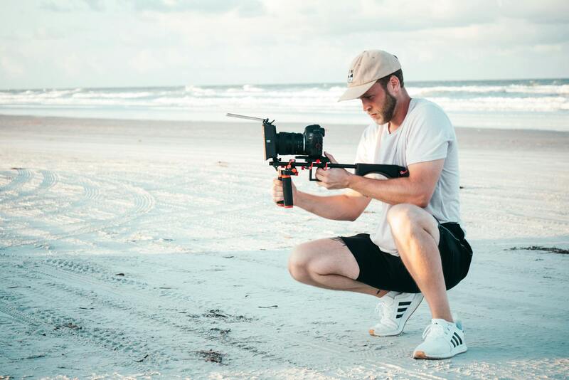
In the competitive world of real estate marketing, showcasing properties in their best light is essential to attract potential buyers and investors. Aerial real estate photography services have transformed the way properties are presented, offering innovative and captivating perspectives that traditional ground-based photography simply cannot match. Utilizing state-of-the-art drone technology, these services provide high-resolution images and videos from aerial viewpoints, enabling real estate professionals to highlight the full scope and grandeur of a property and its surroundings.
By integrating aerial imagery into marketing strategies, real estate agents and developers can effectively showcase features such as expansive lawns, proximity to amenities, scenic views, and neighborhood appeal. These unique angles create a powerful visual narrative that enhances listing appeal and accelerates the decision-making process for buyers. Furthermore, aerial photography allows for detailed depictions of larger properties, commercial estates, and land parcels, providing a comprehensive understanding that is vital for all stakeholders involved in the transaction.
Drone technology has democratized access to high-quality aerial footage, making it more affordable and accessible than traditional helicopter or fixed-wing aircraft methods. This advancement ensures that real estate professionals can incorporate professional-grade visuals into their marketing campaigns with greater ease and consistency. The dynamic nature of aerial photography also opens up possibilities for cinematic videos and virtual tours, further elevating property presentations in a crowded market.
In addition to marketing benefits, aerial photography serves practical purposes such as property inspections, environmental assessments, and land development planning. By capturing detailed images from multiple angles and altitudes, professionals can identify potential issues early and plan effectively for construction or renovation projects.
With the increasing demand for visually compelling real estate content, leveraging aerial photography services—such as those offered by Miami Event Videography at miamieventvideography.net—has become a strategic necessity. These services not only elevate the aesthetic quality of property listings but also improve overall brand credibility and client engagement in the digital age.
Types of Aerial Photography Services Offered
In the realm of aerial real estate photography, a variety of specialized services are available to meet the diverse needs of property marketers and developers. These services utilize cutting-edge drone technology to capture stunning visuals from multiple perspectives, emphasizing the property's surrounding environment, architectural details, and outdoor amenities. The primary types of offerings include:
- High-Resolution Aerial Photography: Utilizes professional-grade drones equipped with high-definition cameras to deliver crisp, detailed images that showcase the property’s exterior, landscaping, and nearby features from elevated angles.
- Aerial Videography: Provides dynamic video footage that walks potential buyers through the property's exterior and environment, often incorporated into virtual tours or promotional videos to enhance engagement.
- 360-Degree Panoramic Shots: Captures immersive panoramic images that allow viewers to experience the scope of the property and its surroundings interactively, ideal for online listings and virtual walkthroughs.
- Roof Inspections and Detailed Land Surveys: Critical for assessing structural integrity or land development planning, these services employ precise drone operations to gather comprehensive visual data in a safe and efficient manner.
- Nighttime and Low-Light Imaging: Some providers offer specialized aerial photography during twilight or night conditions to produce striking visuals that stand out in digital marketing campaigns.
Many professional service providers tailor their offerings to suit properties of varying sizes and complexities, ensuring that the visual presentation aligns perfectly with the marketing goals. When selecting a provider specializing in aerial real estate imagery, it is essential to verify the equipment capabilities, experience in property marketing, and adherence to safety standards to produce consistent and impactful results. These services, when executed with precision, can dramatically increase property visibility, attract more inquiries, and accelerate the sales process by highlighting unique selling points from perspectives impossible to achieve through traditional ground-based photography.
Implementing Aerial Photography as a Core Component of Real Estate Marketing
Integrating aerial imagery into a property’s marketing strategy amplifies its visibility and appeal to prospective buyers. The captivating overhead views provide a comprehensive understanding of the property’s layout, surroundings, and proximity to key amenities, which are often difficult to convey through ground-level photography alone. To maximize the impact, it is essential to synchronize aerial visuals with traditional photography and virtual tour platforms, creating a seamless narrative that highlights the property’s unique features from multiple angles.
Successful implementation involves strategic timing of shoots, considering natural lighting conditions and seasonal cues to enhance visual quality. Incorporating aerial photos and videos into online listings, social media campaigns, and website galleries ensures that the property garners the attention it deserves in a competitive market. The use of high-resolution images allows for detailed inspections and better visualization, which can significantly influence purchasing decisions.

Employing aerial services also facilitates targeted marketing efforts. For instance, showcasing the property's position within the neighborhood, proximity to parks or commercial centers, and positioning within the landscape can attract specific buyer demographics. When coupled with community highlights or regional amenities, aerial visuals can present a holistic narrative that enhances the property's allure.
Furthermore, aerial photography supports comprehensive land assessments and helps in identifying potential site issues. This visual clarity assists brokers, developers, and property owners in making informed decisions and planning future development or renovation projects. The efficiency of capturing high-quality data from drones reduces the need for extensive on-site inspections, saving both time and resources.
High-quality aerial imagery also plays a pivotal role in storytelling, especially for luxury estates, commercial complexes, or properties with extensive landholdings. Dynamic drone footage can showcase the property’s scale and its relation to natural features or urban infrastructure, providing a compelling visual story that resonates with targeted audiences. Real estate professionals who leverage these advanced visual tools often see faster sales cycles and higher engagement rates.
Implementing comprehensive aerial visualization tools—such as drone panoramas, flyover videos, and interactive maps—can set a property apart in online marketplaces. These tools facilitate detailed virtual presentations, letting prospective buyers explore the estate remotely with a better spatial understanding. For developers and investors, aerial data can also inform zoning, land use planning, and environmental assessments, adding value beyond the immediate sale process.
For best results, aligning aerial photography schedules with other marketing activities ensures a consistent message. Posting high-quality images and videos during peak engagement times on social media platforms further boosts visibility. Collaborating with experienced aerial photography teams also guarantees adherence to safety standards and optimal shot execution, which directly impacts the effectiveness of the marketing campaign.
Types of Aerial Photography Services Offered
To meet the diverse needs of real estate professionals, aerial photography providers offer a comprehensive range of services that highlight the unique features of each property. These include high-resolution drone aerial images taken at varying altitudes and angles to showcase the property's layout, landscaping, and proximity to surrounding features. Such images serve as compelling visual assets when marketing residential estates, commercial properties, or vacant land.
Beyond static images, video footage captured through drone technology provides dynamic perspectives. Flyover videos or cinematic walkthroughs allow potential buyers or investors to virtually explore the property as if they were physically present. These videos can be enhanced with smooth transitions and aerial shots that emphasize key selling points such as expansive acreage, architectural design, or scenic surroundings.
Another valuable service is the creation of 3D mapping and virtual tours. These detailed, interactive representations enable viewers to navigate the property from various viewpoints, gaining a comprehensive understanding of the land’s topography and spatial relationships. The integration of Geographic Information System (GIS) data can further inform zoning decisions and land utilization planning, adding an extra layer of value for developers and investors.
In addition to standard imagery and video, providers often incorporate specialized techniques such as thermal imaging for energy audits or environmental assessments, which can assist in showcasing sustainable features or identifying potential issues. Moreover, aerial panoramas and drone fly-throughs can be stitched into cohesive visuals, offering a panoramic overview that captures the property’s entire environment in a single shot.
Utilizing advanced editing and post-production techniques, these services ensure the final deliverables are polished and aligned with marketing strategies. High-definition visuals tailored for various platforms—websites, social media, print brochures—maximize exposure, engaging prospective clients and accelerating the sales process.

Ensuring Compliance and Safety Protocols in Aerial Real Estate Photography
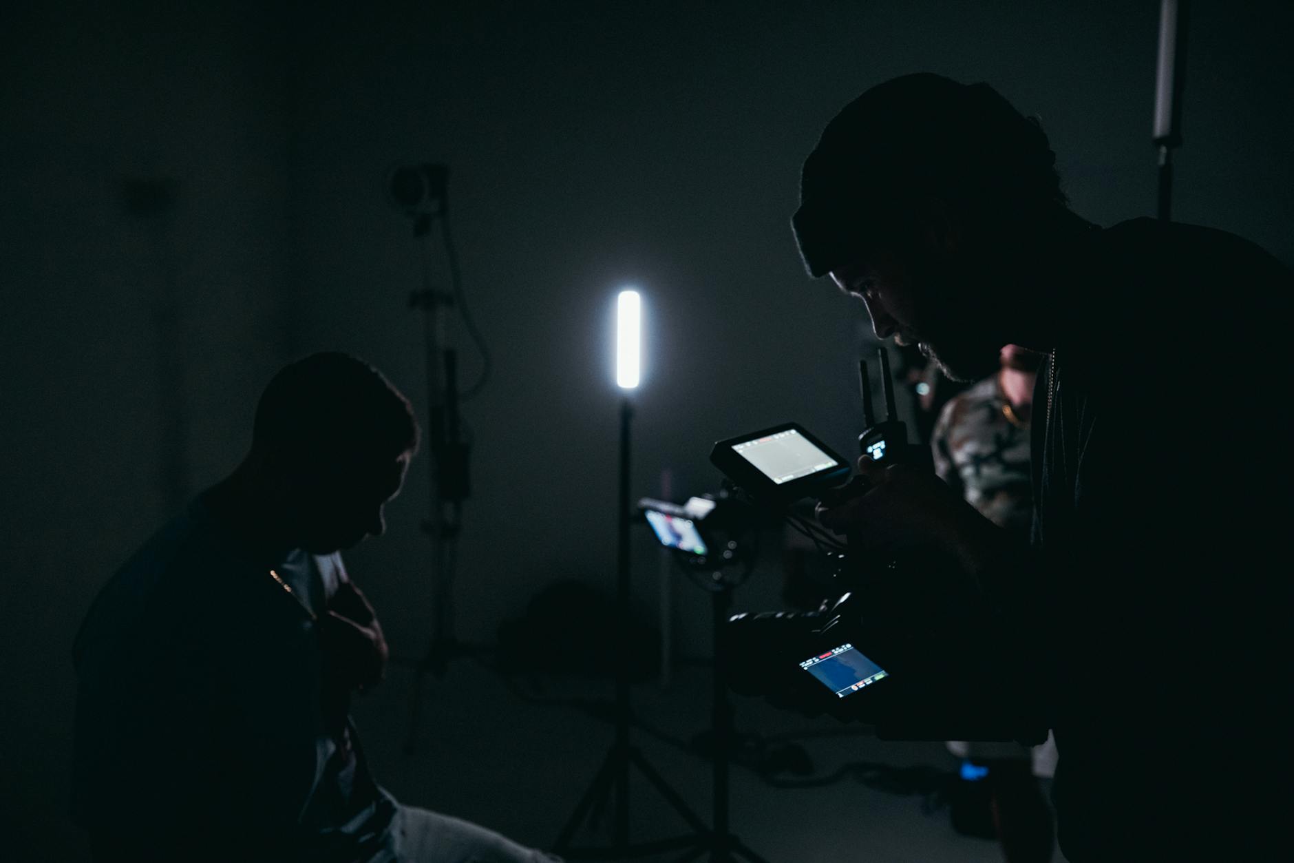
Implementing aerial real estate photography services hinges on adherence to official operating procedures that promote safety and efficiency. Professional drone operators employ meticulous flight planning, which includes obtaining necessary permissions from airspace authorities, such as the Federal Aviation Administration (FAA). These operators utilize detailed maps, weather assessments, and risk evaluations prior to each shoot to ensure the safety of both personnel and equipment. They rely on validated flight plans that delineate permissible flight zones, altitude limits, and no-fly areas, thereby minimizing the risk of incidents or disruptions.
Operational safety is further reinforced through rigorous training and certification processes. Licensed drone pilots who provide aerial real estate photography services complete comprehensive training that covers navigation, emergency procedures, and airspace regulations. This training ensures they possess the expertise required to conduct flights responsibly, especially in complex environments such as densely populated urban areas or near airports.

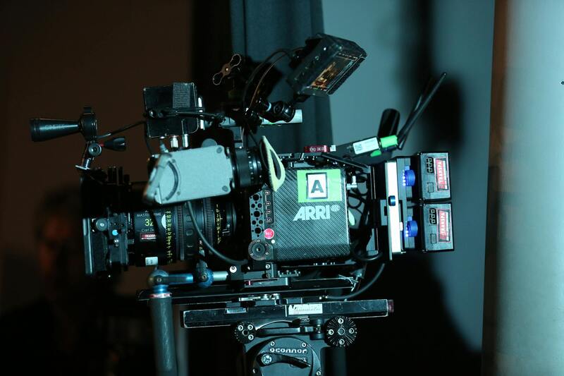
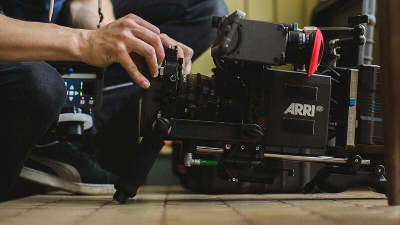
Equipment maintenance and pre-flight inspections are vital steps undertaken by seasoned operators. These inspections verify that all components, such as batteries, rotors, and cameras, are functioning correctly, thereby reducing the likelihood of technical failures during a shoot. Additionally, post-flight data management involves securely storing and processing captured imagery, ensuring client confidentiality and data integrity.
In terms of content legitimacy, only methods that utilize certified, approved equipment and official airspace clearances are employed. These standards guarantee high-quality images and videos while respecting all regulatory requirements, providing clients with visuals that are both visually stunning and compliant with operational norms.
Employing such refined methods facilitates adherence to best practices, reinforces safety, and enhances the professionalism of aerial photography providers working within Miami and broader Florida regions. It assures clients that their property visuals are produced using responsible, certified, and precise techniques that respect legal frameworks and safety protocols.
Legal and Safety Considerations in Aerial Photography
When engaging in aerial photography for real estate, it is essential to adhere to strict operational procedures that ensure both safety and compliance with established standards. Certified operators consistently utilize official flight plans developed in accordance with regional airspace management protocols, especially when operating in complex environments such as urban centers or airports. These flight plans often incorporate detailed maps, altitude restrictions, and designated no-fly zones to prevent interference with manned aircraft and other aerial activities.
Pre-flight inspections are a critical component of responsible drone operation. Experienced pilots meticulously check all equipment, including batteries, propellers, and camera systems, to verify they are in optimal condition. Such practices minimize technical issues mid-flight, which could compromise data quality or create unsafe conditions. Post-flight procedures typically involve secure data management, ensuring the integrity, confidentiality, and proper storage of the captured imagery for client review and potential marketing use.
All operators must abide by official regulations governing drone flights, which include obtaining necessary airspace authorizations and operating within permitted altitude ranges. Utilizing approved, certified equipment is fundamental in producing high-resolution imagery that meets industry standards while respecting operational boundaries.
This comprehensive approach reinforces professional standards, prioritizes safety, and ensures that the visuals provided are legally compliant and technically superior. Working with experienced providers guarantees that every aspect of the aerial shoot— from planning to data handling—aligns with the best practices mandated by current protocols. Such diligence not only enhances image quality but also protects all parties involved from unforeseen risks or conflicts.
Choosing the Right Aerial Photography Provider
Selecting a reputable provider for aerial real estate photography involves evaluating their adherence to official methods and industry best practices. Key indicators of a competent service include certified pilot credentials, extensive experience operating within regulated airspace, and a track record of delivering high-quality visuals consistently. Transparency regarding safety protocols and equipment maintenance also signals a provider’s commitment to responsible operation.
Clients should inquire about the provider’s certification, experience in similar projects, and their process for obtaining necessary airspace approvals. Providers who follow official procedures typically have comprehensive risk management strategies, ensuring flights are conducted safely and legally. Additionally, a provider’s ability to seamlessly integrate aerial imagery into marketing campaigns demonstrates their understanding of real estate marketing dynamics and visual storytelling.
By partnering with professionals dedicated to responsible, legitimate methods, clients gain confidence in the quality and legality of their aerial assets. This confidence translates into powerful marketing materials, enhanced property visibility, and a smoother overall experience from project initiation through delivery.
Ensuring Proper Certification and Compliance in Aerial Photographic Operations
Choosing an aerial real estate photography provider that strictly follows official procedures is essential for projects that demand not only stunning visuals but also reliable and consistent results. Certified operators, particularly those holding credentials such as FAA Part 107 certification, demonstrate a commitment to operating within established aviation standards. These certifications require rigorous training and testing to ensure pilots understand airspace regulations, safety protocols, and effective operational procedures, thereby minimizing risks and upholding high standards of professionalism.
Beyond individual certification, the provider's overall approach to compliance should be transparent and detailed. This includes thorough planning of flight routes according to the designated airspace classifications, securing necessary permissions in advance, and maintaining detailed documentation for each operation. Such processes guarantee that aerial shoots are not only compliant with official procedures but also adaptable to varying local regulations that may differ by region or city. Additionally, providers investing in ongoing training and certification updates stay current with any regulatory changes—an essential aspect of responsible aerial photography services.
Utilizing Approved Equipment and Technology for Authentic Results
In managing aerial real estate projects, employing appropriately certified and approved equipment is a non-negotiable standard. This entails using drones that meet current industry stipulations for safety, performance, and image quality. Advanced stabilization features and high-resolution cameras enable capturing crisp, clear visuals from various altitudes and angles, which are critical for compelling real estate marketing materials.
Providers committed to official methods often utilize software solutions for precise flight planning and airspace authorization requests. These tools facilitate detailed pre-flight checks, account for local restrictions, and automate compliance documentation. The ability to adapt quickly to changes in airspace conditions without compromising on image quality or operational safety exemplifies a professional’s adherence to approved techniques.
Managing Airspace Authorities and Filing Necessary Permits
Executing aerial shoots within regulated airspace requires diligent communication and coordination with relevant authorities. Licensed operators proactively identify the specific airspace zones involving their project locations, obtain necessary authorizations, and complete all required filings well before scheduled flights. This may include submitting detailed flight plans, which outline the intended flight paths, altitudes, and times, to ensure the operation aligns with air safety protocols.
This process demonstrates operational responsibility and respect for existing aviation infrastructure, preventing potential conflicts with manned aircraft. It also ensures smooth workflow, avoiding costly delays or cancellations. Professional aerial photographers often keep abreast of updates in airspace regulations, adjusting their procedures accordingly to stay within official boundaries and avoid operational disruptions.
Implementing Industry-Standard Safety Protocols During Flights
Safety is the cornerstone of reputable aerial real estate photography services. This involves implementing comprehensive safety protocols oriented toward minimizing hazards during flights. These protocols include pre-flight risk assessments, clear flight zone demarcation, and continuous monitoring of weather conditions. Additionally, operators must maintain a safe operational perimeter to avoid disturbances or accidents involving spectators, property, or other aerial vehicles.
Professional providers routinely conduct equipment inspections to verify drone integrity, battery status, and functionality of safety features such as obstacle avoidance systems. They also establish communication channels with relevant parties, including property owners, to inform them of flight plans and potential risks. Such meticulous planning ensures that aerial activities proceed smoothly and responsibly, aligning with official procedures designed to uphold safety at all times.
Assessing Technical Capabilities and Certification
When selecting an aerial real estate photography service, evaluating the technical proficiency and certification status of the provider is essential. Experienced operators utilize high-end drones equipped with advanced stabilization systems, high-resolution cameras, and obstacle avoidance technologies to ensure crisp, clear visuals and safe operation. These professionals are often certified under recognized programs that provide rigorous training on flight safety, airspace management, and effective imaging techniques. Their familiarity with different drone models and their ability to adapt to varied environmental conditions enable them to produce consistent, high-quality results tailored to real estate marketing needs.
Evaluating Portfolio and Customer Testimonials
Reviewing a provider's portfolio offers insight into their capability to capture the unique features of various properties. A reputable aerial photography company maintains a comprehensive collection of past projects that demonstrate their proficiency in handling different property sizes, structures, and landscapes. Additionally, authentic customer testimonials highlight the provider’s professionalism, reliability, and ability to meet client expectations. Prospective clients should seek evidence of previous successful campaigns to gauge the provider’s experience and versatility in the real estate sector.
Assessing Service Range and Customization Options
Leading aerial real estate photography services offer a broad spectrum of options, including high-definition aerial images, immersive videos, 3D mapping, and virtual tours. They are adept at customizing their offerings to align with individual property marketing strategies, whether for luxury estates, commercial complexes, or residential developments. Providers should be flexible in delivering tailored packages that include detailed pre-flight planning, diverse shot angles, and post-processing enhancements. Such adaptability ensures that visual content effectively accentuates a property's distinctive features, attracting potential buyers and tenants more effectively.
Understanding Pricing Structures and Service Guarantees
Transparent pricing is a hallmark of reputable aerial photography providers. Their fee structures typically correlate with the complexity of the project, such as flight duration, image quantity, and post-production requirements. Many professionals offer clear quotes that encompass all necessary permits, equipment usage, and editing work to prevent unforeseen expenses. Service guarantees, including timely delivery and satisfaction policies, demonstrate the provider’s commitment to quality and client service. Clear communication about deliverables and timelines upfront fosters trust and ensures the successful integration of aerial visuals into current marketing campaigns.
Incorporating Technology for Enhanced Marketing Impact
Modern aerial imagery benefits significantly from the integration of cutting-edge technology. Providers employing software solutions like 3D mapping, thermal imaging, and high dynamic range (HDR) techniques elevate the visual storytelling of properties. These technological advancements enable more comprehensive property presentations, from detailed architectural visualizations to environmental assessments. Furthermore, the use of cloud-based project management platforms streamlines collaboration, making it easier for clients to review drafts, request modifications, and approve final images or videos swiftly. Such technological integration enhances the overall effectiveness of a property’s marketing outreach, attracting interest from a broader audience.
Through careful evaluation of these key aspects—certification, portfolio quality, service customization, pricing clarity, and technological capability—clients can confidently select an aerial real estate photography service that aligns with their marketing objectives and operational standards. This strategic choice directly impacts the property's visibility and marketability, providing a competitive edge in today’s dynamic real estate landscape.