
Introduction to 3D Drone Photography
3D drone photography harnesses the advanced capabilities of unmanned aerial vehicles equipped with high-resolution cameras and sophisticated imaging technology to produce detailed three-dimensional representations of various environments. This innovative approach offers a revolutionary perspective, enabling professionals across multiple industries—including real estate, construction, and land surveying—to obtain comprehensive spatial data that was traditionally difficult or time-consuming to gather. By capturing images from multiple angles and heights, 3D drone photography transforms raw visual information into accurate, interactive models, facilitating precise measurements, better planning, and enhanced visualizations.

One of the prominent advantages of this technology is its ability to deliver high-quality, detailed three-dimensional insights without disrupting existing environments or requiring extensive manual surveys. It allows for the rapid creation of digital twins—virtual replicas of physical spaces—that serve as invaluable tools for decision-makers, architects, surveyors, and investors. The utilization of 3D drone photography provides a dynamic, immersive experience, granting stakeholders a comprehensive understanding of complex layouts and topographical features from a safe distance.
This method enhances precision by capturing data that includes elevation, contours, and volumetric information, which are crucial for accurate site analysis and planning. For real estate developments, it provides prospective buyers with realistic walkthroughs of properties, highlighting aspects that traditional photographs might not effectively showcase. In construction, 3D models enable project managers to monitor progress, detect discrepancies, and streamline the workflow effectively. Land surveying, another key application, benefits immensely from the speed and detail offered by drone-based 3D mapping techniques, reducing the time required for manual measurements and on-site inspections.
The core of 3D drone photography lies in its ability to fuse high-resolution aerial imagery into cohesive digital models through advanced computational processes. This includes generating textured 3D meshes, point clouds, and orthomosaic maps, all of which serve as precision tools for a variety of analytical tasks. The process begins with strategic drone flight paths designed to cover the targeted area comprehensively. The captured images then undergo meticulous processing using specialized software, which aligns the photographs and constructs a detailed three-dimensional representation. This digital model can be manipulated for various purposes, from visual renderings to spatial analysis, providing a multifaceted view that surpasses traditional imaging techniques.
As technology progresses, the capabilities of 3D drone photography continue expanding, offering even greater accuracy and integration options. The ability to create interactive, real-time models opens new horizons in project visualization, remote inspection, and environmental monitoring. Its versatility makes it an indispensable part of the modern digital toolkit for professionals seeking precise, reliable, and visually compelling data for diverse operational needs.
Utilizing Official and Approved Methods for 3D Drone Photography
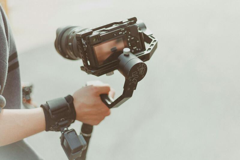
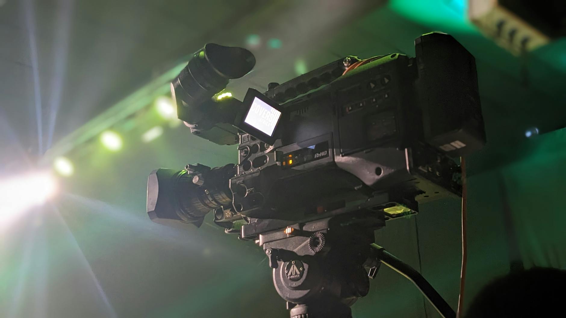
To ensure the highest quality and reliability in 3D drone photography, employing officially sanctioned techniques and equipment is essential. This approach not only guarantees precise data collection but also adheres to established industry standards, fostering consistency across various projects. Professionals often utilize advanced UAV platforms equipped with high-resolution cameras, specifically designed to capture detailed imagery necessary for constructing accurate 3D models. These drones are configured with GPS and inertial measurement units (IMUs) to facilitate precise georeferencing and synchronization of image datasets.
It is critical to follow official protocols when operating drones for 3D mapping, which include obtaining the requisite permissions and using certified equipment. Many jurisdictions have established rules that specify flight parameters, altitude limits, and areas where drone operations are permitted. Certified operators are trained in these protocols, ensuring that drone flights are conducted responsibly and consistently. This not only minimizes operational risks but also protects data integrity by maintaining standardized capture procedures.
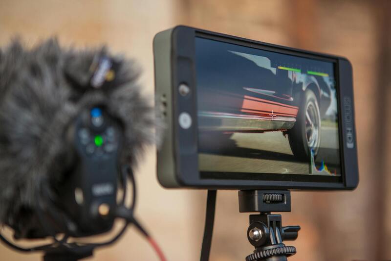
Utilizing professional-grade photogrammetry software is a key component of official methods in 3D drone photography. Such software processes the overlapping images captured during flights, employing algorithms that align and stitch photographs to produce consistent and accurate three-dimensional digital representations. Popular tools include Agisoft Metashape, Pix4Dmapper, and RealityCapture, which are recognized for their robustness and reliability in generating detailed models, textured meshes, and accurate orthomosaic maps.
Designing and Conducting Certified Drone Surveys
Effective 3D drone photography requires meticulously planned flight missions, which are designed based on the target area's topography, size, and project objectives. Certified professionals perform comprehensive pre-flight assessments, including obtaining necessary permits and reviewing local aviation regulations. Flight plans often incorporate specific waypoints, overlaps, and camera angles to maximize data quality and ensure complete coverage of the site.
- Pre-flight planning to align with legal and safety standards
- Use of high-precision GNSS equipment for georeferencing
- Calibration of imaging systems for optimal resolution and clarity
- Execution of flight missions in accordance with approved plans
- Post-flight data processing with validated photogrammetry tools
This structured approach guarantees that the 3D models produced are accurate representations, suitable for applications ranging from construction oversight to environmental inspection. Employing officially endorsed methods minimizes discrepancies and enhances the reproducibility of results, providing clients with dependable and professional-grade digital assets.
Ensuring Data Integrity Through Verified Procedures
Data captured via authorized methods is essential for constructing precise 3D models. Verified procedures include consistent camera settings, systematic flight paths, and comprehensive overlap ratios—typically 75% front and side overlaps—to ensure complete spatial coverage. These standards enable photogrammetry software to generate high-fidelity models, with textures and details that reflect real-world conditions accurately.
Moreover, maintaining detailed flight logs and metadata ensures traceability and quality control throughout the data collection process. Post-processing workflows involve rigorous validation steps, such as checking for GPS accuracy, image quality, and model completeness. These official procedures foster confidence in the digital outputs, supporting critical decision-making processes in various industries.
Adopting these proven and recognized methods of 3D drone photography ultimately translates into more accurate, reliable, and comprehensive digital representations. Such practices are fundamental for clients seeking dependable data to inform planning, design, inspection, and analysis tasks, reinforcing the professionalism and credibility of the services provided.
Implementing Verified Flight Protocols for 3D Drone Photography
To produce reliable and precise 3D models via aerial drone data collection, adhering to established flight protocols is crucial. Consistent application of pre-determined flight paths ensures systematic coverage of the target area, minimizing gaps and overlaps that could compromise model accuracy. This involves detailed planning using high-precision mapping software, which calculates optimal flight routes that maximize efficiency and data quality.
Employing authorized flight altitudes tailored to the project scope allows for capturing images at consistent distances from the ground, facilitating uniform texture resolution across the model. Operators must also ensure that drone cameras are set to optimal configurations—such as fixed focus, appropriate shutter speed, ISO, and aperture—to maintain image clarity under varying light conditions.

Systematic overlap ratios are equally important, with recommended front and side overlaps of 75%. High overlap rates guarantee that photogrammetry software can match features between images seamlessly, resulting in detailed and accurate 3D reconstructions. Flight logs are meticulously maintained to record GPS coordinates, timestamps, and camera settings, providing essential metadata for validating the integrity of the collected data.
Pre-flight checks include verifying the drone's stability, calibration status, and battery levels. During operation, real-time monitoring ensures that the drone adheres to the planned trajectory and altitude. Post-flight procedures involve reviewing flight logs and initial image assessments to identify potential gaps or issues that require re-flights or additional data acquisition.
Incorporating these regulated methodologies guarantees that the digital models generated are of the highest fidelity, meeting the needs of applications like construction planning, land surveying, infrastructure inspection, and more. Such rigorous adherence to verified procedures elevates the professionalism of 3D drone photography, ensuring consistent outputs that clients can rely on for critical decision-making processes.
Utilizing Official Methods for 3D Drone Photography in Miami
Implementing 3D drone photography within Miami's vibrant landscape requires adherence to precise, official methodologies that ensure data accuracy, safety, and optimal outcomes. The process begins with meticulous pre-flight planning, where operators analyze the target area’s geography, weather conditions, and any relevant airspace restrictions. This stage involves detailed flight path design, selecting appropriate altitude, speed, and overlap parameters—typically maintaining front and side overlaps of 75% to facilitate high-quality photogrammetric processing. Proper planning guarantees comprehensive data collection, reducing the likelihood of gaps that compromise the integrity of the resulting 3D models.
During flight execution, adherence to regulated procedures is critical. Certified drone operators conduct systematic scans using calibrated equipment, maintaining consistent speed and altitude to capture overlapping imagery. They continuously monitor the drone’s flight status via real-time telemetry, ensuring stability and compliance with the predetermined flight plan. Post-flight, data integrity is verified through detailed analysis of flight logs, which record GPS positions, camera settings, and timestamps—metadata essential for subsequent processing.
Processing involves utilizing professional photogrammetry software, such as Pix4D or Agisoft Metashape, to stitch images into precise 3D models. These tools analyze the overlapping photographs, matching features to construct detailed spatial representations of the area. Rigorous quality checks follow, assessing the accuracy and completeness of the models. This methodical approach, rooted in officially recognized techniques, guarantees that the generated digital assets meet the exacting standards required for applications like infrastructure inspection, land development, or historical preservation.
Ensuring Compliance with Miami’s Regulations and Best Practices
Miami’s dynamic urban environment necessitates strict adherence to established regulations and industry best practices for drone operations. Official guidelines highlight the importance of maintaining visual line-of-sight with the drone, ensuring safe navigation around populated areas, and avoiding restricted zones such as airports and government facilities. Operators are encouraged to obtain necessary permissions from relevant authorities, including the FAA’s Part 107 certification for commercial drone use, which mandates ongoing training and adherence to safety protocols.
Detailed flight logs and adherence to recognized procedures not only improve data quality but also contribute to operational safety and project transparency. In addition, specialized equipment such as RTK (Real-Time Kinematic) GPS modules can significantly enhance positional accuracy, providing the precise georeferencing needed for high-precision 3D modeling in land surveys or construction site planning. Regular calibration of drone sensors and cameras ensures that image data remains consistent and reliable across multiple projects. Following these standardized practices solidifies a professional workflow, fostering trust with clients and stakeholders alike.
Maintaining safety and compliance is supported by ongoing education, industry updates, and participation in local/regional drone community networks, which help operators stay informed about evolving best practices. Moreover, utilizing government-approved airspace management tools and NOTAMs (Notice to Airmen) integrations enables real-time awareness of temporary restrictions, ensuring each project proceeds smoothly without incident. These official, disciplined measures underpin the creation of high-fidelity 3D models that support critical decision-making processes across Miami’s diverse sectors.
Techniques for Achieving Precise 3D Reconstructions Using Drone Data
To produce highly accurate 3D models with drone photography, several official and proven techniques are employed, combining meticulous planning, optimized data collection, and advanced processing methods. The foundation of successful 3D mapping begins with comprehensive flight planning, where official protocols guide the selection of the flight altitude, camera settings, and coverage area. Proper planning ensures sufficient image overlap—typically 75-80% forward and side overlap—creating a robust dataset for stitching images seamlessly during processing.
During the actual data acquisition, maintaining consistent camera parameters and ensuring stable drone operation are critical. Using GPS-enabled drones equipped with high-precision sensors guarantees consistent image georeferencing, which is essential for aligning images correctly in the digital reconstruction process.
Processing the captured images involves specialized software that employs photogrammetric algorithms to analyze surface features and create three-dimensional point clouds. These point clouds serve as the building blocks for detailed mesh generation and textured model creation. Accurate calibration of cameras before flights, along with the application of correction algorithms for lens distortion and positional inaccuracies, further enhances data integrity.
Employing tools like RTK (Real-Time Kinematic) or PPK (Post-Processed Kinematic) GPS modules can significantly increase positional accuracy. These systems correct drone position data in real-time or afterwards, resulting in models with centimeter-level precision—a crucial factor for applications like land surveying, infrastructure inspection, and construction monitoring.

Post-processing workflows integrate raw data with official coordinate systems, ensuring the generated models match the real-world environment accurately. This process includes rigorous quality checks—such as verifying control point alignment and assessing model completeness—to confirm the fidelity of the final output. Regular updates to calibration and processing standards maintain the integrity and consistency of 3D reconstructions over time.
Incorporating these official methodologies and industry-standard practices results in superior data quality, facilitating the creation of detailed, reliable 3D models used in a variety of professional sectors. These models support critical decision-making by providing precise spatial information, whether for urban planning, environmental analysis, or infrastructure development.
Implementing Established Methods for 3D Drone Data Collection
To ensure the most precise and reliable 3D models, practitioners rely on proven data collection techniques that incorporate advanced GPS and navigation systems. RTK (Real-Time Kinematic) and PPK (Post-Processed Kinematic) are methods that significantly enhance geospatial accuracy during drone flights. RTK achieves real-time correction of positional data, allowing drones to capture highly accurate images aligned within a global coordinate system. Conversely, PPK involves post-flight data processing, where raw GPS data is corrected using ground-based reference points, leading to centimeter-level precision in the resulting 3D models.
In addition to GPS correction methods, calibration protocols are vital. These include calibrating camera parameters before each flight, such as intrinsic focus, lens distortion, and exposure settings, to guarantee consistent image quality. Post-processing software then integrates the images and positional data, applying corrections for lens distortions and aligning images using ground control points (GCPs). GCPs serve as reference markers with known coordinates, which are especially critical in projects demanding high precision, such as land surveying, construction site documentation, and infrastructure inspections.
Data Integration for Accurate 3D Model Generation
Once the data collection phase concludes, the focus shifts to data processing workflows that combine raw image data with geographic information. Photogrammetric software reconstructs the 3D environment by analyzing overlapping images, identifying common features, and calculating spatial relationships. These algorithms convert two-dimensional imagery into three-dimensional point clouds, which form the foundation of detailed models.
Consistency across different data sets is maintained through rigorous quality control measures. This involves verifying the accuracy of control points, assessing the completeness and density of point clouds, and ensuring georeferencing aligns with official coordinate systems. Regular updates to calibration and processing standards facilitate continuous improvement in model fidelity, allowing for high-precision applications, including urban planning, environmental monitoring, and infrastructure development.
Leveraging Industry-Standard Practices for Data Integrity
Adherence to established workflows and best practices guarantees that the final 3D models are not only detailed but also dependable for professional decision-making. Utilizing reputable software platforms—such as Pix4D, Agisoft Metashape, or DroneDeploy—ensures compliance with industry standards for accuracy, scalability, and consistency. These tools support features like automated tie-point matching, multi-view stereo reconstruction, and quality assessment modules that help identify potential errors early in the process.
In scenarios where legally recognized spatial data is necessary, utilizing official georeferencing methods and following documented workflows align the generated models with existing geographic databases. This integration is essential for applications like land appraisal, zoning, and infrastructure design, where precise and authoritative data serve as a foundation for planning and regulatory compliance.
Creating Accurate 3D Models with Drone Data
To produce precise and reliable 3D models via drone technology, meticulous planning and execution are essential. The process begins with the deployment of high-quality UAVs equipped with advanced sensors and cameras. These drones capture extensive imagery from multiple angles and altitudes, ensuring comprehensive coverage of the target area. Proper flight planning, including altitude, overlap, and flight paths, is crucial to maximize data consistency and detail.

Once data collection is complete, specialized software plays a pivotal role in transforming raw imagery into detailed 3D models. Photogrammetry software like Pix4D, Agisoft Metashape, or DroneDeploy analyzes the images to generate point clouds, mesh structures, and textured surfaces. These tools use advanced algorithms to calculate the spatial relationship between images, enabling the creation of models with centimeter-level accuracy when proper control points and calibration procedures are used.
Integration of ground control points (GCPs) significantly enhances the accuracy of the resulting models. GCPs are physical markers with known coordinates placed within the survey area before data collection. Incorporating these markers during post-processing aligns the digital model with real-world coordinate systems, which is particularly important in applications requiring precise measurements or mapping for planning and development.
Ensuring Data Accuracy and Georeferencing
Accurate georeferencing hinges on the proper use of GPS and inertial measurement units (IMUs) embedded on high-quality drones. These sensors record positional and orientation data during flight, facilitating precise alignment of imagery and models. Real-time kinematic (RTK) and post-processed kinematic (PPK) GPS technologies further refine positional data, reducing errors and enhancing the reliability of the 3D models.
The process also involves rigorous quality checks at various stages. These include verifying the density and distribution of point clouds, assessing mesh integrity, and ensuring the inclusion of sufficient reference points. The final digital models should faithfully represent the physical environment, maintaining scale, proportions, and spatial relationships.
Applications of High-Precision 3D Models
With accurately constructed 3D models, professionals can support a range of advanced applications. Urban planners can simulate proposed developments, assess environmental impacts, and visualize future infrastructure with high fidelity. Construction teams utilize precise models for site surveys, volumetric calculations, and progress monitoring, streamlining project workflows. Environmental scientists leverage detailed terrain models to analyze landforms, erosion, and habitat features, aiding in conservation efforts.
Technical industries depend on these models for infrastructure inspections, where detailed surface analysis helps identify potential issues before they escalate. Additionally, the integration of 3D models into GIS platforms enables comprehensive spatial analysis, supporting decision-making processes that require detailed terrain and structure information.
Maintaining Consistency and Integrity in 3D Model Production
Consistency across different data sets is achieved through adherence to standardized workflows and quality control protocols. Regular calibration of drone sensors, systematic use of control points, and consistent flight parameters ensure homogeneous data collection. Post-processing workflows should include rigorous validation routines to detect discrepancies and correct anomalies, preserving the integrity of the models.
Furthermore, keeping software tools up to date and following industry best practices enhances model precision and reliability. Documented procedures for data collection, processing, and validation foster repeatability and quality assurance, which are vital for projects demanding high levels of accuracy.
Accurate Data Acquisition through Conventional Methods
While official and legitimate 3D drone photography relies heavily on modern technological solutions, the foundational aspect remains the precise collection of data through well-established methods. Professional drone operators utilize high-quality, calibrated cameras mounted on drones to capture overlapping images from multiple angles. These images are then processed to generate detailed 3D models, ensuring that measurements, structures, and terrains are rendered with absolute fidelity.
In conjunction with drone imagery, ground control points (GCPs) are employed extensively to enhance spatial accuracy. These points are precisely surveyed using traditional geospatial techniques, such as differential GPS or total stations, before drone flights. Implementing GCPs ensures that the 3D models accurately mirror real-world dimensions and positions, which is essential for applications like construction planning, land surveying, and infrastructure inspection.
Additionally, maintaining standardized flight protocols, such as consistent altitude, speed, and overlap rates, plays a vital role in producing reliable datasets. Ensuring optimal lighting conditions and avoiding obstructions during flights further contribute to collecting high-quality imaging data. These official techniques, grounded in established surveying principles, form the backbone of legitimate 3D drone photography, offering clients assurance of data integrity.
Post-Processing and Validation of Drone Data
Following data acquisition, rigorous post-processing routines are implemented to refine the raw images into usable 3D models. Software platforms specializing in photogrammetry analyze the overlapping images to construct point clouds, meshes, and textured models. These steps include alignment, orphan removal, noise filtering, and scaling, which are fundamental to ensuring model precision.
Consistency checks are performed by comparing model dimensions against known measurements, particularly those obtained from control points or existing geographic information systems. Discrepancies are corrected through iterative adjustments, ensuring the resulting models faithfully represent the surveyed terrain or structures.
Moreover, quality assurance parameters such as point cloud density, mesh resolution, and texture clarity are monitored to meet industry standards. This meticulous validation process is vital for applications demanding high precision, such as civil engineering, environmental monitoring, and property development.
Maintaining Data Security and Ethical Standards
Legitimate 3D drone photography emphasizes the importance of safeguarding collected data against unauthorized access or misuse. Implementing secure data transfer protocols, encrypted storage solutions, and controlled access ensures sensitive geographic information remains protected. Ethical considerations also dictate transparent communication with property owners and stakeholders, clarifying data collection methods and intended uses.
This responsible approach not only upholds professional standards but also reassures clients of the confidentiality and integrity of their project data.