
Introduction to Real Estate Aerial Photography in Miami
In the dynamic and competitive Miami real estate market, high-quality visual presentation has become a vital component of effective property marketing. As properties become more diverse and buyers increasingly rely on online listings, the need for innovative and captivating imagery has never been greater. Aerial photography, leveraging advanced drone technology and traditional methods, offers a distinctive perspective that captures the essence of a property and its surrounding environment from above. This approach not only enhances the visual appeal of listings but also provides prospective buyers with comprehensive views of property exteriors, landscapes, and neighborhood features.

Miami’s vibrant real estate scene benefits significantly from aerial imagery. The city’s iconic skyline, sprawling waterfront properties, and lush landscape require photography that can showcase their grandeur in a way traditional ground-based photos cannot match. Aerial views allow real estate agents and property owners to highlight unique property features, such as expansive yards, swimming pools, or proximity to beaches and parks, all within a single shot. This perspective helps listings stand out in crowded online marketplaces and improves engagement from potential buyers.
Moreover, aerial photography plays a strategic role during listing presentations and virtual tours. Its ability to demonstrate the full scope of a property and its surroundings creates a compelling narrative that encourages prospective buyers to envision themselves in the space. This is especially important in Miami, where waterfront developments and luxury properties demand spectacular visuals to communicate their exclusivity and appeal.
As technology continues to evolve, the integration of aerial footage into real estate marketing strategies becomes essential. Professional aerial photography near Miami offers not only high-resolution images but also video footage that can be incorporated into virtual walkthroughs, social media marketing, and website galleries. These visual tools significantly enhance the visibility and desirability of listings, enabling sellers and brokers to tap into wider audiences.
When considering aerial photography services, Miami-based providers employ state-of-the-art drone technology operated by certified pilots. This ensures that the captured images are not only visually stunning but also adhere to strict safety and quality standards. By choosing seasoned professionals, clients can trust that their properties are showcased accurately, attractively, and in a manner that aligns with the high standards of Miami’s real estate market.
In summary, as Miami continues to grow as a hub for luxury and waterfront properties, aerial photography offers a strategic advantage. It transforms ordinary listings into captivating visual stories that draw more attention, generate higher interest, and ultimately facilitate quicker sales. For property owners and real estate professionals aiming to elevate their marketing efforts, engaging with specialists in aerial photography near Miami is an investment that yields substantial benefits.
Verification of Technical Requirements for Aerial Photography in Miami
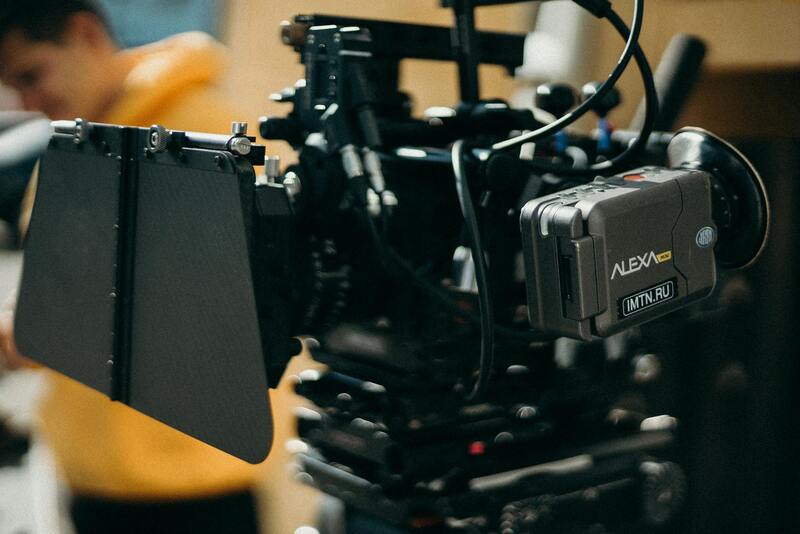
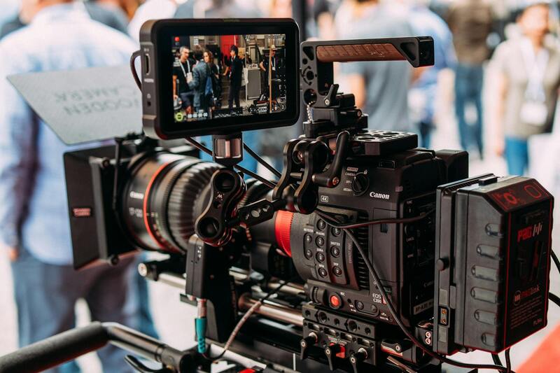
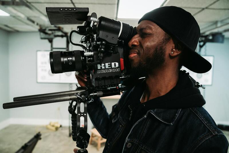
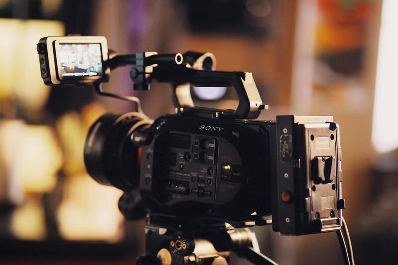
Executing successful aerial photography for real estate listings in Miami hinges on adhering to specific technical standards that ensure image clarity, safety, and consistency. The foundation of high-quality aerial imagery begins with selecting appropriate camera equipment capable of capturing high-resolution images, even under challenging lighting conditions prevalent in Miami’s vibrant environment. Certified aerial photographers utilize professional-grade drones equipped with stabilized gimbal systems, advanced sensors, and high-resolution cameras. These tools facilitate sharp, undistorted images that accurately represent the property and its surroundings.
In addition to camera specifications, optimal flight planning is critical. This involves assessing weather conditions, lighting angles, and site accessibility to determine the best times for shooting. Miami's often sunny and breezy climate requires pilots to plan flights during periods of minimal wind and good visibility to maintain safety and image quality. Furthermore, flight paths are pre-mapped to ensure comprehensive coverage of the property from multiple angles, providing a diverse set of visuals for marketing use.
Post-flight, images undergo meticulous editing to enhance visual appeal while maintaining authenticity. Adjustments include color correction, brightness enhancement, and perspective correction to present the property in its best light. For videos, smooth stabilization and color grading further heighten engagement, delivering a polished product aligned with the client’s branding goals.

Utilizing Cutting-Edge Drone Technology for Enhanced Results
State-of-the-art drone technology plays an essential role in fulfilling technical requirements for real estate aerial photography near Miami. Drones equipped with adjustable aperture and ISO settings allow photographers to adapt to varying lighting conditions, ensuring optimal exposure. Multi-directional sensors and GPS stabilization systems contribute to capturing precise, steady images from multiple angles.
Moreover, integrating thermal imaging or 3D mapping technology can provide added value, allowing for comprehensive property assessments or virtual tours. These advanced features are particularly beneficial in competitive markets, where unique visual content drives buyer interest. The combination of reliable hardware and sophisticated software solutions guarantees that property listings stand out visually and meet high industry standards.
Implementing Safety and Compliance Protocols During Aerial Operations
Safety protocols are integral to maintaining the integrity of aerial photography projects in Miami. Certified pilots follow strict operational procedures, including pre-flight checks, site surveys, and continuous communication with ground personnel. This ensures adherence to established flight paths and altitude restrictions, safeguarding both the equipment, surrounding environment, and individuals in the vicinity.
Regulatory compliance involves obtaining necessary permissions and conforming to local airspace regulations overseen by the Federal Aviation Administration (FAA). Careful planning and documentation are essential to navigate Miami’s dynamic airspace, especially in areas near airports, high-rise buildings, or crowded neighborhoods. Thorough adherence to these protocols results in efficient, risk-mitigated operations capable of producing high-quality imagery without incident.
Comprehensive Methods for Securing Reliable Aerial Photography Near You
When seeking real estate aerial photography near me, it is crucial to rely on proven, professionally managed methods that guarantee high-quality results while adhering to stringent operational standards. A primary approach involves engaging with certified drone service providers who possess extensive experience in residential and commercial property imaging. These professionals utilize advanced, high-resolution drones equipped with stabilized gimbals and powerful cameras, capturing clear and detailed visuals from various altitudes and angles.
One of the most reliable means is working with companies that have established industry credentials, which include certifications from entities such as the Federal Aviation Administration (FAA) or equivalent local authorities. These organizations follow strict operational protocols, from pre-flight safety checks to flight execution, ensuring minimal risk and maximum image quality. Additionally, many have their pilots continuously trained on the latest drone technology and aerial imaging techniques, which further guarantees competent handling of complex projects involving high-value property assets.
For consistent results, partnering with reputable service providers often involves reviewing their portfolio, client testimonials, and industry accreditations. A well-curated portfolio demonstrates their capability to handle diverse environment and property types, from wide estates to condominium complexes. Client references can verify their dependability, punctuality, and professionalism in delivering on project specifications. It’s beneficial to solicit samples or case studies relevant to real estate projects in Miami, highlighting their familiarity with local conditions and regulations.
Besides individual service providers, specialized aerial photography companies offer comprehensive packages tailored specifically for real estate marketing. These packages may include high-resolution images, dynamic video tours, and 3D virtual walkthroughs, which are critical in creating engaging property listings for digital platforms. They often assign a dedicated project manager to coordinate shoots, ensuring alignment with marketing goals and property features, thereby optimizing client investment in visual content.
Utilizing state-of-the-art equipment, certified operators promote safety and efficiency during aerial shoots. Some providers employ thermal imaging or augmented reality overlays to enhance property features, which can be particularly advantageous for unique listings or properties with extensive exterior amenities. The integration of such advanced technologies often elevates a listing’s appeal and can significantly influence prospective buyers’ decisions.
In addition, local drone operators within Miami who specialize in real estate tend to have a deep understanding of the area’s landmarks, zoning laws, and airspace restrictions. This geographic knowledge facilitates smoother planning and execution, reducing delays or compliance issues that can arise from unfamiliarity with local regulations. Working with locally based professionals also allows for more flexible scheduling, including twilight or sunset shots that can dramatically enhance the property’s visual narrative.
For property owners and real estate professionals aiming for dependable results, verifying the provider’s experience specifically within Miami’s diverse neighborhoods is invaluable. This includes assessing their capability to navigate crowded urban environments or expansive waterfront properties, which may require specialized flying skills and equipment. Ensuring the provider’s familiarity with Miami’s specific aerial photography challenges helps deliver imagery that captures the essence of each property while adhering to all operational parameters.
Securing the Right Aerial Photography Partner Near You
When searching for "real estate aerial photography near me," selecting a qualified professional is vital to ensure your property’s visual presentation stands out. A reputable provider employs FAA-certified drone operators with extensive experience in the local Miami area. Such expertise guarantees that the operator understands Miami’s unique airspace characteristics—ranging from dense urban environments to waterfront landscapes—and navigates them without compromising safety or compliance standards.
Beyond certifications, verify that the service provider holds comprehensive insurance coverage. This safeguards your interests against unforeseen liabilities, should any mishaps occur during the shooting process. Experience working specifically in Miami’s diverse neighborhoods—be it bustling downtown districts, sprawling suburban communities, or scenic waterfronts—enables these professionals to anticipate and adapt to the specific challenges each setting presents.

Additionally, a local provider’s familiarity with Miami’s zoning laws and airspace restrictions facilitates smoother scheduling and fewer delays. Their ability to coordinate with local authorities and understand restricted zones reduces the risk of violations and ensures timely delivery of high-quality images. The integration of local knowledge with cutting-edge drone technology ensures that the visual content captures the property’s essence, highlighting its unique features from impressive aerial angles and enhancing its market appeal.
Key Factors in Choosing a Local Aerial Photography Service
- Certification and Insurance: Confirm FAA certification and comprehensive insurance coverage.
- Extensive Local Experience: Look for providers with a proven track record in Miami’s diverse neighborhoods.
- Understanding of Regulations: Ensure they are well-versed in Miami’s airspace rules and restrictions.
- Advanced Equipment: Use of high-resolution drones equipped for detailed images and smooth video during varying lighting conditions.
- Portfolio and References: Review previous local projects to assess quality and reliability.
Partnering with a professional who combines local expertise with technical proficiency will maximize your property’s visual impact, facilitating faster sales and superior marketing outcomes.
Comprehensive Methods for Legal and Effective Drone Usage in Miami
Securing proper authorization for drone operations in Miami necessitates adherence to established protocols that ensure seamless integration into the city’s dynamic airspace. Drone pilots must obtain specific permits from relevant agencies, such as the Federal Aviation Administration (FAA), and sometimes coordinate with local authorities to comply with Miami’s unique airspace regulations. This process often involves submitting detailed flight plans, demonstrating operational safety, and confirming that the drone operation will not interfere with manned aircraft, especially around busy areas like Miami International Airport and various airports serving the region.
Certification plays a crucial role in establishing credibility and proficiency for operators. The FAA mandates that commercial drone pilots, including those conducting real estate aerial photography, possess a Remote Pilot Certificate (Part 107 license). This certification verifies that pilots understand airspace rules, weather considerations, and safety procedures. Operators should also maintain comprehensive insurance coverage, which provides coverage against potential damages or liabilities during flight, further safeguarding client investments and ensuring uninterrupted service delivery.
High-quality aerial images captured by certified professionals in compliance with regulations can significantly elevate property listings, providing prospective buyers with a compelling view of the property’s surroundings and features.
Miami’s vibrant neighborhoods and coastal landscapes offer spectacular vantage points that can be captured through regulated drone flights. However, pilots must respect specific restrictions, such as altitude limits, no-fly zones around sensitive areas, and temporary flight restrictions during events or emergencies. Collaboration with local authorities in planning the shoot ensures that operations stay within legal boundaries, avoiding penalties or delays, and facilitating efficient scheduling of aerial sessions.
Understanding and integrating these regulations into the project planning phase ensures that each aerial photography endeavor proceeds smoothly. By working with experienced, licensed operators familiar with Miami’s legal landscape, clients benefit from high-quality imagery without compromising safety or compliance. Such professionalism translates into cleaner workflows, timely deliveries, and ultimately, more effective marketing assets that resonate with potential buyers.

Proper licensing and adherence to local regulations empower real estate professionals to harness aerial photography’s full potential, showcasing properties from impressive angles while maintaining operational integrity.
Legal Considerations and FAA Regulations for Drone Use in Miami
When engaging in real estate aerial photography near me in Miami, understanding and adhering to established rules is essential to ensure smooth project execution. The city’s diverse landscape, including urban neighborhoods, beaches, and protected wildlife areas, requires compliance with specific operational guidelines to avoid disruptions during shooting sessions. Certified professionals who specialize in aerial property imaging are well-versed in navigating these regulations, which allows them to deliver stunning visuals while maintaining strict adherence to legal requirements.
The Federal Aviation Administration (FAA) establishes key parameters for drone flights that must be observed, including altitude restrictions, line-of-sight operations, and restrictions over private property or near sensitive areas such as airports, government buildings, or emergency zones. Miami's busy airspace and proximity to major airports, like Miami International Airport, emphasize the importance of pre-flight planning and coordination with authorities. Aerial photography providers often obtain special authorizations or waivers that allow operations in specific zones, ensuring that photographers can capture desired imagery without infringing on airspace regulations.
Understanding No-Fly Zones and Temporary Flight Restrictions
Miami contains several no-fly zones, often around critical infrastructure and densely populated areas, which are marked by the FAA’s geographic information systems. Drone pilots conducting real estate photography must perform thorough site assessments and obtain operational permits if necessary. Additionally, temporary flight restrictions (TFRs) may be enacted during special events, emergencies, or government activities, necessitating real-time awareness and flexibility from service providers.
Collaborating with Certified Professionals
Partnering with licensed aerial photographers ensures compliance with the latest regulations and reduces the risk of penalties or project delays. These professionals typically possess the necessary certifications, insurance, and experience to operate safely alongside other airspace users in Miami. The process includes obtaining proper authorization, preparing comprehensive flight plans, and following established safety protocols that prioritize privacy and operational integrity.
Maintaining Privacy and Respecting Local Regulations
Respecting individuals' privacy during aerial shoots is a crucial part of legal compliance. Professional operators seek consent when necessary and utilize technology to minimize intrusion, such as intentionally avoiding residential windows or private properties unless explicitly permitted. Staying updated on Miami's specific ordinances regarding drone operations further enhances the professionalism of aerial photography services, ensuring all projects align with current legal frameworks.
Ultimately, thorough knowledge of FAA guidelines, city-specific restrictions, and proactive collaboration with qualified providers are key to executing successful real estate aerial photography near me. Such diligence not only produces high-quality imagery but also guarantees smooth operations that respect Miami’s regulatory landscape, creating impactful marketing assets for real estate listings and development projects.
Legal Considerations and FAA Regulations for Drone Use in Miami
Understanding and adhering to the established operational guidelines is vital for conducting aerial photography safely and effectively in Miami. The Federal Aviation Administration (FAA) sets forth comprehensive regulations that govern drone usage for commercial purposes, including real estate photography. These rules ensure that drone operations are conducted responsibly, with respect for privacy, safety, and other airspace users.
Operators must obtain proper authorization before conducting flight operations. This typically involves acquiring a Remote Pilot Certificate, which demonstrates compliance with FAA standards. Additionally, drone pilots in Miami need to secure a Part 107 waiver if they plan to undertake specific activities that fall outside standard regulations, such as operating beyond visual line of sight or over people.
Operators are required to prepare detailed flight plans that account for Miami’s unique airspace characteristics, including busy urban areas, airports, and restricted zones. Proper pre-flight planning minimizes risk and prevents accidental breaches of airspace restrictions. Conducting thorough site assessments, including checking for temporary flight restrictions (TFRs) or local ordinances, is critical for lawful operations.
Safety protocols also involve maintaining safe distances from individuals and private property, particularly in residential neighborhoods or commercial developments. Respect for privacy is built into FAA guidelines; drone operators should avoid capturing images of private spaces without consent and should navigate around sensitive locations carefully.
In Miami, professional aerial photographers often collaborate with local authorities or property owners to gain necessary permissions, further bolstering the legitimacy of each project. Staying informed about city-specific regulations, such as Miami's restrictions on drone flights near certain zones or during particular times, helps operators avoid inadvertent violations.
Investing in proper insurance coverage is another critical aspect for legitimate operations. Liability insurance not only protects the operator but also reassures clients of professionalism and readiness to handle unforeseen incidents.
Best Practices for Effective Aerial Real Estate Photography
To maximize the impact of aerial imagery in real estate marketing, professional operators follow a set of best practices that emphasize quality, safety, and legal adherence. These include using high-resolution cameras capable of capturing crisp, vibrant images that highlight the property's best features. Optimizing flight angles and altitudes ensures comprehensive views of the property, landscape, and surrounding amenities.
Timing plays a crucial role; shooting during the golden hour—the period shortly after sunrise or before sunset—provides soft, warm lighting that enhances visual appeal. Weather conditions should be carefully monitored; clear, stable days yield the best results for aerial photography, while wind, rain, or fog can compromise image quality and safety.
Post-flight editing is essential for producing polished marketing assets. Color correction, perspective adjustments, and HDR techniques can elevate raw images to professional standards. Incorporating 3D mapping or virtual walk-through integrations can further augment marketing strategies by offering potential buyers immersive experiences.
Finally, consistent branding and detailed property metadata help in aligning aerial imagery with overall marketing campaigns. Implementing a cohesive visual style across listings, social media, and website platforms ensures recognition and credibility in the marketplace.
Finding Local Aerial Photography Services Near You in Miami
Locating reputable aerial photography providers for real estate in Miami involves a strategic approach. First, consider leveraging online search engines with targeted keywords such as "real estate aerial photography near me" or "Miami drone photography services". These searches often yield a list of experienced professionals specializing in aerial imagery tailored for real estate listings. It is advisable to scrutinize service portfolios and client reviews to gauge the quality and reliability of the providers.
Local real estate agents and property developers often maintain strong connections with reliable drone photography companies. Consulting with these professionals can provide valuable recommendations grounded in firsthand experience. Additionally, visiting local industry events or expos focused on real estate marketing and drone technology can help in establishing direct contacts with certified operators.
Online directories and specialized platforms dedicated to drone services also serve as valuable resources. These platforms offer filters based on location, service specialization, and customer ratings, streamlining the selection process. When requesting quotes, ensure to specify the scope of work, desired photo quality, and preferred delivery timelines, which help in accurately comparing service offerings.
Miami’s vibrant neighborhoods range from luxury waterfront estates to bustling urban developments. To effectively capture these diverse landscapes, choose a provider with local knowledge of Miami’s neighborhoods. Familiarity with local airspace regulations, popular vantage points, and city-specific challenges ensures smooth operations and high-quality results.

Engaging a local professional also facilitates flexible scheduling to capture images during optimal lighting conditions, such as golden hour, which enhances visual appeal. Furthermore, providers with local expertise typically have established relationships with authorities and possess the necessary permits for aerial operations within Miami’s regulated airspace.
In sum, systematically researching and vetting local aerial photography services near Miami guarantees access to top-tier images that elevate real estate marketing efforts. Combining professional skill, local knowledge, and reliable service ensures properties stand out in competitive listings, attracting potential buyers through impactful visual storytelling.