
Overview of Drone Realty Photography
Drone realty photography has revolutionized the way properties are showcased and marketed within the Miami real estate industry. Utilizing unmanned aerial vehicles equipped with high-resolution cameras, professionals can capture stunning aerial perspectives that reveal the full scope of a property's surroundings, layout, and proximity to notable landmarks. This method surpasses traditional ground-level photography by providing potential buyers with a comprehensive view that enhances visual appeal and drives engagement.
In the competitive Miami real estate market, where waterfront properties, luxury estates, and expansive developments are commonplace, the incorporation of drone imagery becomes a strategic tool to stand out. These aerial images not only highlight the aesthetic qualities of a property but also emphasize its geographic advantages, such as nearby recreational areas, city skylines, and easements. Consequently, drone realty photography integrates cutting-edge technology with artistic composition, enabling real estate professionals to present listings with a level of detail and grandeur that appeals to discerning buyers.
This innovative approach is supported by the increasing availability of advanced drone equipment, capable of capturing ultra-high-definition imagery and smooth cinematic footage. The execution of effective drone realty photography requires proficiency in pilot operations, understanding of lighting conditions, and mastery of aerial composition. As a result, Miami's flourishing real estate scene benefits immensely from the expertise of specialized drone photography services, which are adept at translating property features into captivating visual narratives.
Legal and Regulatory Considerations in Miami
Implementing drone realty photography within Miami’s vibrant real estate market involves adhering to a structured set of guidelines designed to ensure safe and responsible operation. These procedures encompass obtaining the necessary permits and authorizations for aerial filming, which are issued by relevant aviation authorities. Precision in complying with altitude restrictions, flight zones, and operational boundaries helps facilitate smooth integration of drone services into real estate marketing efforts.
Operators must have a clear understanding of local airspace classifications and restricted zones, especially near airports, government buildings, and other sensitive areas. Prior coordination with municipal agencies and adherence to designated drone operation protocols are essential to maintaining seamless workflow.
To guarantee safety during aerial shoots, professionals conduct pre-flight risk assessments, verify weather conditions, and plan flight paths meticulously. This comprehensive approach minimizes potential disruptions and ensures that aerial captures are performed responsibly and efficiently.
In addition to operational procedures, drone operators are encouraged to maintain updated knowledge of Miami’s specific regulations, which often evolve alongside technological advancements. Staying informed about any new ordinances or changes to existing policies helps prevent legal complications and fosters a trustworthy relationship with clients.
Employing licensed and insured drone pilots further enhances the credibility of a service provider. Insurance coverage not only protects against unforeseen incidents but also underscores a commitment to professional standards. Many Miami-based drone photography companies invest in continuous training and certification programs, ensuring their pilots are well-versed in the latest best practices.
Furthermore, engaging with documented flight plans and maintaining detailed records of each operation supports transparency and accountability. These measures allow real estate professionals to confidently utilize aerial imagery, knowing that all regulatory requirements are being met.
Finally, integrating drone operations with comprehensive property marketing strategies involves coordination with other marketing channels to maximize visibility. Respect for regulatory frameworks ensures that the use of drone realty photography remains a sustainable asset within Miami’s competitive real estate environment.
Overview of Drone Realty Photography
Drone realty photography has revolutionized the way properties are showcased in the competitive Miami real estate market. By employing unmanned aerial vehicles equipped with high-resolution cameras, real estate professionals can offer prospective buyers a comprehensive visual perspective that traditional photographs often cannot capture. This technique extends beyond simple aerial shots, encompassing advanced imaging methods, such as 3D mapping, panoramic views, and dynamic video tours. The integration of these high-quality visuals allows for an immersive viewing experience, highlighting property features, surrounding amenities, and neighborhood attributes with unparalleled clarity and depth.
Employing drones in real estate marketing offers a strategic advantage, enabling agents and developers to present properties in a compelling, innovative manner. The popularity of drone realty photography in Miami is driven by the city’s vibrant real estate scene and the unique value aerial imagery brings to marketing campaigns. From waterfront mansions to high-rise condos and sprawling suburban estates, drones provide a versatile tool to showcase a property's best features and location benefits that ground-level photos may not fully capture.
Advantages of Using Drones in Real Estate Marketing
- Enhanced Visual Appeal: Aerial shots create eye-catching visuals that distinguish listings in competitive markets.
- Broader Property Coverage: Drones can capture the entirety of large properties or sprawling developments, giving potential buyers a comprehensive view.
- Cost-Effective Marketing: In comparison to helicopter photography, drone services are more affordable and accessible, delivering high-quality results with less logistical complexity.
- Faster Turnaround: Drone operators can execute shoots swiftly, providing timely visuals that keep marketing campaigns on schedule.
- Neighborhood and Surrounding Highlights: Aerial imagery effectively showcases local amenities, accessibility, and scenic views, adding contextual value to property listings.
The strategic use of drone realty photography not only boosts aesthetic appeal but also enhances the storytelling aspect of property marketing. It allows potential buyers to envision living in the space through dynamic and engaging visuals, often leading to quicker sales and higher property valuations. As Miami’s real estate market continues to evolve, the integration of aerial imagery remains a key differentiator for forward-thinking agents and developers seeking to maximize their marketing effectiveness and reach a broader audience.
Legal and Regulatory Considerations in Miami
To ensure smooth and compliant drone realty photography operations in Miami, it is essential to adhere to specific guidelines and protocols set forth for aerial imaging. Operators should obtain the necessary permits before conducting any flights, particularly over private properties or in congested areas. Securing authorization often involves coordinating with local authorities and adhering to established flight windows, especially in busy neighborhoods or near public spaces.
Safety protocols form a core aspect of operational standards. These include maintaining visual line-of-sight with the drone at all times, respecting altitude limitations—generally up to 400 feet—and avoiding flight over individuals or crowds. Proper pre-flight planning, which encompasses weather assessments and risk evaluations, helps mitigate potential hazards. Additionally, drone operators should have comprehensive insurance coverage to protect against unforeseen incidents, ensuring accountability and safeguarding client investments.
Understanding regional airspace restrictions, such as proximity to Miami International Airport or restricted zones, is vital. Accurate knowledge of these restrictions prevents violations and potential penalties. Consulting with professional drone operators knowledgeable about Miami’s specific requirements guarantees that each project complies with local standards, thus maintaining the integrity of marketing campaigns and fostering trust with clients.
Choosing a Miami-based Drone Real Estate Photography Service
Selecting a reputable local provider with extensive experience in aerial property photography ensures high-quality results and a thorough understanding of regional regulations. Look for professionals who hold relevant certifications and demonstrate a strong portfolio of Miami real estate projects. A seasoned service will also be well-versed in navigating the city’s airspace, securing necessary permits, and implementing safety measures effectively. Establishing clear communication channels and discussing project scope upfront enhances collaboration and guarantees that visual content aligns with marketing objectives.
Ultimately, a dedicated Miami-based drone photography service provides both legal peace of mind and the technical excellence required to showcase properties at their absolute best, creating compelling, compliant visuals that resonate with prospective buyers and investors alike.
Legal and Regulatory Considerations in Miami
Engaging in drone realty photography within Miami necessitates a comprehensive understanding of the local airspace regulations and operational standards. Professionals operating drone photography services in this region invest substantial effort in navigating these frameworks to ensure seamless project execution while maintaining safety and compliance. This involves obtaining requisite permits for aerial shoots, especially when capturing images over private properties or environmental zones, and adhering to altitude restrictions that safeguard both aerial traffic flow and nearby structures.
Part of effective planning includes coordinating with the Miami Downtown Aeronautical Authority and other relevant agencies to secure the necessary clearances. These agencies typically require detailed flight plans outlining the scope, duration, and locations of drone operations. A well-versed service provider maintains current knowledge of Miami’s specific airspace restrictions, commonly associated with major airports like Miami International, and respects temporary restrictions during special events or emergencies.
Operational safety is paramount in this context. Professional drone operators implement rigorous risk assessment protocols, conduct pre-flight site surveys, and utilize advanced equipment calibrated for high-resolution imaging. Their expertise not only ensures that images meet marketing standards but also guarantees that all flights are conducted within authorized parameters, thereby avoiding potential administrative issues or unintended disruptions to ground activities.
An experienced provider maintains transparent communication with clients regarding regulatory requirements and operational constraints. This proactive approach enables precise scheduling, minimizes delays, and ensures that the final images capture the property from optimal perspectives while respecting local airspace rules. Such adherence to professional standards builds trust and underscores the integrity of the marketing campaign.
Ultimately, by partnering with a seasoned Miami-based drone photography service, real estate marketers can achieve compelling visuals that highlight property features effectively. These professionals blend technical expertise with regulatory knowledge, ensuring that each shoot respects local frameworks and delivers results that elevate property listings in a competitive market.
Cost and Investment in Drone Real Estate Photography
Investing in drone realty photography involves careful consideration of costs, potential returns, and the value it adds to property marketing strategies. The pricing models for professional drone services can vary based on numerous factors, including the complexity of the shoot, the location, equipment used, and the experience level of the operators. Typically, packages might include a combination of aerial photographs, video footage, and post-production editing to create compelling visual content that resonates with prospective buyers.
For most Miami-based real estate professionals, starting budgets often range from several hundred to over a thousand dollars per property. Factors influencing costs include:
- Property size and complexity: Larger properties or those with intricate layouts may require additional flight time and specialized angles.
- Type of media: High-resolution images, 4K videos, and 360-degree virtual tours demand more advanced equipment and editing efforts.
- Location and accessibility: Urban environments with restricted airspace or proximity to busy flight paths may incur additional planning and regulatory compliance measures.
- Post-production services: Enhancing images with color correction, stabilized footage, or cinematic effects contributes to the overall cost but significantly improves marketing impact.
From a strategic perspective, the return on investment (ROI) gained by integrating drone photography into marketing campaigns can be substantial. High-quality aerial visuals tend to attract more online views, generate greater engagement, and facilitate faster property sales. Furthermore, the unique perspectives offered by drones can highlight a property's location advantages, nearby amenities, and spatial relationships that static photos cannot convey. As a result, real estate agents in Miami often find that the incremental costs associated with professional drone services are justified by the increased visibility and competitive differentiation they provide.
Ultimately, establishing a clear budget aligned with marketing goals and property value enables real estate professionals to leverage drone technology efficiently. Partnering with experienced providers ensures that expenditures translate into high-quality content that accelerates sales cycles, appeals to discerning buyers, and showcases properties at their best.
Key Drone Photography Techniques for Real Estate
To maximize the effectiveness of drone realty photography, certain technical approaches and methods are employed to produce compelling visuals that capture the property’s essence and appeal. Mastery of these techniques ensures high-quality content that resonates with prospective buyers and enhances marketing campaigns.
Optimal Flight Planning and Shot Composition
Pre-flight planning is crucial in establishing safe and efficient flight paths. This involves mapping out angles that highlight the property’s best features, such as sprawling gardens, scenic surroundings, or unique architectural elements. Strategic shot composition includes framing aerial views to showcase property boundaries, landscapes, and neighboring amenities, creating a comprehensive visual story that underscores the property's value.
Utilizing Stabilization Equipment
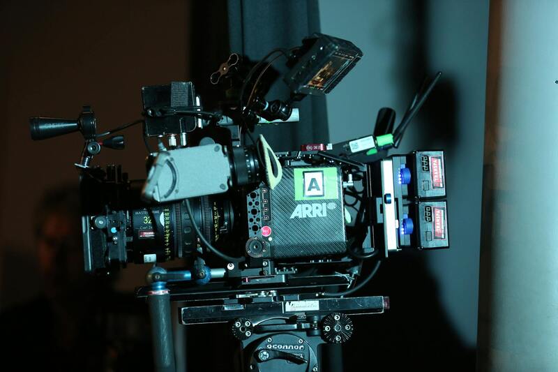
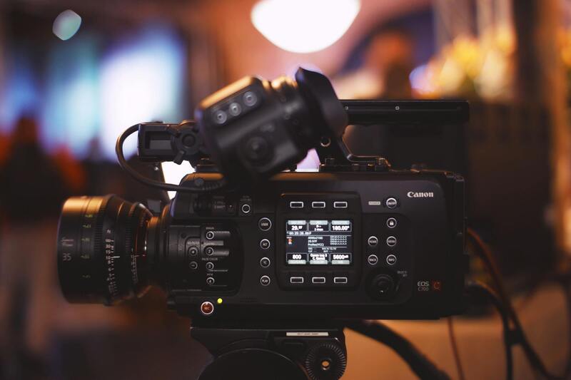
Stable footage is essential for professional-grade imagery. High-quality gimbals and stabilization systems help eliminate vibrations and jitters that can obscure details or distract viewers. Proper stabilization not only results in smooth footage but also enhances the overall cinematic quality of the visuals, making the property appear more luxurious and desirable.
Adjusting Camera Settings for Lighting and Clarity
Optimal camera settings—such as ISO, shutter speed, and aperture—are adjusted based on lighting conditions to produce vibrant, sharp images. Shooting during golden hours, early morning or late afternoon, often yields warmer light and softer shadows, giving the property a welcoming radiance. Post-processing adjustments further refine color accuracy and contrast to enhance visual appeal.
Incorporating Dynamic Camera Movements and Angles
Dynamic movements such as sweeping panoramas, rising upward shots, or orbiting angles provide engaging perspectives that static imagery cannot achieve. These techniques highlight the scale and context of the property within its environment. Using cinematic techniques like slow reveals or drone fly-throughs can capture attention and create immersive experiences for viewers.
Post-Production Enhancements
After capturing the footage, professional editing integrates color correction, stabilization, and special effects to deliver polished content. Enhancements like HDR processing can reveal intricate details in shadows and highlights, ensuring the final product stands out across digital platforms. Cinematic effects or transitions may also be employed sparingly to maintain a professional appearance without overwhelming the viewer.
Final Considerations and Best Practices in Drone Realty Photography
To maximize the benefits of drone realty photography in Miami's competitive real estate market, professionals must adopt a comprehensive approach that emphasizes precision, safety, and strategic planning. Careful pre-shoot planning ensures the chosen flight paths capture the property's most appealing aspects while maintaining safety and compliance. Utilizing high-quality drone equipment with stabilized gimbals and high-resolution cameras guarantees crisp, clear visuals that do justice to the property’s architectural details and surrounding landscape.
Weather conditions play an essential role in drone photography. Optimal shooting conditions include clear, windless days with consistent lighting to prevent motion blur and ensure sharp imagery. Scheduling drone shoots during the golden hours—early morning or late afternoon—can produce warmer, more inviting images, emphasizing the property’s features and creating an emotional connection with viewers.
Effective Post-Processing and Image Optimization
Post-production is a critical phase where raw footage is refined to enhance visual appeal and consistency across marketing materials. Skilled editing involves adjusting exposure, contrast, and color balance to produce vibrant, true-to-life images. HDR processing can reveal nuanced details that might be lost in shadows or highlights, providing a comprehensive view of the property.
Additionally, integrating aerial panoramas and 3D mapping can offer potential buyers an immersive understanding of the property’s layout and surroundings. These advanced techniques add a layer of interactivity and depth to real estate listings, enabling prospective buyers to virtually explore the property from different angles.
Maintaining Ethical Standards and Transparency
Transparency with clients about drone photography processes and techniques fosters trust and demonstrates professionalism. Clear communication about what to expect from drone footage, including coverage areas and shot types, helps manage client expectations and enhances satisfaction.
Furthermore, ensuring all operations adhere to established best practices minimizes disruptions and maintains a positive relationship with local communities. Properly respecting privacy and property boundaries demonstrates a commitment to responsible drone usage.
Final Tips for Optimal Drone Real Estate Photos
- Schedule shoots during optimal lighting conditions for vibrant visuals.
- Utilize high-resolution cameras and stabilization equipment.
- Incorporate a variety of perspectives, including aerial panoramas and close-up architectural shots.
- Ensure thorough planning to cover all angles and features of the property.
- Employ professional editing to enhance clarity and color accuracy.
- Communicate clearly with clients about the scope and methods of drone photography.
- Remain cognizant of changing weather conditions to prevent compromised footage.
Implementing these best practices in drone realty photography not only elevates the visual presentation of Miami properties but also boosts marketing efficacy, attracting more potential buyers and accelerating sales cycles. Investing in meticulous planning, quality equipment, and professional post-production assures that each property listing stands out in a saturated market.