
Overview of Drone Property Photography
Drone property photography has rapidly become an indispensable tool in the modern real estate marketing landscape, especially in vibrant markets such as Miami, FL. Utilizing state-of-the-art unmanned aerial vehicles (UAVs), agents and property owners gain access to high-quality visual content that captures the essence and grandeur of a property from an elevated perspective. This innovative approach helps listings stand out in a crowded marketplace, providing viewers with a comprehensive view of the property’s exterior, surrounding environment, and unique features.
In Miami’s competitive real estate scene, where luxury waterfront homes, sprawling estates, and commercial properties abound, drone photography offers a compelling way to showcase a property’s best attributes. It creates immersive visual narratives that convey scale, location advantages, and aesthetic appeal, which traditional ground-level photography can often overlook. Through strategically captured aerial shots, potential buyers can assess layout, landscaping, and nearby amenities, all from a single, dynamic vantage point.
Official and Verified Methods for Drone Property Photography in Miami
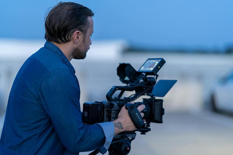
Ensuring the quality and compliance of drone property photography begins with selecting the right operational methods. Legitimacy in drone usage is achieved through adherence to established protocols, utilizing certified equipment, and engaging licensed pilots who have undergone comprehensive training. In Miami, professionals operate under specific flight procedures that meet the standards set by overseeing authorities, ensuring that each sortie captures stunning, high-quality images without compromising safety or privacy.
One of the primary methods involves employing drone operators who have obtained the necessary certifications, such as the Part 107 license. This credential indicates the pilot's proficiency in safe drone operations, understanding airspace boundaries, and adhering to operational guidelines. These professionals also maintain current knowledge of Miami’s airspace rules, which include restrictions around certain zones such as airports, heliports, and densely populated areas.
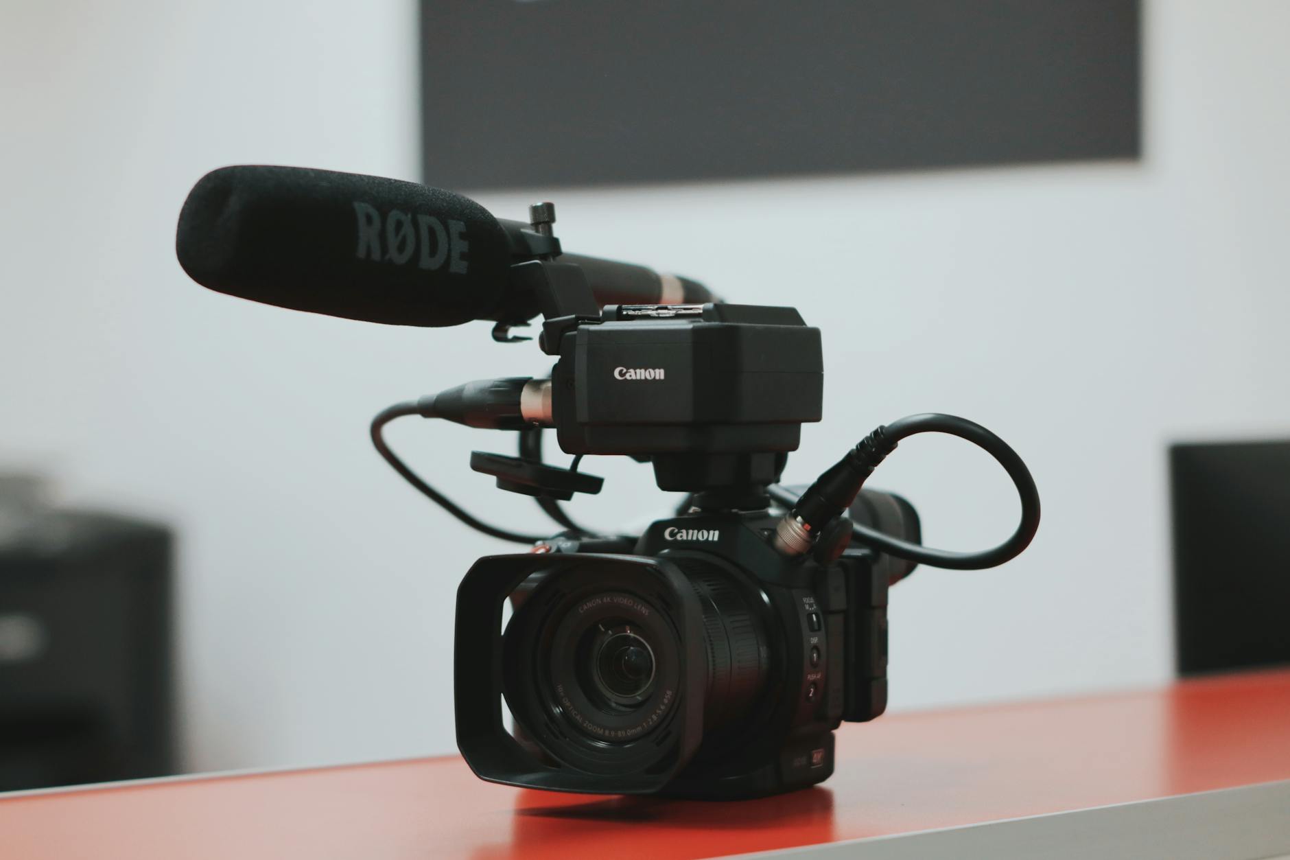
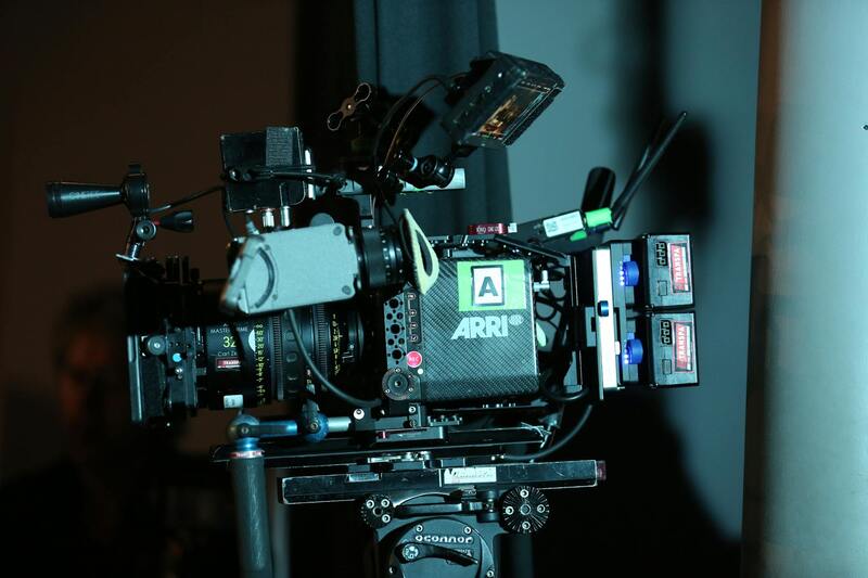
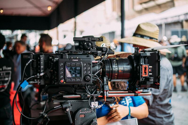
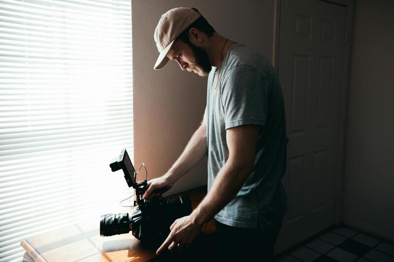
The use of purpose-designed equipment is another legitimate method. This includes drones equipped with professional-grade cameras capable of capturing high-resolution imagery and stabilized gimbals that produce crisp, steady videos. The drones used are regularly maintained and calibrated to ensure optimal performance and image quality, which is vital for presenting properties with accuracy and visual appeal.
Utilizing Approved Flight Technologies and Platforms
In addition, utilizing pre-approved flight platforms and software controllers ensures that operations comply with local regulations. These platforms often incorporate geofencing features, which prevent drones from entering restricted zones, and provide real-time telemetry data to pilots. Software solutions like DJI Terra or FlightHub can assist pilots in planning safe, efficient flight paths, particularly when capturing complex property layouts or expansive estate grounds.
Legitimacy also extends to the methodical process of planning flights. This includes obtaining necessary permission or notifications if required, conducting comprehensive site surveys before flight, and respecting privacy boundaries during data collection. All these practices ensure that drone property photography is performed responsibly, producing official aerial content aligned with professional standards.
Engaging Certified Aerial Photography Services
To maintain high levels of compliance and operational legitimacy, many property owners and real estate agents in Miami choose to work with certified aerial photography service providers. These providers employ licensed pilots, use certified equipment, and follow strict operational procedures. Their expertise not only guarantees stunning visuals but also ensures that each shoot adheres to the safety and operational guidelines that uphold the integrity of drone property photography.
Opting for reputable service providers also means benefiting from ongoing industry education, access to the latest drone technology, and adherence to evolving industry standards, all crucial for producing credible, high-quality property imagery.
}Official Methods for Drone Property Photography in Miami
Executing drone property photography in Miami requires adherence to official procedures that ensure consistent quality, safety, and compliance with operational standards. Property owners and real estate professionals should collaborate with licensed drone operators who utilize certified equipment and follow established flight protocols. These methods include detailed planning of flight paths to cover the entire property and surrounding areas, especially when capturing large estates or difficult-to-reach vantage points. Proper pre-flight surveys are critical, involving site assessments that identify potential hazards and create comprehensive flight maps. When undertaking aerial photography, operators must respect privacy boundaries by avoiding intrusive captures of neighboring properties or private spaces, maintaining professional ethics throughout the process.
The use of specialized drone platforms equipped with high-resolution cameras guarantees professional-grade imagery that captures detailed visuals suitable for marketing, inspection, or documentation. Flight logs and metadata are meticulously documented, ensuring traceability and accountability for each mission, which is essential in maintaining operational integrity. Training for drone pilots encompasses not only mastering flying skills but also understanding the specific regulations and standards that govern aerial photography in Miami, enabling them to execute safe, legitimate flights that align with industry best practices.
In practice, this process involves obtaining any required notifications or permissions from local authorities if necessary, conducting thorough site surveys to identify safe flight zones, and ensuring clear communication with property stakeholders before and during the shoot. These official methods foster trust, ensuring that the resulting footage is both credible and compliant with the high standards expected in professional real estate marketing or documentation efforts.
Training and Certification Standards
Drone operators engaged in property photography in Miami must complete official training programs that cover technical flying skills, safety protocols, and relevant regulations. Many pilots obtain certifications, such as the FAA Part 107 license in the United States, which signifies a thorough understanding of operational standards and airspace regulations. Certification demonstrates a commitment to professionalism, allowing operators to confidently execute aerial captures that adhere to both legal and industry expectations.
This training often involves comprehensive coursework focused on airspace rules, emergency procedures, and risk management, enabling pilots to conduct flights that respect safety boundaries and privacy concerns. Continuous education keeps operators informed about evolving standards and innovative techniques, ensuring that each project benefits from current best practices and technological advancements.
Utilizing Certified Equipment and Software
Manufacturers of drone hardware and software play a key role in producing compliant property imagery. Licensed drone operators select only certified, high-quality equipment capable of capturing sensor data, high-definition images, and detailed orthomosaic maps. Advanced flight planning tools such as DJI Terra or FlightHub streamline the process, allowing for precise path plotting, real-time monitoring, and data management. These tools ensure that flights are conducted systematically, minimizing risks and maximizing data quality.
Data collected through certified methods can be used for various purposes, including virtual tours, property documentation, or larger-scale mapping projects. Maintaining meticulous records and metadata enhances the credibility of the captured content, aligning with industry standards for professional property imagery. Employing such structured, official methodologies guarantees that aerial photographs and videos serve as reliable assets within real estate portfolios, construction documentation, or legal records.
By following these standardized procedures, Miami-based property professionals can ensure that their drone photography projects are not only visually compelling but also formally compliant, safe, and environmentally respectful. These practices underpin the credibility and effectiveness of drone photography as a tool in the competitive real estate market and other industries requiring aerial data collection.
Official Methods and Certified Practices in Drone Property Photography
Implementing official methods in drone property photography begins with adherence to certified operational procedures that ensure the quality and authenticity of the captured data. These procedures involve utilizing properly registered and certified drone equipment, which is subject to rigorous inspections and regular maintenance schedules. This guarantees the equipment consistently produces high-resolution images and videos, vital for detailed property documentation and marketing efforts.
Furthermore, conducting flights within pre-mapped, approved flight zones is crucial to maintain safety standards and ensure that all aerial data collection complies with established guidelines. These zones are determined through meticulous planning, considering local airspaces, no-fly zones, and proximity to critical infrastructure. Employing such sanctioned routes minimizes disruptions and enhances the reliability of the data collected.
Use of professional-level software like DJI Terra or FlightHub is a key component of official practices. These platforms enable precise flight path planning, real-time flight monitoring, and systematic data collection, ensuring consistency, accuracy, and compliance with safety standards. They also facilitate the creation of orthomosaic maps, detailed 3D models, and high-definition videos that serve as credible assets for real estate listings or documentation projects.
In addition to operational equipment and software, rigorous record-keeping practices form the backbone of official drone photography activities. Maintaining comprehensive logs of flight paths, environmental conditions, and equipment checks not only enhances transparency but also supports data validation processes. Such meticulous documentation aligns with professional standards and provides an audit trail that confirms the legitimacy of the imagery produced.
Data management is another critical aspect that underscores official practices. Ensuring stored images and videos are correctly cataloged with metadata—such as date, location, altitude, and camera specifications—further authenticates the content. This structured approach not only increases credibility but also makes it easier to retrieve, analyze, and utilize the data in legal or contractual contexts.
When expanding the scope of drone inspections or mapping projects, adherence to these structured methodologies guarantees that the resulting data sets are comprehensive, consistent, and fit for purpose. Whether used for virtual tours, property evaluation, or large-scale mapping, these disciplined practices foster trust and confidence among clients, stakeholders, and regulatory bodies alike.
Ultimately, applying official, certified methods in drone property photography enhances the professionalism and dependability of the service. It ensures the captured content aligns with industry standards, providing clients with high-quality, verifiable, and actionable imagery that supports successful real estate transactions and property management activities in Miami and beyond.
Comprehensive Documentation and Data Management Practices
Precise record-keeping forms the backbone of professional drone property photography. Documenting each flight with detailed logs that include flight paths, environmental conditions, time stamps, and equipment settings ensures a high degree of accuracy and accountability. These records serve as an essential reference point, validating that the imagery was captured under controlled, traceable parameters. Additionally, maintaining organized metadata for each file, such as date, location coordinates, altitude, and camera specifications, enhances the integrity and usability of the data. Such meticulous documentation facilitates seamless retrieval, analysis, and presentation, especially when images are used for legal, contractual, or marketing purposes.
Moreover, structured data management supports consistent quality control. By adhering to standardized protocols for logging and cataloging data, drone operators can identify and rectify anomalies promptly, ensuring each capture aligns with industry benchmarks. When property listings incorporate drone content, this consistent approach reassures clients and stakeholders of the authenticity and professionalism of the visuals. It also expedites workflows in large-scale projects involving multiple operators or multiple flights, ensuring the final outputs are comprehensive, accurate, and dependable.
Application of Certified and Verified Methods in Drone Photography
The utilization of certified practices ensures that drone property photography in Miami adheres to set standards that promote quality and consistency across all projects. Employing only certified drones and trained pilots who follow established operational procedures guarantees that imagery is captured reliably and reproducibly. These practices involve pre-flight checks, calibration protocols, and adherence to prescribed flight altitudes and angles, which are critical for producing high-quality images that accurately represent properties.
In addition, leveraging verified methods means utilizing trusted equipment and software that conform to recognized standards. Regular calibration, software updates, and adherence to manufacturer guidelines help maintain optimal performance and image fidelity. When a drone operator employs tested, certified techniques, clients gain confidence in the authenticity of the visuals, knowing they are generated through methods that meet industry benchmarks for precision and professionalism.
Enhancing Professionalism and Trust in Miami’s Real Estate Market
Implementing official, verified methods in drone photography elevates the standard for visual marketing in Miami’s competitive real estate environment. When clients observe that imagery is produced through certified procedures utilizing state-of-the-art equipment, their confidence in the property’s online presentation increases significantly. Authentic, high-quality visuals contribute to a more engaging listing, attracting potential buyers and facilitating faster transactions.
Furthermore, maintaining transparency about the methods used—such as certification levels, equipment models, and operational protocols—strengthens credibility. It demonstrates a commitment to excellence and accountability, fostering trust among real estate agents, property owners, and prospective buyers. As the market continues to evolve, firms that prioritize verified, official practices will set themselves apart by consistently delivering dependable visual content that supports successful property sales and effective property management in Miami’s vibrant real estate landscape.
Understanding Official Drone Operation Methods in Miami
In the dynamic landscape of Miami’s real estate marketing, leveraging drone technology for property photography demands adherence to precise operational standards. These standards ensure that aerial imagery is not only visually striking but also obtained through responsible and methodical practices that maintain consistency and quality. Establishing a structured approach to drone operation involves meticulous planning, proper equipment handling, and adherence to refined flight protocols that have been validated through industry-recognized processes.
Developing a Certification-Based Approach to Drone Operations
To capitalize on the potential of drone property photography, Miami professionals often pursue certification-driven training programs that focus on best practices, safety procedures, and advanced operational techniques. These programs typically encompass theoretical coursework on airspace regulations, equipment tutorials, and practical flight sessions. Graduates of such programs attain proficiency in executing complex flight paths that optimize spatial coverage and image quality while adhering to established protocols. Certification not only enhances operational credibility but also signals a commitment to maintaining high standards in property visualization.
Regular Equipment Calibration and Maintenance
Consistent calibration and maintenance of drone hardware ensure optimal performance during property shoots. This involves routine checks of camera lenses, stabilization systems, GPS modules, and batteries, ensuring reliable operation across diverse weather conditions common in Miami. Maintaining a rigorous maintenance schedule helps mitigate technical glitches, reduces downtime, and guarantees that captured imagery meets the high resolution and clarity expected by clients.
Operational Protocols for Precise Drone Flights
Implementing standardized flight protocols is crucial for producing uniform, high-quality images. These procedures include pre-flight risk assessments, setting predefined flight paths, and executing controlled altitudes and angles that highlight a property’s best features. During flight, pilots utilize advanced GPS-based waypoint navigation to maintain accuracy, especially in complex layouts or large estates. Post-flight procedures involve detailed data review and quality assurance checks to confirm that every captured shot aligns with the desired property presentation standards.
Utilizing Verified Data Collection Methodologies
Infrastructural data accuracy forms the foundation of trustworthy property imagery. Official methods in drone property photography emphasize the collection of precise spatial data without deviation, often involving the integration of orthomosaic mapping and 3D modeling. These techniques require the drone operator to employ validated software solutions that stitch images seamlessly, creating accurate top-down views and architectural models that reflect the property's true dimensions. Such meticulous data collation enhances the credibility of the visuals, providing clients with realistic insights.
Ensuring Transparency and Accountability in Drone Operations
Transparency in operational practices fosters greater trust among clients, real estate agents, and property owners. Documenting each phase of drone missions, from pre-flight checks to data processing, allows for accountability and reproducibility of results. Offering detailed reports that include equipment specifications, flight logs, and data handling procedures bolsters confidence in the imagery’s authenticity. Such practice not only reflects a commitment to professionalism but also aligns with the high standards expected in Miami’s competitive real estate market.
Training and Continuous Improvement
Ongoing education in official drone methodologies is essential for adapting to evolving technological standards and regulatory updates. Participating in recognized training programs enables practitioners to refine their skills, ensuring their approach aligns with industry best practices. Additionally, engaging in peer reviews, attending industry workshops, and staying informed about advancements in drone technology contribute to continuous operational enhancement—delivering consistently superior property visuals that meet client expectations.
Overview of Drone Property Photography
Drone property photography has revolutionized the way real estate professionals showcase properties. Utilizing high-quality unmanned aerial vehicles (UAVs), drone photography captures expansive, detailed views of properties from various perspectives that traditional photography cannot easily achieve. This technique provides an aerial vantage point, highlighting features such as landscaping, architectural details, and neighborhood context, all contributing to a comprehensive visual narrative of the property. With state-of-the-art drone equipment, photographers can achieve sharp, high-resolution imagery that emphasizes the property's best qualities, creating compelling listings that stand out in competitive markets. The use of drone photography also enables real estate professionals to present multi-dimensional views, including panoramic shots and dynamic video tours, which increase engagement and attract prospective buyers. Such visual assets are integral to constructing an impactful online presence, essential in today’s digital-centric real estate landscape.

Benefits of Using Drone Photography in Real Estate
- Enhanced Property Visibility: Aerial shots provide a unique perspective that can highlight features often missed in ground-level images, such as property size, exterior amenities, and surrounding landscape.
- Improved Listing Appeal: High-quality drone visuals attract more attention online, increasing the likelihood of inquiries and viewings.
- Contextual Neighborhood Insights: Drone images convey the neighborhood environment, proximity to amenities, and overall community appeal, helping buyers make informed decisions.
- Time Efficiency: Drones can quickly capture comprehensive coverage of large properties, reducing the need for multiple ground-based photos and videos.
- Enhanced Marketing Content: Aerial videos and virtual tours offer immersive experiences, giving potential buyers a realistic sense of the property layout and scale.
Legal Requirements and Certifications in Miami
Miami-based drone operators engaged in property photography are required to adhere to specific operational standards. These include obtaining certifications that attest to their ability to fly drones safely and responsibly. Certification processes often involve comprehensive training, covering areas such as airspace regulations, safety procedures, and best practices for capturing aerial imagery. Ensuring that drone pilots hold recognized credentials demonstrates compliance with local protocols and a commitment to professional standards. Additionally, drone operators should maintain detailed flight logs and adhere to prescribed flight altitudes and operational zones, especially when photographing sensitive or restricted areas. Working with licensed pilots promotes smooth, interruption-free shoots that produce high-quality images while respecting privacy and operational guidelines, critical to maintaining a trustworthy reputation in Miami’s competitive real estate market.
Types of Drone Shots for Property Listings
Effective drone property photography encompasses various shot types tailored to highlight different aspects of a property:
- Overview Shots: Wide-angle images that capture the entire property, providing context within the neighborhood.
- Close-Up Detail Shots: Focused images emphasizing unique architectural features, landscaping details, or outdoor amenities.
- Elevation Shots: Shots from higher altitudes showcasing the property’s scale and its relation to surrounding areas.
- Panoramic and 360-Degree Shots: Seamless wide views that offer a comprehensive visual perspective of the property and environment.
- Dynamic Video Flythroughs: Smooth aerial videos that guide viewers through the property, highlighting key features and layout.
- Night Shots with Lighting Effects: Aerial images captured during twilight or with strategic lighting to accentuate architectural details or outdoor spaces.
Best Practices for Drone Property Photography
To ensure high-quality results, drone operators should adhere to several practices:
- Pre-Flight Planning: Conduct thorough site assessments to identify optimal flight paths, lighting conditions, and potential obstacles.
- Equipment Calibration: Regularly verify that drone sensors and camera settings are correctly calibrated to produce sharp, color-accurate images.
- Weather Considerations: Schedule flights during favorable weather to prevent issues caused by wind, rain, or poor visibility.
- Optimal Flight Altitudes: Maintain appropriate heights to balance detail and safety while capturing the desired perspectives.
- Post-Flight Data Management: Implement secure data handling protocols and utilize professional editing tools to enhance images and videos.
- Compliance with Operational Standards: Follow local regulations pertaining to flight zones, altitude limits, and time restrictions to avoid disruptions or safety hazards.
Integrating Drone Content into Real Estate Marketing
The strategic incorporation of drone visuals can significantly amplify a property’s market presence. High-quality aerial images and videos should be integrated seamlessly into online listings, virtual tours, and social media campaigns. The visual storytelling created through drone content offers potential buyers an engaging experience, allowing them to explore the property remotely with an immersive sense of scale and environment. Additionally, pairing drone imagery with traditional ground-level photos creates a comprehensive presentation that highlights both interior and exterior features. QR codes linking to drone videos can be embedded in printed materials, expanding reach and encouraging virtual engagement. By leveraging drone visuals thoughtfully within marketing strategies, real estate professionals can differentiate their listings, attract more qualified inquiries, and expedite sales processes without complication or delay.
Final Insights on Drone Property Photography in Miami
To fully leverage the advantages of drone property photography in Miami, it's essential to work with reputable service providers who maintain rigorous operational standards. These providers often employ advanced equipment and adhere to strict safety protocols, which ensure high-quality capture of aerial images and videos. They also utilize professional editing tools to refine media, delivering visually compelling content that aligns with marketing objectives.
Clients should prioritize providers with a robust portfolio demonstrating versatility across diverse property types, from luxury estates to commercial developments. It's advisable to review case studies or request samples of previous work. Additionally, transparency regarding the equipment used, flight procedures, and data handling processes affirms a commitment to quality and professionalism.
Choosing the right partner involves assessing their experience with specific property markets and understanding their approach to capturing optimal shots. Clear communication about project scope, timelines, and deliverables fosters a smooth workflow. A reputable provider also ensures compliance with all relevant operational standards, tailoring their services to meet both client expectations and technical requirements effectively.
Beyond initial capture, the integration of drone content into broader marketing strategies is crucial. Stunning aerial visuals paired with detailed ground-level imagery tell a compelling story about a property's unique features and surroundings. Virtual tours incorporating drone footage enrich the buyer's experience, providing a comprehensive view that enhances engagement and facilitates faster decision-making.
Staying informed about technological innovations, such as 3D mapping, thermal imaging, and virtual reality, can further elevate Miami's real estate presentations. These emerging tools enable more interactive and immersive experiences, setting listings apart in a competitive market. Regularly updating techniques and embracing new solutions helps maintain a cutting-edge approach that attracts sophisticated buyers and investors.
In conclusion, the transformative potential of drone property photography in Miami hinges on professional execution, innovative application, and strategic integration. When engaged thoughtfully, drone imagery not only elevates individual listings but also reinforces a real estate brand’s reputation for high-quality, visually impactful marketing. By continuously exploring new capabilities and refining operational practices, real estate professionals can maximize the return on their drone investment and secure a competitive advantage in the Miami real estate landscape.