
Introduction to Drone Photography of Houses
In recent years, the integration of drone technology into real estate marketing has transformed the way properties are showcased. Drone pictures of houses offer a distinctive vantage point that traditional ground-level photography simply cannot achieve. By capturing aerial perspectives, these images highlight the full scope of a property's features, providing potential buyers with a comprehensive view that encompasses both the structure and the surrounding landscape.
Utilizing drones for real estate photography enhances the visual appeal of property listings, allowing real estate professionals and homeowners to present homes in a dynamic and engaging manner. Aerial shots can emphasize unique architectural details, sprawling gardens, luxurious outdoor amenities, and neighborhood layouts, all contributing to a compelling narrative about the property's attractiveness and potential lifestyle.
The benefits of incorporating drone imagery extend beyond aesthetic appeal. They serve as powerful marketing tools that can significantly influence buyer interest and engagement. When viewers can see the entire property and its context within the community, they gain a better understanding of the property's value and unique selling points. This broader perspective often results in faster sales and increased buyer confidence, establishing drone photography as an essential component of modern real estate marketing strategies.
Moreover, drone pictures of houses can be integrated into virtual tours and online listings to create immersive experiences for prospective buyers. These images provide an authentic sense of space and scale, helping buyers to assess how the property fits their needs from the comfort of their current residence. Consequently, drone photography has become a vital tool for real estate professionals aiming to stand out in a competitive market and appeal to an increasingly digital-savvy audience.
In summary, drone photography of houses combines innovation with practicality, offering an array of benefits that elevate property presentations. It captures the full scope of a home's exterior and surroundings in ways traditional photography cannot, making it a valuable investment for anyone looking to maximize their property's visual impact and marketability.
Key Features Captured in Drone House Photos
Drone photography provides a comprehensive view of residential properties by capturing crucial exterior features from an elevated perspective. These images often highlight elements that are difficult to showcase through traditional ground-based photographs, such as the overall property layout, roof condition, landscaping, and outdoor amenities. A well-composed drone shot can emphasize curb appeal by highlighting the symmetry of the facade, the condition of the driveway, and the arrangement of surrounding features like gardens, patios, or pools.
Beyond the immediate exterior, drone images can reveal contextual surroundings that influence a property's desirability. For example, aerial views can depict proximity to parks, bodies of water, major roads, or neighborhood infrastructure, giving potential buyers a holistic understanding of the property's environment. This broader perspective allows viewers to assess privacy levels, property size, and how the residence integrates within its community.
Drone photography also excels at capturing details of outdoor spaces that enhance the property's overall presentation. Features such as multi-car garages, custom fencing, or unique landscaping designs gain visual emphasis, helping to communicate the full scope of your home's exterior features. These high-altitude images can be used effectively in online listings, brochures, and virtual tours to create a compelling narrative about the property's value and lifestyle appeal.
Technical Aspects of Drone House Photography
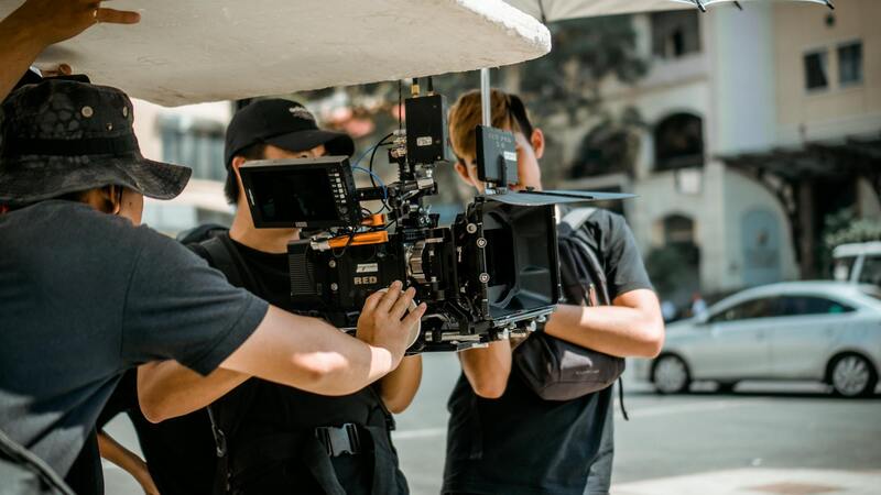
Effective drone house photography relies on a combination of proper equipment, optimal flight parameters, and skilled image handling. Modern drones equipped with high-resolution cameras—often exceeding 20 megapixels—are standard for capturing crisp details from various angles. The choice of camera settings, including aperture, shutter speed, and ISO, plays a vital role in ensuring clarity and color accuracy.
Plan your flight to avoid motion blur and ensure proper focus. Maintaining a steady hover and executing smooth, stable movements delivers professional-quality images free of shaking or distortion. Drone operators should also adhere to prescribed altitude limits to capture comprehensive views while preserving safety and image quality.
Post-processing is an essential step in drone photography. Techniques such as HDR (High Dynamic Range) imaging can enhance details in shadows and highlights, resulting in images with balanced exposure. Stitching multiple photos into panoramic shots can also provide expansive views of property grounds and neighboring areas.
Technical Aspects of Drone House Photography
Achieving high-quality drone images of houses necessitates the deployment of advanced equipment paired with precise operational techniques. Modern drones used for house photography are typically equipped with high-resolution cameras, often exceeding 20 megapixels, capable of capturing intricate exterior details. The choice of camera settings—such as aperture, shutter speed, and ISO—is critical in optimizing image clarity, color fidelity, and exposure balance. Properly configuring these settings ensures crisp images that accurately portray every aspect of a property’s exterior.
Flight planning is a vital component in drone house photography. It involves determining optimal flight paths, setting appropriate altitudes, and selecting angles that highlight key property features. Maintaining steady hover stability and executing smooth, controlled movements during flight minimize motion artifacts, resulting in professional-grade images free from blurring or distortion. Respecting predefined altitude limits not only enhances safety but also guarantees comprehensive coverage of the property’s exterior from multiple perspectives.
Post-processing is an indispensable phase in producing polished drone images. Techniques such as High Dynamic Range (HDR) imaging allow for the enhancement of shadow and highlight details, delivering images with balanced exposure throughout. Stitching multiple photos into expansive panoramic shots can further showcase large grounds or neighboring amenities, offering potential buyers a comprehensive visual context of the property’s surroundings. Employing these methods ensures that the final images not only meet high aesthetic standards but also provide an accurate and detailed portrayal of the property.
Exploring Techniques for Capturing Effective Drone Pictures of Houses
Achieving high-quality drone images of residential properties involves a combination of precise equipment setup, strategic flight planning, and optimal environmental conditions. Professionals utilize advanced drone platforms equipped with high-resolution cameras capable of capturing detailed exterior views. These cameras often feature adjustable lenses to accommodate various lighting scenarios and architectural features, ensuring that every detail of the property is accurately represented.
Choosing the right flight angles is crucial for showcasing a house’s unique features and its surrounding landscape. Overhead shots from multiple altitudes can provide comprehensive views of the roof design, yard layout, and landscaping details. Angled shots from various directions help highlight architectural elements such as patios, balconies, or garden features. Employing consistent flight paths and smooth maneuvers reduces motion artifacts, resulting in crisp, professional imagery.
Lighting plays a significant role in drone photography. The best results are often achieved during the golden hours—shortly after sunrise or before sunset—when natural light casts a warm glow and creates shadows that add depth to the images. Overcast days can also produce soft, even lighting, minimizing harsh shadows and reflections. Additionally, the time of day affects drone stability; calmer winds and mild temperatures contribute to steadier flights and sharper images.
Post-flight planning, including reviewing the captured footage and images, ensures that the selected photographs highlight the property’s most appealing aspects. Adjustments such as color correction, contrast boosting, and perspective correction can enhance the visual impact. Seamless stitching of multiple images into panoramas provides expansive views of large properties or surrounding scenery, enriching the overall presentation.
In sum, the key to effective drone house photography lies in meticulous preparation, capturing diverse viewpoints during optimal lighting conditions, and refining images through professional editing. These combined efforts produce compelling visuals that effectively communicate the property's value and appeal to prospective buyers or viewers.
Technical Methodologies for Securing Drone House Imagery
Acquiring high-quality drone pictures of houses hinges on selecting appropriate techniques and equipment that align with the unique attributes of each property. The process begins with utilizing drones equipped with high-resolution cameras capable of capturing detailed and sharp images from various altitudes. Flight planning plays a crucial role, involving pre-determined routes that ensure comprehensive coverage of the property’s exterior, including front, rear, and roof angles.
Optimal flight parameters are critical: maintaining stable hover points, controlling flight altitude for perspective accuracy, and ensuring balanced camera settings for exposure and focus. Professionals often employ gimbal stabilization technology to eliminate vibrations, resulting in clear, professional images. Depending on the property’s size and landscape, automated flight paths programmed via sophisticated software can guarantee consistent image quality and coverage.
Lighting conditions are meticulously considered; early mornings and late afternoons provide softer light that accentuates textures and colors. On overcast days, diffuse lighting minimizes shadows, revealing more detailed surface features. Wind conditions are monitored since stable weather enhances the drone’s steadiness, reducing blur and ensuring sharp imagery.
Post-flight, images are reviewed and processed to optimize visual appeal and accuracy. Techniques such as perspective correction ensure orthogonal views, avoiding tilting distortions. Color correction and contrast adjustments enhance visual vibrancy, making features stand out. Stitching multiple images can create panoramic shots of large properties or surrounding areas, providing a comprehensive visual experience. Advanced editing software is used to remove any unwanted artifacts or distortions, resulting in polished, impactful visuals that accurately represent the property’s exterior. This methodical approach ensures that each drone picture of a house communicates its unique features effectively to prospective buyers or viewers, elevating the overall marketing presentation.
Technical Aspects of Drone House Photography
Achieving high-quality drone images of houses requires a nuanced understanding of both aircraft operation and photographic principles. Certified drone operators utilize advanced stabilization technology to minimize vibrations, ensuring crisp, clear images. Automated flight paths, programmed with sophisticated flight planning software, allow for precise control over altitude, angle, and coverage. These pre-determined routes guarantee uniformity across multiple shots and maximize efficiency during the shoot.
Lighting plays a vital role in drone photography. Early mornings and late afternoons provide ideal lighting conditions, casting a warm, diffuse glow that enhances surface textures and architectural details. On overcast days, the diffuse natural light minimizes shadows, allowing for detailed capture of surface features such as roofing, landscaping, and exterior finishes.
Weather conditions are carefully monitored to optimize shot quality. Stable, windless days reduce drone movement, preventing motion blur and ensuring sharp images. Additionally, the calibration of drone sensors and cameras is meticulously maintained to match environmental conditions, reducing distortion and color inaccuracies.
Post-capture, images undergo detailed processing. Perspective correction algorithms rectify any tilting issues, providing orthogonal views essential for accurate representation. Color grading and contrast adjustments further enhance visual appeal, highlighting the intended features of the property. Stitching multiple images can produce panoramic or 3D visualizations, offering comprehensive views of large properties or landscapes.
Key Methods for Capturing Drone Pictures of Houses
Acquiring high-quality drone images of residential properties entails meticulous planning and execution using proven, professional techniques. These methods not only ensure optimal visual results but also maintain safety standards and respect property boundaries. Among the essential practices are pre-flight planning, choosing appropriate equipment, and executing methodical flight operations.
Pre-Flight Planning and Site Evaluation
Before any aerial photography session, a comprehensive site assessment is conducted. This involves analyzing factors such as the property's layout, surrounding environment, obstructions like trees or power lines, and prevailing weather conditions. Effective planning minimizes risks during flight and guarantees the capture of the desired visuals. A detailed site survey includes identifying the best angles for capturing the house's architecture, driveway, landscaping, and neighboring features that add contextual value.
Optimal Equipment Selection
High-resolution drones equipped with stabilized gimbal cameras are preferred for residential property photography. These devices facilitate sharp, distortion-free images even in complex lighting conditions. Employing drones capable of adjustable flight parameters, such as altitude, speed, and camera angles, allows for customization according to the specific requirements of each property. Additionally, supplementary accessories like ND filters can enhance image quality by managing light exposure, especially during bright sunlight.
Executing Effective Flight Operations
Professional drone operators follow precise flight protocols, including maintaining safe distances from structures and adhering to predefined flight paths. Utilizing automated flight modes and waypoint navigation ensures consistent coverage of the entire property, capturing multiple perspectives and angles. To achieve comprehensive imagery, multiple passes at different altitudes and viewpoints are performed, including overhead shots, oblique angles, and panoramic sequences.
Post-Flight Data Handling and Image Processing
Once the flight is completed, the captured footage and images undergo rigorous processing. Techniques such as stitching, perspective correction, and color grading enhance visual clarity and realism. Correcting distortions caused by lens fisheye effects or tilt ensures orthogonal views suitable for marketing materials or virtual tours. Advanced software can assemble multiple images into high-resolution panoramas or 3D models, providing immersive visualizations that elevate property presentations.
Maintaining Consistency and Quality Standards
Consistency in image quality across different projects is achieved through standardized shooting protocols and regular equipment calibration. Maintaining focus, proper exposure, and stabilized framing contributes to professional-grade visuals. Additionally, drone operators stay updated with latest advancements in drone technology and photography techniques to continually improve their results.
Summary of Best Practices
- Thorough site assessment and planning to identify optimal flight paths and angles
- Utilization of high-resolution, stabilized drone platforms with capable cameras
- Execution of multiple flight passes for comprehensive coverage
- Application of post-processing techniques for image enhancement and correction
- Adherence to safety and operational protocols to minimize risks
- Regular equipment maintenance and software updates to ensure peak performance
Through the disciplined implementation of these methods, drone photography of houses can yield detailed, compelling visuals that significantly enhance property listings and marketing campaigns. Precision in execution coupled with rigorous post-processing ensures that each image authentically represents the property’s architectural beauty and contextual surroundings, making it a powerful tool for real estate professionals.
Ensuring the Quality and Authenticity of Drone Pictures of Houses
Obtaining high-quality drone images that accurately represent a property involves meticulous planning and execution, focusing on both technical precision and adherence to best practices. To guarantee that the footage and photographs meet professional standards, it is essential to start with a comprehensive site assessment. This includes evaluating the property's layout, surrounding landscape, lighting conditions, and potential obstructions that could interfere with drone flight paths. Effective planning allows for the determination of optimal flight angles, heights, and timing, which collectively contribute to capturing compelling visuals of the house and its environment.
Utilizing high-resolution, stabilized drone platforms equipped with advanced camera systems is crucial for capturing crisp, detailed images. These drones should be capable of multiple flight passes to ensure comprehensive coverage of the property from various perspectives, including aerial shots of the roof, landscape, and surrounding neighborhood. Proper operation hinges on controlled, smooth flight maneuvers that prevent motion blur and distortion, preserving image integrity for both marketing and record-keeping purposes.
Post-processing techniques further enhance drone photographs, allowing for correction of exposure, color balance, and minor distortions. Consistent calibration of equipment and standardization of workflow protocols maintain image quality across different projects. This disciplined approach not only results in visually stunning visuals but also provides a reliable, authentic representation of the property, which is vital in real estate listings or promotional materials.
Regular maintenance of drone hardware and software updates are fundamental to operate at peak performance. This includes cleaning camera lenses, updating firmware, and checking battery health to prevent technical failures during flights. Implementing standardized operational procedures and safety protocols ensures that drone activities are conducted responsibly, minimizing risks and fostering trust with clients and stakeholders. These measures enable the consistent production of credible, high-quality drone images of houses that serve as a powerful marketing tool and an accurate visual record for property owners.
Legitimate sources of drone imagery emphasize consistency, technical excellence, and compliance with operational standards. Working with experienced drone operators who utilize professional-grade equipment and follow established guidelines ensures the generation of authentic visuals that effectively highlight the architectural features, landscape aesthetics, and contextual surroundings of a property. When properly executed, drone pictures of houses become an invaluable asset capable of elevating a listing’s appeal and facilitating informed decision-making for prospective buyers.