
Understanding the Role of Drone Photography in Commercial Real Estate
In the rapidly evolving landscape of property marketing, the adoption of drone photography has proved to be a game-changer for the commercial real estate sector. This innovative approach employs unmanned aerial vehicles (UAVs) equipped with high-resolution cameras to capture expansive, detailed imagery from above, offering perspectives that traditional ground-level photography simply cannot provide. By integrating drone technology into their marketing strategies, property owners and brokers obtain comprehensive views of commercial assets, facilitating better decision-making and attracting more prospective tenants or buyers.
Drone photography enables the presentation of expansive large-scale properties such as office parks, industrial complexes, retail centers, and multifaceted commercial sites in a manner that highlights their scale, layout, and surroundings. Aerial shots can reveal contextual information about accessibility, proximity to transportation hubs, and neighboring developments—elements crucial for commercial investments and leasing decisions. Moreover, these high-quality visuals are especially valuable in competitive markets like Miami, FL, where showcasing unique features and strategic location advantages can differentiate a property among numerous listings.

Beyond simple imagery, modern drone photography can be integrated with advanced imaging techniques such as 3D mapping and orthomosaic images, providing comprehensive visual documentation of property boundaries and existing structures. These tools are particularly useful for property analysis, development planning, and visual documentation of the site's current condition. The ability to capture high-resolution footage from varied angles enhances marketing sophistication and helps to communicate the true scale and potential of commercial assets to stakeholders.
Another significant benefit of drone technology is its efficiency. Traditional ground-based photography for large properties can be time-consuming and sometimes limited in scope. Drones can swiftly cover extensive areas, reducing the time required to gather comprehensive visuals without compromising quality. This speed ensures that marketing campaigns launch promptly, aligning with market demands and client expectations. Furthermore, the consistent quality of drone-captured images reinforces a professional brand image, appealing to discerning investors and tenants who seek detailed and visually compelling presentations.

The transformative impact of drone photography on commercial real estate marketing is evident in its ability to deliver accurate, engaging, and comprehensive content. This technology extends beyond mere visuals; it acts as an integral tool for strategic marketing, helping clients to visualize the full potential of a property while fostering transparency and trust. As the industry continues to evolve, the integration of high-resolution aerial imagery will remain a fundamental component in the effective marketing and management of commercial real estate assets in vibrant markets such as Miami, FL.
Understanding the Role of Drone Photography in Commercial Real Estate
In the realm of commercial real estate, visual content holds paramount importance for effective marketing strategies. Professional drone photography equips industry professionals with an unparalleled vantage point that captures the full scope of a property. The strategic use of high-resolution aerial imagery enables stakeholders to showcase expansive land developments, complex architectural designs, and the intricate details of urban environments with clarity and impact. By providing comprehensive visuals, drone imagery fosters a deeper understanding of property layouts, neighborhood contexts, and spatial relationships, which are critical factors influencing investor decisions.
Implementing drone photography in commercial real estate marketing enhances transparency and facilitates more informed negotiations. Drones are capable of capturing images from numerous angles and altitudes, providing a multi-dimensional perspective that ground-level photographs simply cannot replicate. This versatility is particularly advantageous when highlighting large-scale projects such as business parks, industrial facilities, or shopping centers. Moreover, aerial footage can emphasize the property's accessibility, transportation links, and proximity to key infrastructure, all of which are vital elements for potential tenants or buyers.
Efficiency and Precision in Visual Content Acquisition
Traditional photography methods for extensive commercial sites often involve significant logistical planning, multiple site visits, and considerable time investment. Drone technology streamlines this process by rapidly covering vast areas, capturing detailed imagery that aligns with the project's specific marketing goals. The ability to generate consistent, high-quality visuals quickly permits campaign launches that are timely and relevant, ensuring properties stay competitive in dynamic markets like Miami. Additionally, drone footage can be compiled into panoramas, 3D models, and interactive virtual tours, enriching marketing platforms and attracting a wider audience of investors and tenants.
Supporting Strategic Decisions with Accurate Data
Beyond marketing, drone images serve as vital tools in the planning, development, and management of commercial properties. High-resolution aerial maps assist in assessing site conditions, monitoring construction progress, and conducting regular inspections. The precision of drone data supports detailed analysis of land contours, vegetation, and structural elements. These insights enable property managers and developers to make informed decisions regarding renovations, expansions, or maintenance schedules, thereby optimizing operational efficiency and long-term investment value.
The adoption of commercial real estate drone photography also aligns with the increasing demand for environmentally conscious and resource-efficient practices. By minimizing the need for extensive on-site visits for inspections or surveys, drones help reduce carbon footprints while maintaining high standards of accuracy and detail. Their versatility extends further into capabilities such as thermal imaging and 3D mapping, which provide additional layers of data for comprehensive property assessments. This technological integration elevates the professionalism of marketing efforts and operational workflows, reinforcing trust and credibility among clients and partners in the competitive Miami market.
Ensuring Professionalism and Compliance
While deploying drone technology, adherence to established operational protocols ensures the safety and quality of imagery. Certified pilots utilize advanced equipment and follow precise flight plans to capture optimal visuals under varying weather and lighting conditions. Such professionalism mitigates risks and guarantees consistency across projects, maintaining the high standards expected in commercial real estate marketing. This disciplined approach results in captivating imagery that enhances property desirability and supports strategic storytelling within campaigns.
Implementing Methodical and Structured Approaches for Drone Operations
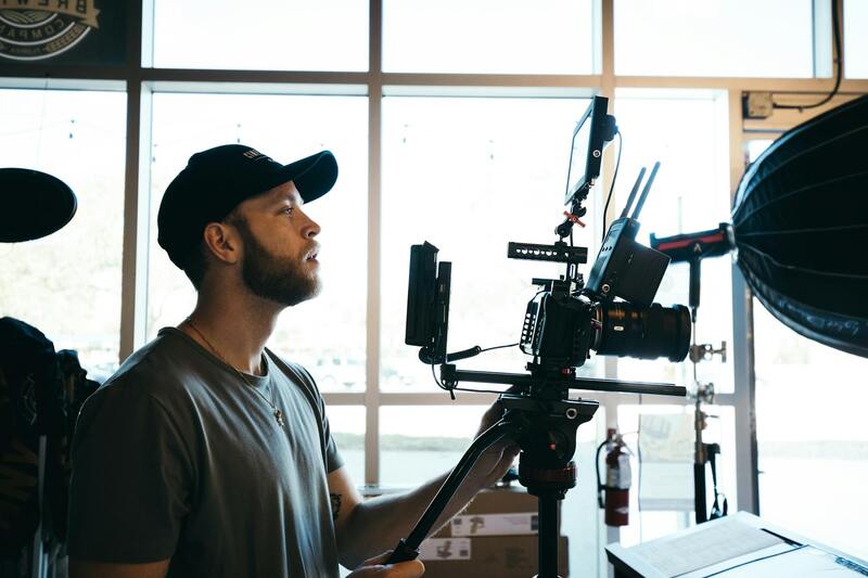
To maximize the impact and effectiveness of commercial real estate drone photography, deploying a methodical and structured operational approach is crucial. This begins with comprehensive pre-flight planning, which involves evaluating weather conditions, understanding the specific architectural and landscape features of the property, and establishing clear objectives for the imagery. Utilizing detailed flight plans, which include GPS waypoints and altitude parameters, ensures consistent coverage and high-quality data capture. Certified pilots leverage advanced flight management software to orchestrate smooth and safe drone operations, reducing the likelihood of abrupt interruptions or suboptimal shots. During the actual shoot, employing proper camera settings tailored to the lighting environment optimizes image clarity and color accuracy. Photographers and operators should focus on capturing multiple angles, elevations, and perspectives that highlight key property attributes—such as proximity to infrastructure, surrounding topography, and unique architectural details. The use of high-resolution sensors, combined with stable flight platforms, guarantees crisp, detailed imagery suitable for marketing, inspection, or surveying purposes. Post-flight, a meticulous review of footage or images ensures that all desired visual elements are captured, and any necessary retakes are scheduled promptly.
Optimizing Data Collection with Advanced Equipment and Techniques
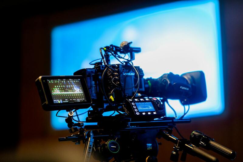
The choice of equipment plays a vital role in achieving superior output in commercial drone photography. High-end drones equipped with 4K or higher resolution cameras facilitate the capture of high-detail visuals that reveal subtle architectural features and intricate structural components. Gimbal stabilization technology ensures steady shots, even in challenging wind conditions. Integrating additional sensors, such as thermal imaging or multispectral cameras, allows for a deeper analysis of property conditions—identifying heat losses, insulation issues, or environmental factors. Employing techniques such as panoramic stitching, 3D modeling, and orthomosaic mapping enhances the comprehensiveness of property presentations. For instance, orthomosaic images created through aerial surveys provide accurate, scaleable maps that support site planning and management. Similarly, 3D modeling offers dynamic views of complex structures, allowing clients to explore properties from multiple perspectives remotely. These technological innovations streamline workflows, minimize on-site visits, and enrich marketing content, thus offering more value to property owners and investors.
Maintaining Consistency and High Standards in Visual Output
Achieving consistency across multiple shoots and projects is essential for reinforcing brand reputation and ensuring reliable data for decision-making. This requires standardizing operational procedures, including calibration of drone equipment, adherence to predetermined flight parameters, and uniformity in camera settings such as ISO, shutter speed, and aperture. Routine maintenance and calibration of drone hardware prevent technical discrepancies that could compromise image quality. Furthermore, establishing quality control protocols involves reviewing imagery for clarity, exposure, and composition before delivering final assets to clients. Implementing a system for feedback and continuous improvement helps refine techniques and adapt to evolving industry standards. When executed meticulously, these practices generate high-quality visual content that elevates marketing strategies, supports strategic analysis, and strengthens client trust.
Strategic Integration of Drone Data into Broader Business Objectives
Once collected, drone imagery and data should seamlessly integrate with broader business workflows to maximize their strategic value. The digital assets generated can be incorporated into property management platforms, marketing campaigns, and inspection reports, providing stakeholders with a comprehensive visual record. Leveraging Geographic Information Systems (GIS) and 3D visualization tools allows for dynamic interaction with the data, supporting planning, development, and investment decisions. In addition, routine analysis of drone-acquired data can identify trends and patterns, such as deterioration in structural components or changes in land use. This proactive approach enhances operational efficiency and helps anticipate future needs or challenges. By embedding drone-derived insights into the core activities of real estate portfolios, professionals can foster transparency, improve service delivery, and achieve better property lifecycle management.
Official and Legitimate Methods for Commercial Drone Photography in Miami
Implementing commercial drone photography in Miami requires adherence to established procedures that ensure safety, efficiency, and high-quality results. These methods encompass meticulous planning, obtaining proper authorizations, utilizing authorized equipment, and following best operational practices. Each step is designed to maximize the impact of aerial imagery while maintaining compliance with industry standards that govern drone usage for commercial purposes.
Firstly, comprehensive planning is essential. This involves assessing the target property, understanding local airspace restrictions, considering weather conditions, and setting clear objectives for the shoot. Accurate site reconnaissance allows operators to determine optimal flight paths, camera angles, and times of day to capture the most compelling visuals. Leveraging detailed maps and property data enhances the planning process, ensuring that each mission aligns with the project’s goals and safety parameters.
Secondly, obtaining the necessary permissions is a critical step. This involves coordinating with relevant authorities, including local aviation agencies and property owners, to secure the required clearances. Many professional drone service providers in Miami collaborate with certified operators who hold a valid Part 107 certification, ensuring adherence to federal regulations pertaining to commercial drone flights. Proper documentation and permissions reduce the risk of disruptions and ensure legal compliance throughout the production process.
Thirdly, the selection of appropriate equipment is crucial. Using high-quality drones equipped with stabilized gimbals and professional-grade cameras guarantees sharp, detailed images suitable for commercial applications. These drones often feature high-resolution sensors, thermal imaging capabilities, and advanced stabilization systems, enabling capturing crisp visuals across various lighting conditions and property types. Regular maintenance and calibration of equipment are necessary to uphold image quality standards and operational reliability.
Executing Drone Flight Operations in a Professional Manner
Once planning and permissions are in place, executing the drone flight involves strict adherence to operational protocols. Professional operators employ pre-flight checklists, comprehensive safety procedures, and real-time communication methods. They utilize GPS-based flight planning tools to maintain precise flight paths, avoid obstacles, and manage airspace safely, especially within densely built environments typical of Miami’s commercial districts.
During flights, operators optimize camera settings for high fidelity images—adjusting parameters such as shutter speed, aperture, ISO, and focus to suit the specific lighting and property features. Flying at appropriate altitudes and angles maximizes visual coverage and highlights key property features for marketing or assessment purposes. Post-flight, the data is carefully processed using advanced editing software, adjusting contrast, color grading, and stitching images for panoramic or 3D visualizations to create compelling visual content.
Establishing consistent protocols and investing in reputable, industry-standard equipment underpin the success of drone photography projects. They serve as the foundation for producing reliable, visually striking footage that aligns with the marketing and analytical needs of commercial real estate professionals. Through adherence to proven methodologies, drone operators can deliver images that not only meet aesthetic standards but also support strategic decision-making and investment evaluations—ultimately fostering transparency, trust, and operational excellence in Miami’s competitive real estate landscape.
Strategies for Accurate and High-Quality Commercial Drone Photography
Achieving superior results in commercial real estate drone photography requires meticulous planning and execution. A well-structured approach begins with comprehensive pre-flight assessments, including site reconnaissance to identify potential obstacles and optimal flight paths. This preparation ensures safe, efficient flights and helps in capturing imagery that aligns with marketing objectives.
Utilizing high-end drone platforms equipped with advanced stabilization systems greatly enhances image clarity and detail. Industry-standard cameras with high megapixel counts and adjustable lenses allow for capturing crisp images that reveal the intricate features of commercial properties. Selecting the appropriate flight altitude is crucial; lower altitudes provide finer detail, while higher altitudes offer comprehensive property views suitable for wide-angle marketing displays.
Proper camera settings tailored to lighting conditions directly influence image quality. Adjustments to ISO, shutter speed, aperture, and focus are necessary to mitigate glare and shadows, especially during variable weather or lighting. Optimal exposure settings help in capturing balanced images that accurately depict the property’s features.
Post-capture processing is equally vital. Utilizing advanced editing software, drone operators can enhance color accuracy, contrast, and sharpness. Stitching multiple images into panoramic or 3D visualizations can provide a comprehensive view, which is particularly valuable for marketing or architectural assessments.
Adhering to legitimate methods not only ensures consistent quality but also builds trust with stakeholders. Employing reputable equipment and following established workflows supports the production of reliable visual content that meets the strategic aims of commercial real estate professionals.
Implementing Effective Flight Planning and Data Management
Efficient flight planning involves creating detailed flight paths using GPS-based programs that specify waypoints and altitude. These tools facilitate precise coverage of the property, ensuring no critical area is overlooked. Additionally, real-time monitoring during flights allows for adjustments in response to dynamic conditions, such as weather changes or unforeseen obstacles.
Data management practices include careful organization and secure storage of captured images and videos. Using cloud-based platforms or dedicated servers ensures easy access and facilitates seamless collaboration among marketing teams, architects, or investors. High-fidelity data management supports subsequent editing, analysis, and documentation efforts, streamlining the workflow from capture to marketing deployment.
The Significance of Certification and Industry Standards
Employing drone operators who are trained and certified by recognized programs reinforces the credibility of the imagery produced. Certification typically involves rigorous training in flight operations, safety protocols, and camera handling, which collectively contribute to safe, efficient, and high-quality outputs.
Many drone platforms and camera systems are designed to meet or exceed industry standards, ensuring that the outputs are both visually compelling and technically accurate. Certification also encourages adherence to specific operational protocols, reducing the risk of project delays or compliance issues.
Legal Considerations and Regulations for Flying Drones in Miami
Operating commercial drones over properties in Miami requires adherence to established flight protocols and regulatory standards that ensure safe and responsible use of aerial technology. These protocols are designed to safeguard privacy, public safety, and airspace management, forming an integral part of professional drone operations.
Before conducting commercial real estate drone photography, operators must familiarize themselves with local and federal regulations that govern drone use. Miami, like many urban centers, enforces restrictions that dictate where, when, and how drones can fly, particularly over inhabited or sensitive commercial areas. Understanding these limitations helps prevent unintended violations and ensures seamless project execution.
Key to compliant drone operation is obtaining necessary certifications and adherence to operational guidelines set forth by relevant authorities. This includes complying with specific drone registration requirements, maintaining line-of-sight during flights, and respecting no-fly zones established around airports, government buildings, or other critical infrastructure. Clear understanding of Miami's airspace regulations allows operators to plan effective flight paths while remaining within legal boundaries.
Developing comprehensive flight plans precedes each aerial project to define the scope, altitude, and timing of drone flights. Flight plans should account for local restrictions, weather conditions, and the presence of protesters or crowds that might impact drone operations. Professional drone operators are trained to utilize advanced GPS-guided flight planning tools which promote safety, precision, and efficiency in capturing high-quality imagery.

Moreover, maintaining detailed logs of all drone flights aligns with best practices in operational accountability and safety. These records include flight paths, duration, weather conditions, and any deviations from planned routes, which are valuable for audits or incident investigations. Such meticulous documentation illustrates professionalism and commitment to responsible drone use.
It is also vital to coordinate with local authorities or airport authorities when necessary, especially for flights in congested urban areas where airspace is increasingly managed for multiple users. Effective communication and obtaining permits where required facilitate smooth drone operations and mitigate the risk of disruptions or penalties.
In essence, professional drone operators in Miami integrate legal considerations into every facet of their workflow. They leverage industry best practices, certifications, and up-to-date knowledge of regulations to produce high-quality commercial real estate imagery that supports marketing, development, and investment initiatives—all accomplished within a framework of compliance that safeguards their reputation and fosters trust among clients and stakeholders.
Understanding the Role of Drone Photography in Commercial Real Estate
In the competitive landscape of Miami's commercial real estate market, high-quality visual representation is essential for attracting investors, tenants, and buyers. Drone photography offers a dynamic approach to capturing the scale, layout, and surrounding environment of commercial properties. By providing aerial perspectives, drone imagery helps stakeholders understand spatial relationships, accessibility, and proximity to key amenities.
Leveraging drone technology allows for comprehensive coverage of expansive properties such as shopping centers, office complexes, warehouses, and industrial sites. The vertical and horizontal angles available through drone photography facilitate detailed visual documentation, which is invaluable for marketing campaigns, property evaluations, and development planning.
Dynamic visuals captured via drone enable listing agents and developers to present properties more compellingly across various platforms, including websites, virtual tours, and social media. Furthermore, drone footage can highlight the property's integration within its environment, including nearby transportation options, green spaces, and urban infrastructure, enriching the informational value provided to prospective clients.
Key Attributes of Effective Commercial Drone Photography
- Precision and Clarity: Use of advanced cameras to produce sharp, detailed images suitable for professional presentations and print materials.
- Comprehensive Coverage: Strategic planning of flight paths to ensure entire properties and surrounding areas are captured effectively.
- Time Efficiency: Quick deployment and rapid image acquisition allow for timely updates and high-volume project workflows.
- Consistency: Maintaining standardized image quality across campaigns ensures cohesive marketing materials.
Enhancing Property Management and Development with Drone Imagery
Regular drone flights can monitor construction progress, document structural changes, and assess site conditions without disruption to ongoing operations. These capabilities support proactive management decisions and facilitate transparent communication among stakeholders. Additionally, orthomosaic maps generated from drone data offer detailed topographical insights, assisting in land grading and infrastructure planning.
By integrating commercial drone photography into the broader property lifecycle, professionals are equipped to deliver comprehensive visual narratives that support marketing, development, and operational efficiency. Employing such innovative imagery techniques significantly enhances the presentation, transparency, and appeal of Miami's commercial real estate assets.
Advanced Strategies for Maximizing Commercial Drone Photography Impact in Miami
To realize the full potential of commercial real estate drone photography, it is essential to adopt advanced operational strategies that align with current industry standards and innovative marketing approaches. Deploying these techniques ensures high-quality visual content that effectively highlights property features, enhances promotional campaigns, and supports strategic development initiatives. Miami’s vibrant commercial real estate market demands precision, professionalism, and adaptability, making these methodologies particularly relevant.
Implementing Precise Flight Planning and Data Management
Successful commercial drone photography begins with meticulous flight planning. This involves analyzing site layouts, understanding property boundaries, and selecting optimal flight paths that maximize coverage while minimizing flight time. Utilizing specialized flight planning software enables operators to create automated routes, ensuring consistent image capture and reducing human error. Additionally, managing the captured data efficiently through robust storage and processing protocols facilitates quick turnaround times and high-resolution outputs.
Harnessing the Power of HDR and High-Resolution Imaging
High dynamic range (HDR) photography and ultra-high-resolution cameras enhance the clarity and detail of aerial images. These technologies enable the capture of nuanced lighting and shadow effects, resulting in striking visuals suitable for both print and digital marketing. Integrating these imaging techniques during the drone flight ensures that prospective investors and tenants receive a vivid, accurate representation of the property's real-world appearance, thereby increasing engagement and interest.
Leveraging 3D Modeling and Orthomosaic Mapping
For comprehensive property analysis and virtual tours, drone operators can utilize 3D modeling and orthomosaic mapping. These advanced tools compile multiple aerial shots into detailed three-dimensional representations or highly accurate topographical maps. Such visualizations aid developers in assessing land characteristics, planning construction phases, and monitoring site progress over time. Moreover, these models serve as powerful assets in marketing materials, providing clients with immersive property experiences that are otherwise difficult to convey through static images alone.

Optimizing Timing and Weather Conditions
The quality of drone imagery is heavily influenced by weather and lighting conditions. Planning flights during optimal times—such as early morning or late afternoon—ensures sufficient natural light and minimal shadow distortion. Avoiding windy or rainy conditions maintains drone stability and safety, resulting in sharper images. Consequently, scheduling flights with attention to weather forecasts and sun positioning optimizes image clarity and consistency across campaigns.
Engaging Local Expertise and Technology Partners
Partnering with local drone service providers who understand Miami’s specific regulatory landscape and environmental factors enhances project outcomes. Experienced professionals employ the latest aerial technology and possess in-depth knowledge of Miami’s urban and natural landscapes, allowing for tailored photographic solutions that meet diverse property needs. This collaboration ensures adherence to industry best practices, safety standards, and high-quality deliverables.
Integrating Captured Content into Broader Marketing and Development Frameworks
Once high-quality aerial visuals are obtained, integrating them into comprehensive marketing campaigns amplifies their impact. Incorporating drone imagery into virtual tours, website galleries, and advertising materials attracts a wider audience and elevates property presentation. Simultaneously, leveraging these visuals in development planning and stakeholder presentations enhances transparency and fosters confidence in project progress and property value.
Conclusion
Adopting advanced drone photography strategies transforms the way Miami’s commercial real estate is showcased and managed. From meticulous flight planning and high-resolution imaging to innovative data visualization and strategic content integration, these practices drive better engagement, informed decision-making, and competitive edge in a dynamic market. The investment in quality drone imagery correlates directly with heightened property visibility, accelerated leasing and sales processes, and strengthened stakeholder confidence, ultimately supporting sustained growth within Miami’s commercial real estate sector.