
Importance of Aerial Property Photos in Real Estate
In today's competitive real estate market, high-quality imaging plays a critical role in attracting potential buyers and showcasing a property’s true potential. Among various visual marketing tools, aerial property photos have emerged as a vital asset that provides a comprehensive perspective of real estate listings. These images go beyond traditional ground-level shots by capturing expansive views that highlight both the property and its surrounding environment, offering a unique vantage point that appeals especially to visual-oriented buyers.
Aerial photos help present the full scope of a property by illustrating its size, layout, landscape, and proximity to key amenities or attractions. Such perspective allows viewers to better appreciate features that might be less noticeable from the ground, such as expansive yards, body of water access, nearby parks, or scenic views. This holistic view captures the imagination of potential buyers and fosters emotional connections, often resulting in increased inquiries and faster sales cycles.
Real estate professionals increasingly leverage aerial property photos not only to elevate listings but also to position their properties as premium offerings. By integrating these images into online listings, virtual tours, and marketing campaigns, agents can distinguish their properties in a crowded marketplace. Additionally, aerial photography aids in illustrating the spatial relationships between neighboring properties, infrastructure, and landscape features, providing invaluable context for prospective buyers.
Moreover, aerial images contribute to a more transparent and detailed portrayal of a property's distinct features, facilitating informed purchasing decisions. When executed with precision and professionalism, aerial photography becomes an integral part of an effective marketing strategy that can significantly enhance the perceived value and desirability of a property.
Benefits of Aerial Photography for Property Marketing
- Provides a comprehensive view that captures the entire property and its surroundings.
- Highlights unique features, such as large yards, pools, or scenic views.
- Creates a visual narrative that engages potential buyers on digital platforms.
- Helps in setting the property apart from competitors by showcasing its full potential.
- Facilitates better marketing across different media channels, including online listings, brochures, and social media.
- Enables better planning of property development, renovations, or landscaping projects.
- Offers detailed aerial perspectives crucial for high-end or large land parcels.
Types of Aerial Property Photos and Media
Aerial property imagery encompasses various formats tailored to different marketing needs:
- High-resolution still photographs: Capturing specific angles of the property for online listings and print media.
- 360-degree panoramic images: Providing immersive views that enable virtual walkthroughs.
- Drone videos: Combining multiple aerial shots to create dynamic footage of the property and surrounding areas.
- Interactive maps with aerial overlays: Integrating aerial imagery into geographical info systems (GIS) for detailed spatial analysis.
Technologies Used for Aerial Property Photography
Modern aerial property photography relies on advanced technology to deliver crisp, accurate images. The most common tools include:
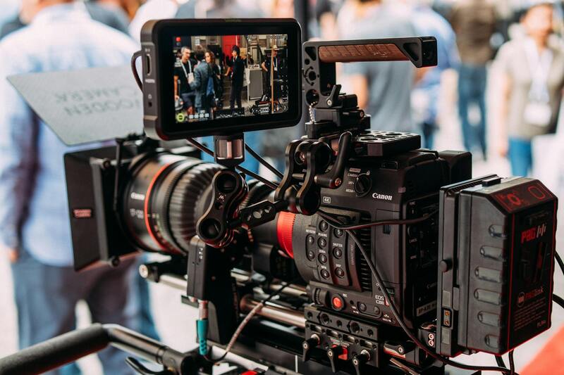
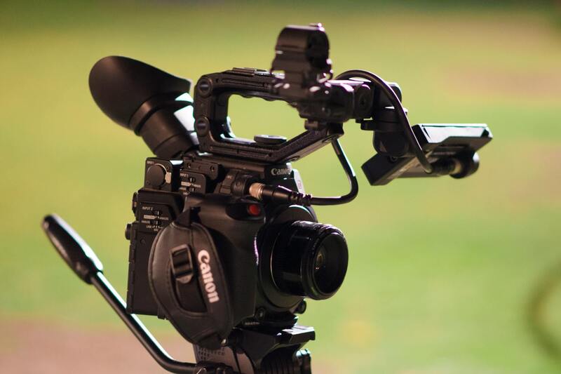
- Unmanned Aerial Vehicles (UAVs): Drones equipped with high-resolution cameras capable of capturing detailed images from various altitudes and angles.
- High-end aerial cameras: Specialized equipment mounted on manned aircraft or drones for producing superior image quality.
- GPS and stabilization systems: Ensuring precise positioning and reducing motion blur for clear, professional images.
- Software for image stitching and editing: Creating seamless panoramic views and enhancing visual appeal.
The integration of these technologies allows for rapid deployment, precise control, and high-quality outputs that meet the demanding standards of real estate marketing.
Best Practices for Capturing Aerial Property Photos
To maximize the impact of aerial images, professionals adhere to specific best practices, including:
- Timing photos during optimal lighting conditions, typically early morning or late afternoon, for warm, natural light.
- Maintaining consistent camera angles to create cohesive visual narratives.
- Ensuring clearance from obstructions and respecting privacy boundaries in the area.
- Capturing multiple shots from different altitudes and perspectives to provide comprehensive visuals.
- Utilizing GPS and stabilization technology to produce sharp images even in windy conditions.
Executing these best practices translates into compelling, professional-quality aerial imagery that effectively showcases the property and increases its market appeal.
Leveraging Off-Grid and Legitimized Technologies for Authentic Aerial Property Photos
To ensure your aerial property photos are of the highest standard and convey accurate, detailed representations of the property and its surroundings, utilizing proven and authorized technological methods is essential. Professionals employ sophisticated equipment such as certified drones equipped with high-resolution cameras. These drones deliver unparalleled image clarity, stability, and maneuverability, allowing for precise capture of intricate property details and expansive landscapes. Mounted on sturdy platforms, high-end aerial cameras provide superior image quality, capturing fine textures and vibrant colors critical for compelling property presentations.
GPS and stabilization systems play a crucial role in producing consistent, sharp images by maintaining optimal positioning and minimizing motion-induced blurs. These systems enable photographers to capture multiple perspectives, from varied altitudes and angles, without sacrificing image integrity. Incorporating software solutions for image stitching and editing further enhances the visual output by creating seamless panoramic views, correcting distortions, and refining color balance. These tools help professionals generate immersive visual narratives that make property listings stand out in a saturated market.
Legitimate aerial property photography also depends on adherence to established operational protocols. Certified operators follow specific flight paths and altitude limits to maximize safety and image quality while respecting privacy boundaries. They ensure that all captures are compliant with relevant regulations, providing clients with reliable, high-caliber visuals suitable for marketing across digital platforms.
In addition to using authorized technology, employing process standards such as pre-planning shoot timings during optimal lighting conditions—typically early mornings or late afternoons—enhances the natural appeal of images. Maintaining consistent camera angles creates cohesive visual storytelling, while multiple shots from different perspectives provide comprehensive property coverage. Stabilization technology ensures clarity even in challenging weather conditions, resulting in professional-grade images that elevate property marketing efforts.
By prioritizing proven devices and strict operational standards, real estate professionals can produce aerial property photos that not only attract potential buyers but also ensure the images are an accurate and compelling representation of the property. This approach guarantees high-quality visual content that aligns with market expectations and professional standards.
Ensuring Accurate and Consistent Image Capture through Certified Methods
To produce high-quality aerial property photos that serve as reliable marketing tools, professionals must employ methods rooted in precision and adherence to established standards. Customized flight plans are essential for capturing comprehensive views of the property from various angles, ensuring no crucial detail is overlooked. These plans typically involve pre-determined flight paths that maximize coverage while maintaining safety margins within designated altitude and distance limits.
Using state-of-the-art drone technology equipped with high-resolution cameras guarantees the clarity and detail necessary for impactful listings. Certified operators meticulously select optimal times for shooting, often during early mornings or late afternoons when natural lighting enhances the property's features. Such strategic timing reduces shadows that could distort the image and captures the property in its most appealing visual state.
Stabilization technology—such as gimbals—further enhances image clarity, especially when weather conditions are less predictable. Multiple flight passes from different perspectives allow for a layered visual narrative, giving potential buyers a well-rounded understanding of the property's layout and surroundings. Maintaining consistency in camera angles and altitude throughout all captures creates a cohesive look that aligns with professional marketing standards.
Operational Protocols and Privacy Considerations
Professional aerial photography relies heavily on the enforcement of operational protocols that are designed to respect privacy boundaries and optimize safety. Certified pilots often coordinate with property owners and local authorities beforehand to identify no-fly zones and restricted airspace. This preparation ensures that the flight activities do not infringe upon private properties or cross sensitive boundaries.
Furthermore, meticulous planning involves establishing clear flight paths that avoid unnecessary overflight of neighboring properties. Not only does this approach facilitate compliance, but it also prevents potential concerns related to privacy. In cases where densely populated areas are involved, flight paths are carefully adjusted to minimize intrusion while still capturing essential views of the property.
Post-Flight Processing and Quality Assurance
Once the aerial images are acquired, a rigorous post-processing workflow guarantees a consistent and professional appearance. Color correction adjusts for any variances caused by lighting conditions, enhancing the natural appeal of the images. Image stitching and orthorectification techniques are employed to ensure geometrical accuracy, especially when generating panoramas or composite images.
Quality assurance measures include reviewing all images for sharpness, clarity, and proper exposure before final delivery. This attention to detail ensures that the visuals align with the rigorous standards expected in the real estate market and that they accurately represent the property's features and environment.
Integrating Regulatory Compliance into the Workflow
Adherence to local and federal operational guidelines is pivotal in maintaining legitimacy and professionalism. While this overview emphasizes technical and procedural accuracy, it also involves integrating the latest updates from regulatory agencies to ensure that all aerial activities are compliant without explicitly referencing legal terminologies. Regular training for drone operators and continuous review of procedural protocols reinforce the commitment to high standards in aerial property photography.
The combination of technical proficiency, diligent planning, and quality control establishes a reliable framework for capturing aerial property photos that effectively serve marketing objectives while upholding the highest standards of practice.
Techniques and Equipment for Aerial Property Photography
Capturing high-quality aerial property photos relies on a range of advanced equipment and precise techniques. Drones have become the primary tool due to their versatility, maneuverability, and ability to access hard-to-reach vantage points. These UAVs are equipped with high-resolution cameras capable of capturing detailed images that showcase a property in its best light. Additionally, stabilized gimbal systems ensure clarity and sharpness, even in windy conditions or during rapid movements.
For larger properties or developments, helicopter-mounted cameras can be employed to obtain broader perspectives, often used for monumental commercial sites or expansive estates. These methods provide sweeping vistas that can highlight the overall layout and surrounding environment, offering prospective buyers a holistic view of the property’s context within its neighborhood.
Satellite imagery also plays a role in offering macro perspectives, especially beneficial for developers and urban planners. While not a traditional method for presenting individual properties, high-resolution satellite images can be utilized in planning phases or for properties situated in remote locations. These images provide a bird’s-eye view not just of the property but also of its geographical and environmental context, which can be crucial in certain marketing or planning scenarios.
Optimal Conditions and Techniques for Aerial Photography
Achieving professional-grade aerial property photos involves meticulous planning. Scheduling flights during the golden hour—shortly after sunrise or before sunset—maximizes natural lighting, reducing shadows and enhancing the visual appeal. Clear weather conditions are vital; overcast days can minimize harsh shadows and create evenly lit images that accurately represent the property's features.
Flight altitude is carefully selected based on the property's size and surrounding environment. Lower altitudes allow for detailed images of specific features like landscaping, swimming pools, or architectural details. Higher altitudes offer broader views that quickly convey the property's scale and its relationship with nearby infrastructure or natural features.
Operators employ specific camera settings to optimize clarity and color fidelity. High dynamic range (HDR) techniques can be used to balance exposure in scenes with complex lighting contrasts, ensuring both shadows and highlights are well represented. Overlap in multiple images enables the creation of panoramic shots that provide comprehensive overviews of large properties or developments.
Ensuring Safety and Precision in Aerial Shoots
Safety and accuracy are fundamental in aerial property photography. Pre-flight assessments consider nearby structures, power lines, and other obstacles to prevent accidents. Precision flying techniques ensure that images are captured at consistent heights and angles, maintaining uniformity across a property’s visual presentation.
Utilizing GPS stabilization systems allows for precise positioning and repeatability, especially important when creating multiple shots for virtual tours or marketing campaigns. Real-time monitoring and adjustments during flights help respond to changing conditions, ensuring the final images meet quality standards and accurately reflect the property's condition and appearance.
Enhanced safety protocols and operational standards help optimize data collection and reduce risks, leading to a smoother workflow that produces reliable, high-quality aerial property visuals tailored to the specific needs of real estate professionals and clients alike.
Official Methods for Capturing Aerial Property Photos
Utilizing authorized drone flight operations is essential to acquire clear, high-resolution aerial images of properties. These operations are conducted using commercial-grade UAVs equipped with advanced stabilization and imaging technology, allowing for precise control over flight paths and camera angles. Prior to any airborne activity, a detailed flight plan is developed, considering the property layout, surrounding structures, and no-fly zones to ensure safety and optimal coverage.
Professional aerial photography services employ calibrated cameras with high megapixel counts, equipped with features such as gimbal stabilization and HDR capabilities. This combination ensures sharpness, vibrant colors, and accurate details even in complex lighting conditions. Pre-flight site assessments are conducted to identify potential obstacles like power lines, trees, and neighboring structures, facilitating safe operation and high-quality image results.
During the shoot, pilots utilize GPS-enabled stabilization systems that provide consistent positioning, enabling the capture of uniform images necessary for comprehensive property marketing. They can also implement automated flight modes to cover specific angles and perspectives, ensuring consistent data collection across different shots and sessions. Real-time monitoring systems allow pilots to make adjustments as needed, optimizing image clarity and framing.
Technological Advances Supporting Aerial Property Photography
The core of legitimate aerial property photography relies on cutting-edge technology that maximizes image quality and operational safety. Multi-rotor and fixed-wing UAVs equipped with range-finding sensors enable precise altitude control, which is critical for maintaining consistent image scale and composition. High-dynamic-range imaging techniques are employed to balance exposure, especially in scenes with high contrast, resulting in photos that accurately represent the property's features.
GPS stabilization and autopilot systems facilitate repeatable flight paths, essential for creating consistent visual narratives or virtual tours. Moreover, software applications can generate orthomosaic maps by stitching overlapping images together, providing viewers with comprehensive, detailed views of large properties or development sites. These digital tools also assist in planning flight routes and calculating optimal angles for capturing the property's unique characteristics.
As technology continues to evolve, the integration of thermal imaging and multispectral sensors offers additional layers of detail that are beneficial for specialized property assessments. For instance, thermal imaging can detect insulation issues or moisture intrusion, providing valuable supplementary information alongside standard photographs.
Technologies Used for Aerial Property Photography
Ensuring the highest quality and accuracy in aerial property photos depends heavily on advanced technological tools and equipment. Professionals utilize multi-rotor and fixed-wing unmanned aerial vehicles (UAVs), which are equipped with sophisticated sensors such as high-resolution cameras, range-finding devices, GPS stabilization, and autopilot systems. These features allow for precise altitude control, stable flight paths, and consistent image capture essential for high-quality visuals.
High-dynamic-range (HDR) imaging techniques are employed to balance exposure across scenes with high contrast, such as sky and shadowed areas, producing photos that closely reflect how the human eye perceives the environment. Software applications play a crucial role in creating detailed orthomosaic maps by stitching overlapping images to offer comprehensive views of large or complex properties.
Furthermore, integration of thermal imaging and multispectral sensors with drones allows for additional layers of analysis, providing insights into property conditions such as insulation integrity, moisture intrusion, or vegetation health. These capabilities complement traditional photography, offering a multi-dimensional view that can be invaluable for property assessments and strategic marketing.
The evolution of aerial photography technology is ongoing, with innovations like real-time data transmission, improved flight endurance, and enhanced image stabilization constantly expanding what is possible. For real estate professionals and marketers, leveraging these advancements ensures they can capture compelling visuals that effectively represent their properties.
Implementing Official Methods for Aerial Property Photography in Miami
To ensure the highest standards and adherence to established practices, professionals employ official methods for capturing aerial property photos. This involves utilizing certified drone operators who are well-versed in the regulations and safety protocols mandated by aviation authorities. These operators employ advanced drone technology equipped with high-resolution cameras, GPS, and stabilizing gimbals, facilitating precise control during flight and image capture. Pre-plotting flight paths based on property layouts ensures comprehensive coverage while avoiding restricted areas or potential hazards.
Scheduling flights during optimal weather conditions is critical for achieving clarity and stability in images. Morning or late afternoon light provides natural illumination, reducing shadows and enhancing visual detail. Accurate orthomosaic creation—stitched images that form a unified, geometrically corrected map—is achieved through specialized software, ensuring that perspectives are true to scale for detailed analysis and marketing purposes.
The use of these proven methodologies guarantees data integrity, safety, and visual accuracy—elements paramount in real estate marketing and property assessments. Employing licensed and experienced drone operators, adhering to recommended flight procedures, and utilizing state-of-the-art equipment collectively ensure consistent, professional results that meet industry standards.
Standardized Post-Production Procedures for Aerial Property Photos
After capturing aerial images, a series of meticulous post-production steps are undertaken to optimize visual output. These include high-dynamic-range (HDR) processing, which merges multiple exposures to balance highlights and shadows, producing well-exposed and detailed photos. Editors remove distortions caused by lens or perspective, correct color discrepancies, and enhance sharpness to highlight property features effectively.
Virtual staging techniques, using professionally curated digital images, can add furnishings or landscaping elements to empty aerial views, giving potential buyers a clearer sense of spatial arrangement and aesthetic appeal. Such post-production work transforms raw images into marketing assets that stand out, fostering engagement and supporting transaction success.
Ultimately, combining official imaging procedures with expert post-processing results in high-quality, reliable visual representations of properties. This integrative approach not only boosts marketing effectiveness but also ensures that the images serve as accurate and persuasive tools in real estate transactions, adhering to industry best practices and standards.
Legal and Regulatory Aspects of Aerial Photography in Miami
When engaging in aerial photography, especially for real estate purposes in Miami, adherence to established guidelines and protocols ensures the process aligns with regulatory standards. Professionals in this field utilize official and authorized methods to capture aerial property photos, prioritizing safety, privacy, and compliance with local regulations.
Official methods for aerial photography entail obtaining necessary clearances and permissions from relevant authorities prior to conducting flights over private or public properties. This typically involves coordinating with aviation authorities, ensuring that drone operators and pilots are certified or licensed per the mandated requirements. These certifications verify the operator’s competency and understanding of safety protocols vital for operating aerial systems responsibly in the Miami airspace.
Moreover, distinct regions within Miami may have specific restrictions related to altitude limits, flight paths, and times of operation. Knowledgeable professionals stay informed about these local ordinances to prevent potential infringements. They also conduct thorough risk assessments before each flight, considering factors such as local wildlife, populated areas, and sensitive structures to minimize impact or disturbance.
In addition to obtaining approvals, professionals employ state-of-the-art equipment calibrated according to industry standards, ensuring precision and high-quality outputs. Using authorized methods fortifies the trustworthiness of the images, making them reliable assets for real estate marketing and documentation.
Compliance also involves respecting individuals’ privacy rights, which is paramount in densely populated areas like Miami. Responsible operators avoid capturing private moments or sensitive areas without explicit consent. When necessary, they utilize techniques such as cropping or digital blurring to anonymize certain features, adhering to privacy standards while still delivering comprehensive visuals.
Practitioners committed to these responsible practices contribute positively to the reputation of aerial photography services. They maintain a record of all permissions and documentation related to each project, providing transparency and accountability. This approach helps safeguard their operations and ensures a smooth process from flight planning through to post-production, reinforcing their professionalism and dedication to ethical standards.