
Understanding Aerial Property Photography
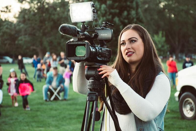
Aerial property photography involves capturing images of real estate from an elevated position, typically using unmanned aircraft, such as drones, or manned aircraft. This specialized form of photography serves to showcase the full scope and scale of properties, highlighting features that ground-level shots may not fully convey. Within the competitive Miami real estate market, aerial imagery has become an increasingly vital component of marketing strategies, providing prospective buyers with a comprehensive view of properties' layout, land boundaries, surrounding landscapes, and proximity to key amenities.
Employing aerial photography allows real estate professionals and property owners to create compelling visual narratives that appeal to a broad audience. These images can demonstrate property size, outdoor attractions, landscaping, and nearby points of interest, making listings stand out amidst a crowded marketplace. As part of a holistic marketing approach, aerial property photography enhances online listings, brochures, and virtual tours by offering an immersive experience that captures the essence and potential of each property.
More than just a visual tool, aerial photography can also facilitate better spatial understanding of property features and land use. For developers, investors, and homeowners alike, these images offer a realistic preview that aids decision-making. Whether illustrating large estates, commercial complexes, or waterfront properties, aerial shots contribute substantially to the effectiveness of real estate marketing campaigns in Miami and beyond.
Additionally, this form of photography aligns with technological advancements and the increasing accessibility of drone technology. It bridges the gap between traditional photography and innovative marketing solutions, providing a cost-effective yet impactful way to elevate property listings. With the right equipment and professional expertise, aerial property photography transforms standard images into dynamic visual assets that boost engagement and accelerate property sales.
Legal and Technical Considerations in Miami
Conducting aerial property photography in Miami involves adhering to established procedures that ensure safety, quality, and compliance with local standards. Professional photographers and drone operators employ a combination of detailed flight planning and technical expertise to deliver compelling images while respecting airspace regulations. Pre-shoot assessments include mapping out flight paths to avoid restricted zones, such as near airports or military installations, and accounting for environmental factors like weather and obstacle navigation.
Operators utilize advanced drone technology integrated with GPS and obstacle avoidance systems, which facilitate precise maneuvering and stable imaging conditions. Calibration of camera settings, including resolution, shutter speed, and aperture, plays a critical role in capturing sharp, high-quality aerial images that accurately depict property features and landscaping.
For optimal results, aerial property photography professionals in Miami typically employ weather monitoring tools and flight management software to schedule shoots during ideal lighting and atmospheric conditions. This meticulous planning helps avoid issues such as wind interference or cloudy skies that could diminish image clarity.
Additionally, maintaining compliance with air traffic control directives and local airspace policies is crucial. Experienced aerial photographers work closely with relevant authorities and utilize official communication channels to secure necessary permissions and coordinate flight operations. This cooperation not only safeguards safety but also upholds the professionalism and reputation of the photographic services offered.

In summary, executing high-caliber aerial property photography in Miami demands a combination of advanced technical proficiency, strategic planning, and strict adherence to established operational protocols. Stakeholders who invest in these meticulous processes ensure their images are not only visually stunning but also created within a framework that prioritizes safety, reliability, and excellence in every shot.
Implementing Certified Aerial Photography Practices in Miami
To achieve consistent, high-quality results in aerial property photography across Miami, professionals rely on a structured approach grounded in proven methods. The process begins with comprehensive site analysis, which involves studying local airspace restrictions, prevalent weather patterns, and topographical features. This preparation phase ensures that flight operations are executed smoothly and without unintended disruptions.
Using advanced flight planning software, aerial photographers map out optimal flight paths that maximize the coverage of the property while adhering to safety protocols. These tools help in predicting wind speeds, lighting conditions, and potential obstacles, enabling photographers to schedule shoots during the most favorable windows of opportunity. Such meticulous planning is essential for capturing clear, vibrant images that effectively showcase a property’s unique features.

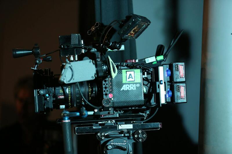
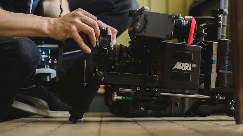
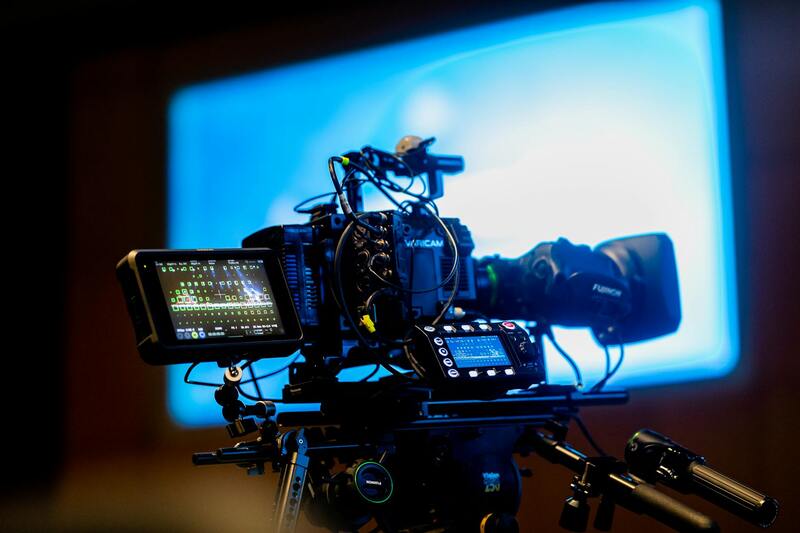
Prior to the actual flight, equipment calibration is performed to ensure optimal operation. High-quality drones equipped with stabilized gimbals and high-resolution cameras are standard. Calibration includes verifying GPS signals, checking battery levels, and test-flying the drone in a controlled environment to confirm stability and responsiveness. This preparation minimizes the likelihood of technical issues during the shoot, resulting in sharper images and smoother video footage.
Throughout the operation, experienced pilots maintain constant communication with local authorities and air traffic control, especially in congested or restricted zones. In Miami, where airspace can be busy with commercial flights, maritime traffic, and recreational drones, coordination is vital. Many practitioners use official communication channels to confirm permissions and receive clearance, thereby ensuring that operations comply with established guidelines and avoid interference with other airspace users.
Post-flight, rigorous review of the captured images involves assessing clarity, color accuracy, and overall composition. Use of professional editing software ensures that images meet client expectations and adhere to marketing standards. Such a comprehensive workflow—from planning and legal compliance to execution and post-production—forms the backbone of successful aerial property photography in Miami, setting professionals apart through reliability and quality.
By strictly adhering to these structured procedures and employing official methodologies, Miami’s aerial property photography services deliver images that are not only visually compelling but also produced within a framework that prioritizes efficiency, safety, and excellence. This approach ensures clients receive superior visual content that effectively enhances property listings, marketing campaigns, and virtual tours, all while maintaining a seamless and professional service experience.
Identifying Secure and Official Methods for Aerial Property Photography in Miami
When undertaking aerial property photography within the vibrant city of Miami, professionals rely on a suite of recognized, established methods to ensure smooth operations and high-quality results. These approaches balance safety, precision, and compliance, allowing photographers to deliver compelling visuals that enhance property marketing without disrupting existing airspace activities. Fundamental to this are structured flight planning processes, thorough site assessments, and adherence to specific operational standards, all of which contribute to a professional and reliable service.
Pre-flight preparations involve meticulous planning, which includes comprehensive site analysis to identify potential obstacles such as tall structures, power lines, and other aerial traffic. Photographers often utilize advanced mapping tools and local geographic data to delineate boundaries and establish optimal flight paths. These tools facilitate detailed route planning, minimizing flight time and ensuring imagery captures the property from the most advantageous angles. Additionally, stakeholders engage with local authorities or air traffic control using formally recognized channels to confirm flight schedules and receive necessary approvals, thereby coordinating activities seamlessly within the existing airspace framework.
Operational safety and efficiency are further enhanced through the use of reputable drone pilots who hold approved certifications and licenses verified by authorized agencies. These professionals demonstrate a comprehensive understanding of Miami's unique airspace environment, including congested zones near commercial centers and waterways. They meticulously document each flight, including environmental conditions, flight path details, and safety protocols, to maintain audit trails and ensure accountability. Employing well-maintained, industry-standard equipment also contributes to achieving high-resolution, sharp images—crucial for marketability and detailed property showcases.
Post-flight, the captured imagery undergoes rigorous review where quality assessment and editing dominate. High-resolution images are scrutinized for clarity, focus, color accuracy, and overall composition. Skilled editors utilize professional software to refine images, correcting transparency issues, increasing contrast, and ensuring that the visuals emphasize the property's best features. This detailed editing process ensures that each image aligns with marketing goals and appeals strongly to prospective buyers or tenants.
In addition to technical competence, professional aerial photography services adhere to a disciplined workflow that includes clear documentation, consistent communication with clients, and strategic deployment of imagery in various marketing platforms. This integrated approach maximizes the visual appeal of property listings while maintaining the assurances of operational safety and regulatory compliance. Such disciplined adherence to official procedures and methods not only garners trust from clients but also fortifies the reputation of aerial property photography services in Miami’s competitive real estate landscape.
Legal and Technical Considerations in Miami
Ensuring the safe and effective execution of aerial property photography in Miami involves adherence to established procedures and industry standards that safeguard both the operators and the equipment. This includes comprehensive planning and risk management protocols, which encompass pre-flight risk assessments, detailed flight plan documentation, and contingency arrangements for unforeseen circumstances. Properly assessing weather conditions and understanding local airspace restrictions during this planning phase are essential components that contribute to a smooth operational process.
Technical considerations extend to the use of calibrated and well-maintained equipment. This involves deploying drones equipped with high-resolution cameras capable of capturing detailed imagery suitable for real estate marketing. Operators must also employ precise navigation and stabilization systems to achieve sharp, well-composed shots in varying environmental conditions. Flight paths are strategically designed to maximize coverage of the property and surrounding features, ensuring the content aligns with marketing objectives.
Operational safety procedures include maintaining secure communication links with ground personnel, utilizing geo-fencing technology to prevent unauthorized drone incursions into restricted zones, and adhering to altitude limits to avoid interference with manned aircraft. Post-flight, images are subjected to strict quality control checks, ensuring clarity, color accuracy, and overall visual impact meet professional standards. This process involves not only technical expertise but also a deep understanding of how imagery will be employed across various marketing platforms, optimizing the property’s appeal.
Both the technical and procedural disciplines practiced during aerial photography campaign serve to elevate the overall quality and professionalism of the service. By systematically documenting every phase of the operation, from pre-flight planning to post-processing, service providers build a reputable foundation that instills confidence among clients. This disciplined approach also ensures compliance with local guidelines and fosters continuous improvement in safety measures and image quality, solidifying aerial property photography as a trusted marketing tool in Miami’s competitive real estate industry.
Understanding Aerial Property Photography
Aerial property photography involves capturing images of real estate from elevated perspectives using remote-controlled aircraft or drones. This technique provides a comprehensive view of a property and its surroundings, highlighting features such as landscaping, proximity to key amenities, and the property's contextual environment. High-quality aerial images can dramatically enhance a listing by offering a visual story that ground-level photographs simply cannot achieve.
In Miami's vibrant real estate market, aerial photography has become an essential marketing tool. The use of drones allows for precise, sweeping shots that showcase the full extent of large estates, waterfront properties, and commercial developments. Such imagery not only attracts potential buyers but also emphasizes the property's scale, location advantages, and unique architectural features.
To ensure maximum impact, aerial photography must be executed with careful planning. Factors such as lighting, weather conditions, and flight angles are meticulously considered. The selection of suitable equipment and adherence to technical standards guarantee images are clear, sharp, and compelling. Additionally, integrating aerial shots into marketing campaigns can create a cohesive visual narrative, positioning properties as desirable investments.

Legal and Technical Considerations in Miami
Operating aerial property photography in Miami involves strict adherence to various technical standards and protocols to ensure the safety and quality of imagery. Certified operators utilize aircraft like drones equipped with high-resolution cameras, deploying the latest stabilization technology to capture sharp, detailed images. They also follow precise flight planning procedures, including pre-flight risk assessments, to navigate the unique urban landscape and waterfront areas prevalent in Miami.
Weather conditions significantly impact aerial shoots. Operators monitor wind speeds, visibility, and other atmospheric factors, choosing optimal times for shooting to minimize motion blur and maintain safety. In addition, maintaining proper flight altitude and distance from structures and people is crucial, not only to comply with operational guidelines but also to safeguard the integrity of the footage.

Technical proficiency extends into post-production processes, where professional editors enhance the color balance, contrast, and clarity to produce compelling visuals. Incorporating mapping and overlay technologies can also provide contextual information, such as property boundaries and surrounding amenities. These advanced methods bring additional value to the viewers, enabling prospective buyers to understand property contours and neighborhood features vividly.
Continuous advancements in drone technology, including obstacle avoidance systems and longer battery life, further improve operational efficiency and safety. As the Miami market evolves with increasingly sophisticated real estate portfolios, aerial imagery can be optimized through the integration of 3D modeling and virtual reality compatibility, offering immersive property tours that captivate potential investors.
Additionally, understanding airspace regulations and securing necessary clearances are vital steps. Operators work closely with relevant authorities, including the Federal Aviation Administration (FAA), to establish approved flight zones, especially around sensitive areas such as airports and federal properties. These practices ensure that aerial photography sessions proceed smoothly, minimizing disruptions and maintaining the integrity of the operational environment.
Understanding Aerial Property Photography
Aerial property photography captures a property's expanse from an elevated viewpoint, offering strategic advantages in real estate marketing. It leverages advanced aerial platforms, predominantly drones, to produce high-resolution images that showcase the full scope of a property’s features and surroundings. Unlike ground-level shots, aerial images provide a comprehensive perspective of land contours, architectural design, and landscape integration, enabling prospective buyers or investors to assess the property within its geographic context.
This photography method not only highlights unique selling points but also allows for creative composition, capturing the property's bold features and its relation to neighboring structures and natural elements. Aerial visuals are particularly beneficial for large estates, commercial properties, and developments where land size, layout, and environmental integration are key decision-making factors.

Advantages of Using Aerial Photography for Real Estate
- Enhanced Property Appeal: Aerial images provide a stunning overview that instantly attracts attention and can set a listing apart in a competitive market.
- Comprehensive Visualization: Buyers gain a clear understanding of the property’s layout, size, and neighborhood context, facilitating better-informed decisions.
- Highlighting Unique Features: Features such as pools, gardens, outdoor amenities, and waterfront access become visually prominent from above.
- Efficient Marketing: High-quality aerial footage and images can be integrated into virtual tours, online listings, and promotional materials, broadening outreach.
- Time and Cost Efficiency: Aerial shots capture extensive areas quickly, reducing the need for multiple ground-based photoshoots, and providing a comprehensive overview in a single frame.
Types of Aerial Shots and Content
Several shot types serve different marketing objectives, including:
- Overview Shots: Wide-angle images that depict the entire property and its relation to surroundings, ideal for listings and promotional videos.
- Detail-focused Shots: Close-up images highlighting specific features like architectural details, landscaping, or unique amenities.
- Vertical and Oblique Angles: Shots taken directly downward or at an angle to emphasize property contours, entrances, and outdoor spaces.
- Night Shots: Aerial images taken in low light conditions, showing outdoor lighting and creating dramatic visual effects.
- Progress Shots: When involved in development projects, time-lapse or sequential images illustrate stages of construction or renovation.
Legal and Technical Considerations in Miami
Miami’s dynamic airspace and dense urban environment demand careful adherence to operational standards. Flight operations require coordination with local authorities and relevant agencies to ensure flight paths are compliant and safe. Establishing coordinated flight zones around sensitive locations like airports, federal properties, and densely populated areas helps maintain airspace order. Compliance with federal and state aviation policies ensures smooth execution of aerial sessions without disruptions.
Operators must also consider environmental factors such as weather conditions, wind speeds, and obstacles like skyscrapers and palm trees. Using advanced obstacle avoidance systems and GPS technology enhances safety margins, while pre-flight planning aids in selecting optimal times and routes. Securing necessary clearances and permits ahead of time facilitates a seamless shoot, providing high-quality imagery with minimal risk.
Equipment and Techniques for High-Quality Aerial Images
Producing exceptional aerial property visuals hinges on the right equipment and skills. Modern drone platforms equipped with high-resolution cameras and stabilized gimbal systems enable capturing sharp, distortion-free images. Wide-angle lenses are essential for encompassing large property features, while tilt-shift lenses help correct perspective distortions for architectural precision.
Post-processing techniques such as color correction, contrast enhancement, and focus stacking ensure images are crisp, vibrant, and appealing. Utilizing HDR (high dynamic range) photography can also improve details in both shadows and highlights, resulting in balanced exposure even in complex lighting conditions. When combined with advanced flight planning and stabilization tools, these techniques produce professional-grade imagery ready for marketing use.

Integrating Aerial Photography into Real Estate Listings
Incorporating aerial visuals into property listings enhances overall presentation and engagement. These images and videos serve as eye-catching elements in online platforms, brochures, and virtual tours. Embedding drone footage into virtual walkthroughs offers an immersive experience, allowing prospective buyers to explore the property remotely with a realistic sense of scale and layout.
Strategically showcasing aerial images at the beginning of property listings emphasizes the expansive nature and setting, drawing viewers deeper into the property’s features. Regular updates and seasonal shots can also inform potential buyers about evolving landscaping, renovations, or developmental progress, keeping listings fresh and informative.
Cost, Providers, and Choosing the Right Service in Miami
When selecting aerial photography services, it's important to evaluate providers based on experience, equipment quality, and compliance practices. Local Miami firms specializing in real estate imagery offer tailored packages that include pre- and post-production support, ensuring a smooth workflow. Costs vary depending on shoot complexity, drone type, and deliverables — typically ranging from affordable packages for standard images to premium options for comprehensive video tours.
Questions to ask potential providers include their familiarity with Miami’s airspace regulations, ability to handle diverse property types, and options for expedited delivery. Partnering with established professionals ensures access to cutting-edge equipment and techniques that maximize property appeal and marketing efficiency.