
Understanding Aerial House Photography
Aerial house photography is a specialized branch of real estate imaging that involves capturing images of properties from an elevated perspective using various aerial platforms. This approach provides a comprehensive view of a property’s layout, surrounding environment, and unique architectural features that are often inaccessible through conventional ground-level photography. In the competitive Miami real estate market, these high-altitude images serve as vital marketing assets that highlight a property's exclusivity and allure, making it stand out in listings and marketing campaigns.
By offering a bird’s-eye view, aerial house photography enables prospective buyers and investors to assess the property’s scale, landscaping, proximity to key amenities, and neighborhood characteristics. Such perspectives can reveal aspects of a property that may otherwise go unnoticed, such as the overall footprint, driveway arrangements, backyard size, and the location of outdoor features like pools, gardens, or nearby water bodies. This comprehensive visual storytelling plays a pivotal role in crafting compelling listings that attract serious inquiries and facilitate quicker sales.
Furthermore, aerial photography complements traditional ground photos by providing context that enhances the overall appeal of a property. It helps real estate agents and property owners communicate the full scope and grandeur of a residence, fostering a stronger connection with potential buyers. With Miami’s vibrant real estate scene, where luxury homes and distinctive architectural designs dominate, aerial images become instrumental in showcasing the true essence of high-value properties, allowing them to command premium prices.
Additionally, aerial house photography supports detailed property assessments for development planning or renovation projects. Developers and architects utilize these images for strategic planning, landscape design, and environmental analysis, demonstrating the versatility and value of aerial imaging services. As technology advances, so does the ability to capture stunning, high-resolution images that encapsulate every angle of exceptional properties, ensuring that marketers and property owners maximize their visual impact in Miami’s dynamic real estate market.
Advanced Techniques and Equipment for Aerial House Photography
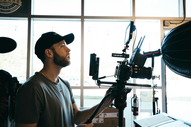
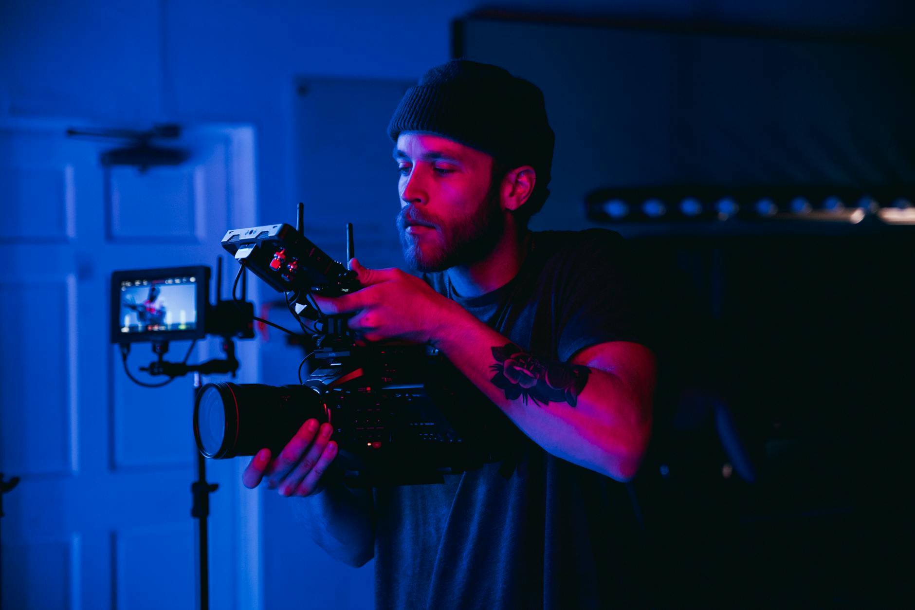
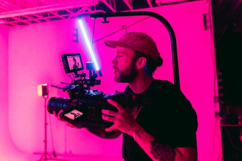
Achieving high-quality aerial house photography necessitates specialized equipment and refined techniques. Utilizing the right tools ensures that images capture the full grandeur and intricate details of Miami’s luxurious properties, ultimately elevating the property's market appeal.
Top-tier Equipment for Aerial Imaging
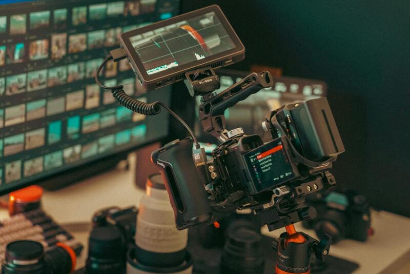
- Unmanned Aerial Vehicles (Drones): Professional drones equipped with high-definition cameras, GPS stabilization, and obstacle avoidance systems are essential for capturing sharp, stable images from various angles. Models with advanced sensors can shoot in 4K or higher resolution, providing crisp detail crucial for marketing and development planning.
- High-Resolution Cameras: Interchangeable lens systems and full-frame sensors increase image quality and allow for detailed close-ups or wide shots that showcase the unique architecture and landscaping elements of Miami's exclusive homes.
- Gimbals and Stabilizers: To ensure steady footage and images, gimbals stabilize the camera during flight, preventing motion blur and artifacts, particularly when capturing in challenging wind conditions common in outdoor environments.
Proven Techniques for Optimal Results
- Pre-Flight Planning: Analyze weather conditions, sun position, and property layouts to plan precise flight paths. This preparation minimizes the need for re-shoots and guarantees comprehensive coverage.
- Optimal Flight Timing: Schedule shoots during the 'golden hours'—shortly after sunrise or before sunset—when natural lighting enhances property features and creates appealing shadows that add depth and dimension to aerial images.
- Altitude & Angle Selection: Varying altitude levels and camera angles provide a multi-dimensional perspective of the property and its surroundings. Low-altitude shots highlight architectural details, while higher altitude images capture the overall site context.
- Panoramic & 360-degree Shots: Incorporate panoramic views to display the property's scale comprehensively, and utilize 360-degree captures for immersive virtual tours, appealing to remote buyers or investors.
Safety Measures and Flight Regulations
Operating aerial photography equipment within Miami involves adherence to airspace management standards. Ensure thorough pre-flight checks, maintain line-of-sight with the drone, and monitor local regulations to execute safe and effective shoots. Employ flight planning software to map out no-fly zones and optimal routes, safeguarding property, residents, and the equipment.
Leveraging Professional Expertise
Collaborating with experienced aerial photographers equipped with cutting-edge technology ensures consistent results. Professionals are adept at adjusting techniques to specific property features and environmental conditions, resulting in compelling visuals that highlight a home's architectural marvels and landscaping features. Their expertise extends to post-shoot analysis, which allows for the selection and enhancement of the best images, further elevating the property's visual presentation.
Advanced Techniques and Equipment for Optimal Aerial House Imaging
To achieve compelling aerial house photographs, professionals employ specialized equipment and refined techniques that optimize image quality and visualization impact. The choice of equipment, particularly drones equipped with high-resolution cameras, plays a crucial role in capturing precise details from various vantage points. Flight stability is enhanced with gimbal-stabilized camera systems that minimize vibrations, resulting in sharper images even in windy conditions. Moreover, the use of tilt-shift lenses, often mounted on custom drone platforms, allows for correction of perspective distortions, producing images that accurately reflect architectural proportions, especially during close-up shots of structural elements.
Optimal angles are identified through careful pre-shoot planning, employing techniques such as high-angle overlooks to showcase panoramic vistas of the property and its landscape, or oblique angles that highlight specific architectural features. The golden hour, shortly after sunrise or before sunset, provides natural lighting that adds warmth and depth to the images, accentuating textures and materials. Professional editors often utilize graduated filters in post-production to elevate the visual appeal, balancing exposure and contrast to produce vibrant yet natural-looking images.
In addition to camera equipment, meticulous flight planning ensures comprehensive coverage of the property while avoiding undesirable elements such as power lines, neighboring structures, or restricted airspace zones. This planning involves analyzing detailed maps, weather conditions, and local airspace regulations to select optimal flight paths and altitudes. The culmination of these efforts results in high-quality visuals capable of showcasing the property in its best light, helping potential buyers or investors to visualize the home's features from multiple perspectives.
Utilizing Techniques for Captivating Views and Detail
Techniques such as multiple passes from different angles and altitudes enable a layered understanding of the property’s layout and surroundings. Overhead shots from varying heights give viewers an understanding of spatial relationships, while close-up oblique shots reveal specific architectural or landscape features. Integrating HDR (High Dynamic Range) photography during flight captures multiple exposures to handle complex lighting conditions, ensuring shadows and highlights are well-balanced. The precise control of drone flight paths and camera settings allows the photographer to adapt swiftly to changing environmental factors, ensuring consistency across the shoot.
Utilizing advanced software tools for flight planning not only simplifies route management but also incorporates safety zones and no-fly restrictions, maintaining compliance with established airspace standards. These tools facilitate the creation of detailed flight logs, capturing optimal flying conditions and ensuring the safety and quality of the shoot. The professional application of these methods results in a portfolio of images that are not only visually stunning but also technically flawless, maximizing the property's appeal in the competitive Miami real estate market.
Choosing Proper Flight Planning and Safety Protocols
Effective aerial house photography begins long before the drone takes to the air. Comprehensive flight planning is essential to ensure the safety, quality, and compliance of each shoot. This includes mapping out specific routes that optimize coverage of the property while avoiding restricted zones or sensitive areas. Implementing sophisticated software tools for flight planning can help establish safe flight corridors, define no-fly zones, and monitor environmental factors such as wind speed and weather conditions. Such preplanning ensures each image capture session proceeds smoothly, yielding consistent, high-quality results.

Adhering to established altitude and distance guidelines preserves both the integrity of the property and the safety of the operation. Maintaining consistent altitude helps produce uniform images that align seamlessly during post-processing, while appropriate distance management prevents invasion of privacy and ensures compliance with airspace regulations. Utilizing real-time flight monitoring tools allows photographers to adapt swiftly to changing conditions, ensuring stability and sharpness in each shot.
Securing Permits and Permissions for Aerial Photography
Even within permitted airspace, securing the necessary permissions enhances the professionalism and smooth execution of aerial house photography projects. This process involves liaising with local authorities and relevant agencies to obtain clearances, especially in densely populated or restricted areas. Proper documentation of permissions on-site reassures clients and stakeholders that all operational protocols are adhered to, minimizing potential interruptions. Additionally, detailed flight logs and adherence to scheduled windows can optimize lighting conditions, resulting in more appealing images.

In Miami, it is advisable to keep abreast of any local ordinances or specific airspace considerations that may influence flight operations. Collaborating with experienced drone operators familiar with Miami's regulatory landscape enhances the efficiency of the project and mitigates instances of protocol breaches. When permissions are granted and restrictions are observed, aerial house photography can be carried out confidently, delivering captivating visuals that truly capture the property's appeal.
Ensuring Data Privacy and Client Confidentiality
Another critical aspect of official aerial house photography involves safeguarding client data and privacy. Implementing protocols such as limited flight zones around sensitive areas and ensuring images are used solely for intended purposes prevents unnecessary exposure of private information. High standards of confidentiality foster trust and demonstrate professional integrity, which are vital in the competitive Miami real estate market. Employing secure storage solutions for raw and edited imagery further ensures that client assets remain protected throughout the project lifecycle.
By combining careful planning, compliance with necessary permits, and privacy safeguards, aerial house photography delivered through professional channels exemplifies a commitment to quality and integrity. This approach not only enhances the final image portfolio but also reinforces the reputation of the service provider within the Miami real estate community.
Comprehensive Methods for Conducting Aerial House Photography in Miami
Achieving high-quality aerial house imagery involves an array of methodologies that prioritize safety, precision, and optimal visual impact. Professionals skilled in aerial photography employ structured approaches to ensure each shot accentuates the property's best features while adhering to established operational standards.
Utilizing Manned Aircraft for Aerial Shots
While less common in residential real estate, manned aircraft such as small planes or helicopters can capture expansive vantage points, especially for large estates or properties with sprawling grounds. These methods require specialized pilot licensing, strict flight planning, and coordination with local authorities to align with Miami's airspace management. The use of stabilized mounted cameras ensures steady footage and sharp still images, providing a broad perspective that can't be achieved with smaller drone units.
Implementing Drone-Based Aerial Photography
Multirotor and fixed-wing drones equipped with high-resolution cameras are the backbone of most modern aerial real estate marketing efforts. They offer unmatched agility, allowing operators to target specific property features such as swimming pools, landscaped gardens, or unique architectural details from various altitudes and angles. In Miami, drone operators are often well-versed in local airspace regulations, ensuring that each flight adheres to prescribed safety protocols and flight paths.
Satellite Imagery as an Auxiliary Tool
Though less detailed for individual property showcases, satellite imagery provides contextual views of neighborhood master plans, proximity to amenities, and overall geographic positioning. For extensive developments or land parcels, integrating satellite data enhances comprehensive property presentations. This method complements drone shots by offering macro perspectives, helping potential buyers visualize the property's location within the broader Miami landscape.
Official Photogrammetry and 3D Mapping
Advanced photogrammetric techniques utilize overlapping aerial images to generate detailed 3D models of the property and its surroundings. These models can reveal topographical features, elevation differences, and structural intricacies that are otherwise difficult to capture with standard photography. Applying these methods lends additional depth to real estate listings, appealing to clients seeking thorough property insights.
Consistent application of these official techniques ensures that aerial house photography in Miami maintains a high standard of quality and professionalism. Combining drone versatility with traditional aerial methods exemplifies a comprehensive approach, elevating property visuals and fostering greater engagement among prospective buyers and investors.
Understanding Aerial House Photography
Aerial house photography has transformed the way real estate professionals and homeowners showcase properties. By capturing images from elevated vantage points, this technique provides a comprehensive view of the property and its surroundings, highlighting features that ground-level photos may overlook. Such perspectives are instrumental in emphasizing a property's size, architectural details, landscape elements, and its proximity to local amenities. The depth and clarity offered through aerial imagery help buyers and investors gain a more accurate understanding of the property's scale and context within the neighborhood.
Approach to High-Quality Aerial Image Capture
Ensuring high-quality aerial images involves a combination of technical expertise, optimal flight planning, and understanding the unique characteristics of each property. Effective planning includes selecting suitable weather conditions to avoid overcast skies, strong sun, or wind that could compromise shot stability. Choosing the right time of day maximizes natural lighting, adding warmth and clarity to the visuals. Moreover, a strategic flight path that encompasses both broad overview shots and detailed close-ups allows for a comprehensive presentation of the property. Attention to framing, height, and angle ensures that each image accentuates key architectural features and landscaping details.
Utilization of Advanced Equipment and Techniques
Leveraging state-of-the-art drones equipped with high-resolution cameras is standard for professional aerial house photography. These devices often incorporate stabilization technology, such as gimbals, to produce sharp, steady images even in fluctuating wind conditions. Additionally, employing techniques like high dynamic range (HDR) imaging captures a broader spectrum of light, resulting in images with balanced exposures that showcase both shadowed and brightly lit areas. Photogrammetry and 3D mapping are increasingly integrated to generate detailed topographical models, providing prospective buyers with in-depth insights into the property's terrain and structural elements.
Furthermore, utilizing panoramic stitching can produce expansive vistas that encapsulate entire neighborhoods or land parcels in a single, compelling image. This method not only enhances visual appeal but also provides context that supports marketing efforts. When combined with consistent shoot protocols and professional editing, these techniques ensure that each aerial photograph meets the highest standards of clarity and impact, effectively conveying the property's unique value propositions.
Understanding Aerial House Photography
Aerial house photography offers a unique perspective that traditional ground-level shots cannot provide. It enables real estate professionals to showcase property layouts, surrounding landscapes, and neighborhood amenities from an elevated vantage point. This approach highlights architectural features with clarity, emphasizing rooftop designs, backyard space, and landscaping details that contribute to the overall appeal of a property. Effective aerial photography captures the essence of the property’s setting, offering prospective buyers a comprehensive view that enhances visual storytelling and marketing impact. High-quality aerial images serve as a compelling visual tool, drawing attention to listings in saturated markets and providing a competitive edge.
Types of Aerial Photography Methods
- Drone-Based Aerial Photography: Utilizing unmanned aerial vehicles equipped with high-resolution cameras, drone photography has become the standard method for capturing detailed and dynamic property images. These drones can hover at various altitudes and angles, providing flexibility for customized shots that emphasize architectural nuances and landscape features.
- Helicopter and Small Aircraft Photography: For larger estates or extensive land parcels, helicopter or small fixed-wing aircraft provide an alternative to drones. They can cover greater distances and heights, offering broad panoramic views suitable for showcasing expansive properties or scenic surroundings.
- Stationary Aerial Platforms and Cranes: In some professional scenarios, stationary systems such as crane-mounted cameras may be employed to get elevated shots, especially in urban environments where drone access may be restricted.
Equipment and Techniques for Aerial House Photography
Advanced equipment forms the backbone of successful aerial house photography. Drones equipped with stabilized gimbals help produce sharp, steady images despite wind or movement. High-resolution sensors capture fine details, ensuring that each shot faithfully represents the property’s features. Techniques such as HDR imaging, which combines multiple exposures, allow for balanced images that reveal details in both shadows and highlights. Panoramic stitching creates wide-view images that encompass entire neighborhoods or land parcels, providing context and visual depth.
Additional Techniques include:
- Optimal Timing: Shooting during daylight hours with soft lighting enhances colors and minimizes shadows, resulting in visually appealing images.
- Strategic Angles: Varying angles and heights help highlight different property aspects, such as front facades, backyard spaces, or landscape features.
- Consistent Shooting Protocols: Maintaining standardized settings and methods ensures a cohesive visual presentation across multiple images and listings.
Post-Production Enhancements
Post-processing plays a vital role in elevating aerial photographs. Adjustments to brightness, contrast, and color saturation can make images more vibrant and appealing. Retouching techniques may be employed to correct distortions or remove unwanted elements, while panoramic images can be stitched together seamlessly to produce expansive views. Proper editing ensures the images align with branding standards and marketing goals, making the property stand out in competitive listings.
Understanding Aerial House Photography
Aerial house photography offers a unique perspective that traditional ground-level shots cannot provide. It captures the full scope of a property, its architectural details, landscaping, and surrounding environment from above, creating compelling visual narratives for potential buyers or clients. This approach emphasizes the property's size, layout, and features by leveraging elevated viewpoints, allowing viewers to appreciate the scale and design in context with the neighborhood or land parcel.
High-quality aerial imagery enhances marketing efforts by delivering immersive visuals that stand out in listings and promotional materials. Precise framing and strategic compositions showcase key features such as expansive front yards, swimming pools, garden layouts, or distinctive architectural elements. Incorporating aerial photos into a property presentation communicates professionalism, enhances visual appeal, and builds trust with prospective clients.
Types of Aerial Photography Methods
- Drone Photography: Utilizes multi-rotor or fixed-wing drones equipped with high-resolution cameras to capture detailed images from various altitudes and angles. Drones enable precise control and flexibility, essential for dynamic property features and difficult-to-access areas.
- Helicopter or Aircraft Photography: For larger properties or extensive land parcels, employing helicopters or small aircraft provides a higher vantage point and broader coverage. This method is often employed for aerial surveys or promotional videos requiring expansive views.
- Satellite Imaging: Although less common for detailed property shots, satellite images can offer contextual views of land boundaries and neighborhood layouts, particularly in planning or development phases.
Equipment and Techniques for Aerial House Photography
To achieve professional-grade aerial imagery, operators must use advanced equipment tailored to the demands of high-resolution property photography. Essential components include stabilized camera gimbals, high-dynamic-range sensors, and GPS-enabled flight controllers. Techniques such as automatic exposure bracketing, panoramic stitching, and HDR imaging are employed to produce vibrant, well-balanced images.
Optimal shooting conditions, including shooting during daylight hours with soft lighting, ensure minimal shadow disruption and vivid colors. Varying flight altitudes and angles help highlight different property features—frontal, rear, and aerial perspectives—providing a comprehensive visual profile. Maintaining consistent camera settings across different shoots ensures a cohesive presentation, especially when compiling multiple images or creating virtual tours.
Legal Considerations and Permits in Miami
Navigating the regulatory landscape in Miami requires adherence to specific operational guidelines to ensure safe and compliant aerial photography. Operators typically need to coordinate with local authorities and obtain relevant permissions when necessary. Key considerations include identifying no-fly zones, which often encompass airports, heliports, and certain urban areas, as well as respecting privacy boundaries.
In practice, this involves reviewing Miami's drone flight regulations, which include altitude restrictions, altitude limits, and operational hours. Professional aerial photographers often work with local authorities or utilize permits issued by the Federal Aviation Administration (FAA) to ensure all activities align with current policies.
Choosing a service provider familiar with Miami's geographic and regulatory landscape simplifies compliance and mitigates risks associated with unauthorized flights. These professionals incorporate the latest safety protocols and maintain proper documentation, facilitating smooth scheduling and execution.
Best Practices for Capturing High-Quality Aerial Images
- Plan Your Flight Path: Pre-visualize the shots needed, considering angles, heights, and timing to optimize lighting and property presentation.
- Monitor Weather Conditions: Schedule shoots during clear, windless days to ensure stability and image sharpness.
- Use Proper Equipment: Employ stabilized drones with high-resolution sensors and appropriate lenses to capture fine details.
- Control Lighting: Aim to shoot during the golden hours—shortly after sunrise or before sunset—for warm, even light with soft shadows.
- Vary Perspectives: Combine low-altitude shots with higher vantage points to demonstrate depth and spatial relationships.
- Maintain Safety and Compliance: Follow all operational guidelines, including altitude limits and no-fly zones, to ensure safe flights.
Editing and Post-Production Enhancement
Post-production is vital for elevating aerial photographs to their highest potential. Adjustments to brightness, contrast, and saturation enhance visual impact, ensuring the images are vibrant and appealing. High Dynamic Range (HDR) techniques may be applied to balance exposure between shadowed and lit areas, revealing intricate details across the property.
Panoramic stitching combines multiple images into wide, seamless views, providing comprehensive overviews of neighborhoods or land parcels. Retouching can remove unwanted objects or distortions, ensuring the visuals align with branding standards. Color correction further enhances the overall aesthetic, making properties more attractive to prospective buyers.
Careful attention during post-processing ensures that each image communicates professionalism and quality, reinforcing a property listing’s effectiveness in a competitive market.
Benefits of Aerial House Photography for Miami Real Estate
In the competitive Miami real estate market, aerial house photography serves as a powerful marketing tool. It captures properties from angles and heights that highlight the most appealing features, such as waterfront access, spacious yards, or luxury amenities. These images attract more attention online, increasing engagement and prospective buyer interest. Professionally captured aerial images can significantly shorten selling timelines by providing comprehensive visual information upfront. They also help in differentiating listings amidst a sea of standard photos, emphasizing the property's unique qualities. Additionally, aerial footage—especially when integrated into virtual tours or promotional videos—provides a dynamic experience, allowing viewers to virtually explore a property. This immersive approach caters to remote buyers and enhances the overall marketing strategy, making aerial house photography an indispensable asset for Miami real estate professionals.