
Understanding the Role of Drone Photography in Real Estate
Drone photography has revolutionized the way properties are showcased in the real estate industry. By utilizing advanced aerial imaging technology, drone pictures provide a perspective that traditional ground-level photos simply cannot match. These images serve to highlight a property's unique features, expansive surroundings, and its relationship with the neighborhood, thereby offering potential buyers a comprehensive visual experience.
Such visuals are especially valuable in marketing high-end homes, commercial properties, and expansive land parcels where the spatial layout plays a critical role in buyer decision-making. Drone images can effectively showcase layout details, landscaping, swimming pools, outdoor amenities, and proximity to local attractions, providing an overarching context that ground photographs may miss.
Beyond the aesthetic appeal, drone imagery aids in creating accurate property representations. It supports detailed virtual tours, allows for enhanced marketing campaigns, and offers a way to reach a broader audience through online listings. As digital platforms continue to dominate property sales, high-quality aerial images have become an essential component of effective marketing strategies.
Furthermore, drone photography facilitates a dynamic presentation of properties, combining high-resolution stills with cinematic videos. This multimedia approach can significantly increase engagement and generate more inquiries from prospective buyers. The compelling visuals provided by drones also help in highlighting the property's best features and creating a memorable impression that stands out in competitive markets.
While the benefits are clear, it is crucial to employ official and legitimate methods for drone photography to ensure safety, quality, and compliance with industry standards. Professional operators utilize certified equipment and adhere to precise operational procedures, which guarantees superior results and mitigates risks. This approach elevates the overall professionalism of real estate listings and enhances credibility among clients and consumers alike.
Official and Professional Techniques for Drone Photography in Real Estate
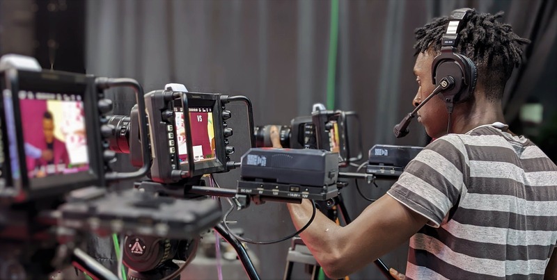
To ensure the highest standards in drone imagery for real estate, command of official and professional techniques is essential. These methods are rooted in industry best practices, utilizing certified equipment and adhering to established operational procedures. Certified drone operators employ advanced flight planning tools that map out optimal flight paths, ensuring comprehensive coverage of property exteriors and surrounding landscapes. Using high-resolution cameras mounted on stable gimbals allows for capturing crisp, detailed images even in challenging lighting conditions. Regular calibration of equipment, including lenses and sensors, guarantees color accuracy and spatial clarity, which are critical for creating compelling property visuals.
Image stabilization is a key aspect of professional drone photography. Advanced gimbals suppress vibrations and movements during flight, preventing blurring and ensuring sharpness in photos and videos. Moreover, utilizing high dynamic range (HDR) imaging and multiple exposures enhances the detail in both shadows and highlights, delivering balanced and vibrant visuals. Skilled operators also optimize flight altitude and angles to highlight key property features, such as expansive lawns, landscaped gardens, or architectural details. Properly scheduled shoots consider the best times of day for natural lighting, often during the golden hour, to add warmth and depth to imagery.
Adherence to industry standards for safety and quality
Maintaining safety standards involves thorough pre-flight checklists and adherence to strict operational protocols. These procedures include assessing wind speeds, avoiding obstacles, and ensuring the flight path remains within designated airspace. Utilizing controlled flight zones and maintaining visual line-of-sight not only enhance safety but also support the production of high-quality footage free of interruptions. Many professional operators invest in continuous training and certification programs to stay up-to-date with evolving industry standards, reinforcing their commitment to delivering professional-grade drone content that effectively elevates real estate marketing efforts.
Furthermore, companies specializing in drone photography often develop comprehensive operational manuals that guide pilots through every aspect of the shoot, from pre-flight preparation to post-processing. This systematic approach guarantees consistency and reliability in the resulting visuals. In addition to video and stills, the professional use of 3D mapping and photogrammetry through drone surveys can provide valuable insights into property layouts and site conditions, enriching marketing materials with accurate and detailed representations.
By adopting official methods, drone operators not only produce superior imagery but also help build trust and credibility in the real estate market. Precision, professionalism, and adherence to industry standards define effective drone photography that resonates with prospective buyers and enhances listing visibility on digital platforms.
Understanding the Role of Drone Photography in Real Estate
Employing drone photography within the real estate industry hinges on the utilization of verified, sophisticated aerial imaging techniques that align with standardized operational procedures. This entails deploying certified drone pilots who are proficient in advanced flight controls, safety protocols, and imaging standards. The process often begins with pre-flight planning, where pilots conduct detailed site assessments to determine optimal flight paths, taking into account terrain, property size, and potential obstructions. These preparations ensure that aerial imagery captures the full scope of the property’s exterior and surrounding environment, creating a comprehensive visual narrative.
During flight, precise navigation systems and high-resolution cameras are employed to achieve crystal-clear visuals that highlight the property’s architecture, landscaping, and unique features. Use of latest-generation drone technology with stabilized gimbals ensures that video footage remains steady, while dedicated imaging sensors allow for capturing high-detail shots suitable for large-scale digital displays. Post-flight, images and videos are processed through professional editing software, which enhances color accuracy, sharpness, and overall aesthetics, ensuring that marketing materials meet industry standards.
In addition to traditional photography, official drone operations often incorporate advanced techniques such as photogrammetry and 3D mapping. These methods generate detailed property models, offering potential buyers immersive virtual experiences. The integrity of these processes is maintained through adherence to verified operational protocols, which specify data collection methods, storage, and processing standards. This systematic approach guarantees consistent quality and helps build trustworthiness in marketing campaigns.
Furthermore, the disciplined execution of drone photography not only results in high-quality visuals but also reinforces market credibility. When drone footage and images are captured following official methods, they convey professionalism and reliability, aligning with brand reputation. This level of precision and adherence to established procedures ensures that real estate listings attract genuine interest, ultimately accelerating the sales process by presenting properties in their best light with accurate geographical and structural context.
Strategies for Collecting and Verifying Drone Imagery
Implementing precise and standardized methods for capturing drone images is essential to maintain high-quality and trustworthy visuals for real estate listings. Utilizing calibrated cameras and stable flight parameters ensures consistency across images, which is vital for creating comprehensive property representations. Before each flight, conducting thorough pre-flight checks on all equipment guarantees optimal performance and minimizes potential disruptions during data collection.
During drone operations, following established flight plans allows for systematic coverage of the property, ensuring all critical angles and features are documented. Utilizing GPS-enabled flight paths permits repeatability and consistency, particularly valuable for comparative analyses over time or future updates. Post-flight, processing images with professional editing software enhances clarity, corrects color discrepancies, and aligns visuals with the property’s true appearance, facilitating accurate and appealing marketing visuals.
Ensuring Data Quality and Accuracy in Drone Imagery
Verifying the accuracy and quality of drone pictures involves implementing a series of checks both during and after the flight. Real estate professionals should ensure sufficient overlap between images to enable seamless stitching for panoramic views or 3D mapping. Deploying ground control points (GCPs)—accurately surveyed markers placed within the property’s vicinity—improves spatial fidelity and scale accuracy in composite images or models.
Regular calibration of drone sensors and cameras prevents distortions and ensures the fidelity of captured data. Additionally, maintaining detailed records of flight conditions—including altitude, lighting, wind conditions, and camera settings—provides context for review and quality assurance. This meticulous approach results in visuals that accurately represent the property’s features, structural details, and geographical context.
Legal Use of Drone Footage and Documentation
Adopting official methods for drone operation involves maintaining comprehensive documentation for each flight, including flight logs, sensor specifications, and image capture settings. These records serve as a formal account of the data collection process and can be referenced to validate the authenticity and methodological rigor of the visuals presented.
Storing all captured data securely and with clear metadata ensures traceability and supports review processes. When utilizing drone imagery in marketing, including detailed descriptions of the data collection procedures demonstrates adherence to recognized standards, bolstering transparency and confidence among prospective buyers and stakeholders. These practices not only streamline project management but also foster a reputation for professionalism and trustworthiness in the competitive real estate market.
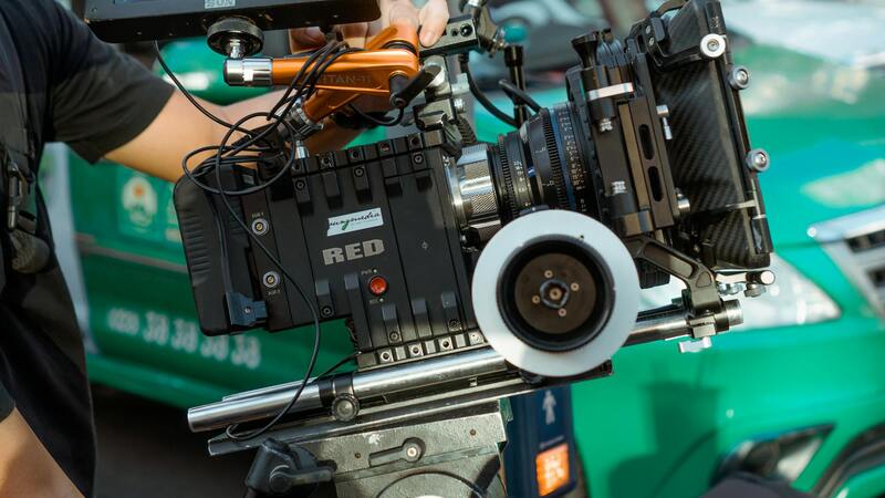
Choosing the Right Drone Equipment and Technology
To maximize the impact of drone pictures for real estate listings, selecting appropriate equipment and technology is crucial. High-quality camera systems with superior image sensors are fundamental, as they produce sharp, detailed imagery that highlights the property's features and surrounding environment. Professionals often opt for drones equipped with 4K or higher resolution cameras to ensure the visual content is vibrant and clear, facilitating immersive virtual tours and engaging marketing materials.
Stabilization technology, such as gimbal systems, plays a vital role in capturing smooth footage, especially when filming dynamic videos or panoramic shots. This minimizes blurriness and shakiness, resulting in professional-grade visuals that resonate with prospective buyers. Furthermore, drones with adjustable camera angles provide versatility, enabling the capture of both sweeping vistas and detailed close-ups, essential for showcasing unique architectural elements and landscape features.
Technology advancements such as obstacle avoidance sensors enhance flight safety and reliability, facilitating complex shoots around challenging structures without risk. Flight endurance and battery life are also critical considerations; longer flight times allow for comprehensive coverage of large properties and multiple vantage points in a single session. Modern drones equipped with intelligent flight modes—such as orbit, waypoint, or follow-me—further streamline the process, enabling consistent, repeatable shots that can be easily integrated into marketing campaigns.
Software compatibility and data integration capabilities matter significantly as well. High-end drones often come with proprietary or compatible editing platforms that simplify post-production work, allowing quick adjustments to exposure, color correction, and HDR imaging. This ensures the final visuals are compelling, accurate representations aligned with the property's branding and marketing strategy.
To achieve the desired results, industry professionals invest in drones from reputable manufacturers known for durability, advanced features, and reliable performance. For example, models incorporating GPS precision, real-time video transmission, and enhanced obstacle avoidance serve as vital tools for capturing impactful visuals ethically and consistently. Choosing the right drone setup lays the foundation for compelling, high-resolution imagery that attracts potential buyers and elevates real estate marketing efforts to a new standard.
Implementing Accurate and Consistent Shooting Practices
To ensure the highest quality drone imagery for real estate listings, professionals must adopt precise shooting techniques that prioritize consistency and attention to detail. Starting with meticulous planning of flight paths helps streamline the process, avoiding overlaps and gaps in coverage. Pre-visualizing the shots, including aerial angles and heights, allows for a more cohesive presentation of the property’s key features.
Optimal lighting conditions are crucial for producing visually appealing images. Scheduling drone flights during the golden hours—early morning or late afternoon—provides soft, warm light that highlights property details without harsh shadows or glare. Additionally, adjusting camera settings manually or using auto modes tailored for specific lighting scenarios ensures consistent exposure and color accuracy across images.
Angles play a pivotal role in showcasing a property's layout. A combination of wide-angle shots, top-down views, and targeted close-ups captures the property’s scale and details effectively. Employing intelligent flight modes such as orbit or stationary hover in designated locations can deliver compelling, stable footage that emphasizes the property’s unique selling points.
Post-flight, the images should undergo careful editing to enhance clarity, correct color balance, and optimize contrast. Techniques like HDR processing help balance highlights and shadows, ensuring every part of the image is visible and detailed. Maintaining a standardized editing workflow guarantees that all visuals align aesthetically and professionally, reinforcing the property's marketability.
Furthermore, drone operators should keep detailed logs of flight parameters, camera settings, and environmental conditions for each shoot. This documentation supports repeatability and allows for adjustments based on previous outcomes, ultimately refining the quality and consistency of future drone captures.
Understanding the Role of Drone Photography in Real Estate
Drone photography has revolutionized the way real estate properties are showcased to potential buyers. By providing elevated aerial perspectives, drone images deliver a comprehensive view of a property's surroundings, offering insights into neighborhood features, nearby amenities, and landscape layouts that traditional photography cannot capture. Utilizing high-resolution cameras mounted on advanced drone platforms allows real estate professionals to create compelling visuals that enhance property listings and marketing campaigns. This approach not only highlights the physical aspects of the property but also paints a vivid picture of the lifestyle that prospective buyers can expect, making it a vital component of modern real estate marketing strategies.
Elevating Property Presentation
Incorporating drone pictures into property listings enables a broader visual narrative. These images can depict extensive land plots, waterfront access, or large estates from a vantage point that emphasizes scale and spatial relationships. Aerial shots often reveal features such as pools, gardens, driveways, and surrounding infrastructure, providing prospective buyers with a clearer understanding of the property's full scope. Furthermore, drone footage can be integrated into virtual tours, creating immersive experiences that connect viewers with the property long before a physical visit. The dynamic and engaging nature of aerial imagery helps listings stand out in a crowded market, captured as a clear advantage over traditional static photos.
Enhancing Marketing Effectiveness
Effective real estate marketing leverages drone imagery to target a wider audience. When featured across online platforms, such as listing websites and social media channels, drone photos and videos draw more attention and generate increased engagement. They facilitate a better understanding of the property's context within its environment, which is particularly valuable for rural, luxury, or commercial properties where surroundings play a significant role in the appeal. Additionally, professionally captured drone visuals bolster credibility and showcase a property in a polished, high-quality manner, reinforcing a brand’s reputation for delivering top-tier marketing content.
Customized Visual Storytelling
Employing drone photography tailored to specific property features allows agents to craft a compelling visual story. For example, capturing sunrise or sunset shots can add aesthetic value, while sequential footage can illustrate the proximity to schools, parks, or transportation hubs. Such versatility in capturing diverse angles and scenes helps in creating a comprehensive visual portfolio that appeals to different buyer personas. The ability to adapt shot composition and incorporate creative flight paths elevates overall marketing quality, making properties more appealing and memorable to prospective buyers.
Data-Driven Marketing Strategies
Beyond aesthetic value, drone images contribute to data-rich marketing efforts. Elevated aerial perspectives allow for precise measurements of land sizes and property boundaries, aiding in accurate listing descriptions. When paired with geolocation tools, these visuals help in mapping out the property’s relation to regional features, supporting targeted advertising strategies aimed at specific demographic groups. This combination of high-quality visuals and spatial data enhances the overall appeal of real estate listings, leading to more informed decisions and quicker property sales.
Legal Regulations and Best Practices for Drone Photography
Adhering to Industry Standards
In the realm of drone photography for real estate, maintaining adherence to established standards ensures that imagery is captured responsibly, efficiently, and ethically. Professional drone operators consistently follow a comprehensive set of guidelines that govern flight operations, image quality, privacy, and safety. These standards emphasize the importance of meticulous planning, including pre-flight site assessments and risk evaluations to prevent unintended disruptions or hazards. Employing proper flight procedures, such as maintaining safe distances from structures and individuals, enhances the safety profile of aerial photography sessions.
Pre-Flight Planning and Site Assessment
Before initiating drone flights for real estate visuals, comprehensive planning is essential. This involves evaluating the surrounding environment, identifying potential obstacles, and understanding regional airspace restrictions. Detailed planning helps in selecting appropriate flight paths that optimize shot angles while minimizing risks. Conducting a proper site assessment also ensures that the property and neighboring areas are not compromised during the acquisition process, fostering a respectful approach to the local community and environment.
Utilizing Certified and Trained Operators
Professional drone photography relies on operators who possess the necessary training and certifications. These specialists are well-versed in drone technology, safety protocols, and aerial imaging techniques. Their expertise guarantees that the drone is operated within the bounds of accepted practices, producing high-quality visuals that accurately depict the property’s features. Skilled operators are also better equipped to respond promptly to unforeseen circumstances, thus safeguarding the integrity of the shoot and the surrounding environment.
Ensuring Data Privacy and Ethical Use
Respecting privacy rights is paramount when capturing aerial imagery that may include neighboring properties or public spaces. Strict protocols are followed to avoid intrusive photography, ensuring that images focus solely on the subject property. Utilizing techniques such as targeted flight paths, camera angles, and controlled zoom helps prevent capturing unnecessary or sensitive information. Ethical use of drone imagery also entails securing client consent and safeguarding digital assets against unauthorized dissemination.
Post-Flight Data Management and Storage
After the aerial shoot, proper handling of data is vital to uphold integrity and confidentiality. Implementing secure storage solutions, backed by regular backups, prevents data loss and unauthorized access. Additionally, adhering to data retention policies aligns with professional standards, ensuring that imagery is accessible when needed for marketing, but also responsibly disposed of once it is no longer required. Clear labeling and organized cataloging facilitate quick retrieval and efficient integration into subsequent marketing materials.
Continuous Improvement Through Certification and Education
The landscape of drone technology and regulations is continually evolving, making ongoing education essential for professionals. Participating in industry seminars, certification courses, and workshops helps operators stay current with best practices and technological advancements. This commitment to continuous learning translates into higher-quality imagery, safer operations, and enhanced client confidence, reinforcing a property’s visual appeal and marketability.
Integrating responsible practices into every aspect of drone photography not only safeguards the welfare of all parties involved but also elevates the overall quality and professionalism of real estate marketing. Precision, respect, and adherence to industry standards are the cornerstones of effective drone imagery that truly benefits sellers, buyers, and agents alike.